Difference between revisions of "2014-04-07 59 10"
From Geohashing
imported>Løventier (→Location) |
m (2020-01-01 update) |
||
| (5 intermediate revisions by 2 users not shown) | |||
| Line 18: | Line 18: | ||
== Expedition == | == Expedition == | ||
| + | |||
| + | |||
| + | *Coordinates reached. Pictures coming, but geohashdroid seems to crash on me. -- [[User:relet|relet]] [http://www.openstreetmap.org/?lat=59.93029981&lon=10.55373416&zoom=16&layers=B000FTF @59.9303,10.5537] 12:40, 7 April 2014 (CEST) | ||
| + | |||
| + | It was a nice short stroller tour, too easy not to take and within my familiar range. Would be lovely to do more geohashing again... for some reason, all these points seem so far away these days. :) | ||
== Tracklog == | == Tracklog == | ||
| Line 26: | Line 31: | ||
{{#vardefine:gaLines|2}} | {{#vardefine:gaLines|2}} | ||
{{Gallery2| | {{Gallery2| | ||
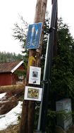
| − | + | {{GalleryItem | File:20140407 120943 (Medium).jpg | The arrow points the way. }} | |
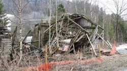
| + | {{GalleryItem | File:20140407 121424 (Medium).jpg | '''NOT''' the result of a juggernaut attempt, I swear. }} | ||
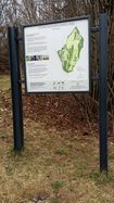
| + | {{GalleryItem | File:20140407 121644 (Medium).jpg | Løventier is not entirely impressed }} | ||
| + | {{GalleryItem | File:20140407 123538 (Medium).jpg | Steinskogen gravlund, the 'stone forest' graveyard. Fitting. }} | ||
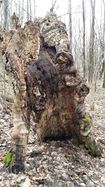
| + | {{GalleryItem | File:20140407 123903 (Medium).jpg | A particular tree stump at hash o spot. }} | ||
| + | {{GalleryItem | File:20140407 123912 (Medium).jpg | Proof of people. }} | ||
| + | {{GalleryItem | File:20140407 123943 (Medium).jpg | Proof of doziness. }} | ||
}} | }} | ||
| Line 32: | Line 43: | ||
{{#vardefine:ribbonwidth|800px}} | {{#vardefine:ribbonwidth|800px}} | ||
| − | |||
| − | |||
| − | |||
| − | |||
| − | |||
| − | |||
[[Category:Expeditions]] | [[Category:Expeditions]] | ||
| − | |||
[[Category:Expeditions with photos]] | [[Category:Expeditions with photos]] | ||
| − | |||
| − | |||
| − | |||
[[Category:Coordinates reached]] | [[Category:Coordinates reached]] | ||
| − | + | {{location|NO|30}} | |
| − | |||
| − | |||
| − | |||
| − | |||
| − | |||
| − | |||
Latest revision as of 00:28, 16 February 2020
| Mon 7 Apr 2014 in 59,10: 59.9303006, 10.5534424 geohashing.info google osm bing/os kml crox |
Location
2.3 km from Løventier's home, at Steinskogen gravlund. Too close not to go.
Participants
Plans
Expedition
- Coordinates reached. Pictures coming, but geohashdroid seems to crash on me. -- relet @59.9303,10.5537 12:40, 7 April 2014 (CEST)
It was a nice short stroller tour, too easy not to take and within my familiar range. Would be lovely to do more geohashing again... for some reason, all these points seem so far away these days. :)
Tracklog
Photos
|
