Difference between revisions of "2014-04-23 45 -122"
imported>Benture (→Expedition) |
imported>FippeBot m (Location) |
||
| (4 intermediate revisions by 2 users not shown) | |||
| Line 28: | Line 28: | ||
== Plans == | == Plans == | ||
| − | This one landed in an easy location not too far from work. So, I decided on an alternative commute. | + | '''M5K:'''This one landed in an easy location not too far from work. So, I decided on an alternative commute. |
'''Ben:''' [[User:Frogman|Frogman]] clued me into the accessibility of this hashpoint, just a block off of the Springwater Corridor trail. | '''Ben:''' [[User:Frogman|Frogman]] clued me into the accessibility of this hashpoint, just a block off of the Springwater Corridor trail. | ||
| Line 34: | Line 34: | ||
== Expedition == | == Expedition == | ||
| − | And, an hour or so later, I parked amid a flurry of cars and kids walking in all directions towards nearby schools, and strolled over to the hashpoint. I left my calling card nearby, took a couple of pictures, and forayed on to work. | + | '''M5K:''' And, an hour or so later, I parked amid a flurry of cars and kids walking in all directions towards nearby schools, and strolled over to the hashpoint. I left my calling card nearby, took a couple of pictures, and forayed on to work. |
'''Ben:''' I took a detour on my bike commute home through the steady rain to get to there. I found [[User:Michael5000|Michael5000's]] calling card there still dry. | '''Ben:''' I took a detour on my bike commute home through the steady rain to get to there. I found [[User:Michael5000|Michael5000's]] calling card there still dry. | ||
| Line 41: | Line 41: | ||
| − | <gallery perrow=" | + | <gallery perrow="3"> |
File:2014-04-23 45 -122 street1.JPG|Looking one way down the street. | File:2014-04-23 45 -122 street1.JPG|Looking one way down the street. | ||
File:2014-04-23 45 -122 street2.JPG|Looking the other way down the street. | File:2014-04-23 45 -122 street2.JPG|Looking the other way down the street. | ||
File:2014-04-23 45 -122 tree.JPG|An attractive nearby tree. | File:2014-04-23 45 -122 tree.JPG|An attractive nearby tree. | ||
| + | File:2014-04-23 45 -122 calling card.JPG|[[User:Michael5000|Michael5000's]] calling card with the distinctive '''Interrobang'''. | ||
| + | File:2014-04-23 45 -122 bike.JPG|[[User:Benture|Benture's]] blurry, wet bike. | ||
| + | File:2014-04-23 45 -122 gg.JPG|[[User:Benture|Benture's]] goofy grin. | ||
</gallery> | </gallery> | ||
| Line 50: | Line 53: | ||
{{#vardefine:ribbonwidth|800px}} | {{#vardefine:ribbonwidth|800px}} | ||
<!-- Add any achievement ribbons you earned below, or remove this section --> | <!-- Add any achievement ribbons you earned below, or remove this section --> | ||
| + | {{bicycle geohash | ||
| + | |||
| + | | latitude = 45 | ||
| + | | longitude = -122 | ||
| + | | date = 2014-04-23 | ||
| + | | name = [[User:Benture|Benture]] | ||
| + | | distance = 13.4 miles | ||
| + | |||
| + | }} | ||
| Line 55: | Line 67: | ||
[[Category:Expeditions with photos]] | [[Category:Expeditions with photos]] | ||
[[Category:Coordinates reached]] | [[Category:Coordinates reached]] | ||
| + | {{location|US|OR|MU}} | ||
Latest revision as of 06:17, 14 August 2019
| Wed 23 Apr 2014 in 45,-122: 45.4800624, -122.5302609 geohashing.info google osm bing/os kml crox |
Location
On SE Ramona Street, off of Foster Boulevard in southeast Portland.
Participants
Plans
M5K:This one landed in an easy location not too far from work. So, I decided on an alternative commute.
Ben: Frogman clued me into the accessibility of this hashpoint, just a block off of the Springwater Corridor trail.
Expedition
M5K: And, an hour or so later, I parked amid a flurry of cars and kids walking in all directions towards nearby schools, and strolled over to the hashpoint. I left my calling card nearby, took a couple of pictures, and forayed on to work.
Ben: I took a detour on my bike commute home through the steady rain to get to there. I found Michael5000's calling card there still dry.
Photos
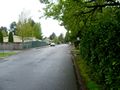
Looking one way down the street.
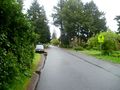
Looking the other way down the street.
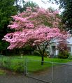
An attractive nearby tree.
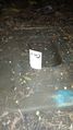
Michael5000's calling card with the distinctive Interrobang.
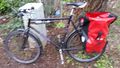
Benture's blurry, wet bike.

Benture's goofy grin.


Achievements
Benture earned the Bicycle geohash achievement
|