Difference between revisions of "2014-05-06 50 -113"
From Geohashing
imported>Guzzby (→Photos) |
m (More specific location) |
||
| (5 intermediate revisions by 3 users not shown) | |||
| Line 1: | Line 1: | ||
| − | |||
| − | |||
| − | |||
| − | |||
| − | |||
| − | |||
| − | |||
| − | |||
| − | |||
| − | |||
{{meetup graticule | {{meetup graticule | ||
| lat=50 | | lat=50 | ||
| Line 15: | Line 5: | ||
}} | }} | ||
| − | |||
__NOTOC__ | __NOTOC__ | ||
== Location == | == Location == | ||
| − | |||
In the community of Douglasdale in Calgary, Alberta Canada. | In the community of Douglasdale in Calgary, Alberta Canada. | ||
In a field south of the Bow River Pathway | In a field south of the Bow River Pathway | ||
== Participants == | == Participants == | ||
| − | |||
| − | |||
* [[User:Guzzby|Guzzby]] | * [[User:Guzzby|Guzzby]] | ||
== Plans == | == Plans == | ||
| − | |||
I plan to drive over to the geohash. Take a couple of pictures. Then go search for some geocaches in the area. | I plan to drive over to the geohash. Take a couple of pictures. Then go search for some geocaches in the area. | ||
== Expedition == | == Expedition == | ||
| − | |||
I drove over to the geohash around 11:00 am. I arrived around 11:15 am. I walked down the bow river pathway and then out into the field where the hashpoint is. I took a couple of pictures then left. | I drove over to the geohash around 11:00 am. I arrived around 11:15 am. I walked down the bow river pathway and then out into the field where the hashpoint is. I took a couple of pictures then left. | ||
== Photos == | == Photos == | ||
| − | |||
| − | |||
| − | |||
<gallery perrow="5"> | <gallery perrow="5"> | ||
Image:2014-05-06_50_-113_guzzby1.jpg | View to the North | Image:2014-05-06_50_-113_guzzby1.jpg | View to the North | ||
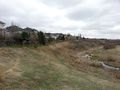
| − | Image:2014-05-06_50_- | + | Image:2014-05-06_50_-113_guzzby2.jpg | View to the East |
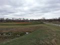
| − | Image:2014-05-06_50_- | + | Image:2014-05-06_50_-113_guzzby3.jpg | View to the South |
| − | Image:2014-05-06_50_- | + | Image:2014-05-06_50_-113_guzzby4.jpg | View to the West |
</gallery> | </gallery> | ||
== Achievements == | == Achievements == | ||
{{#vardefine:ribbonwidth|800px}} | {{#vardefine:ribbonwidth|800px}} | ||
| − | + | {{Land geohash | latitude = 50 | longitude = -113 | date = 2014-05-06 | name = [[User:Guzzby|Guzzby]] }} | |
| − | |||
| − | |||
| − | |||
| − | |||
| − | [[ | ||
| − | |||
| − | |||
| − | |||
| − | |||
| − | |||
| − | |||
| − | |||
| − | |||
[[Category:Expeditions]] | [[Category:Expeditions]] | ||
| − | |||
[[Category:Expeditions with photos]] | [[Category:Expeditions with photos]] | ||
| − | |||
| − | |||
| − | |||
| − | |||
| − | |||
[[Category:Coordinates reached]] | [[Category:Coordinates reached]] | ||
| − | + | {{location|CA|AB|CA}} | |
| − | |||
| − | |||
| − | |||
| − | |||
| − | |||
| − | |||
| − | |||
| − | |||
| − | |||
| − | |||
| − | |||
| − | |||
| − | |||
| − | |||
| − | |||
| − | |||
| − | |||
Latest revision as of 00:07, 10 August 2020
| Tue 6 May 2014 in 50,-113: 50.9386013, -113.9962997 geohashing.info google osm bing/os kml crox |
Location
In the community of Douglasdale in Calgary, Alberta Canada. In a field south of the Bow River Pathway
Participants
Plans
I plan to drive over to the geohash. Take a couple of pictures. Then go search for some geocaches in the area.
Expedition
I drove over to the geohash around 11:00 am. I arrived around 11:15 am. I walked down the bow river pathway and then out into the field where the hashpoint is. I took a couple of pictures then left.
Photos
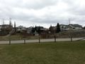
View to the North

View to the East
View to the South
View to the West


Achievements
Guzzby earned the Land geohash achievement
|