Difference between revisions of "2014-08-28 50 11"
imported>Paintedhell (Created page with "{{meetup graticule | lat=50 | lon=11 | date=2014-08-28 }} __NOTOC__ == Location == In a small stretch of forest on Knoll mountain, between Bucha and Coppanz, Thuringia. == ...") |
imported>FippeBot m (Location) |
||
| (3 intermediate revisions by one other user not shown) | |||
| Line 13: | Line 13: | ||
== Expedition == | == Expedition == | ||
| − | + | Today the point was too close to miss once again, but since I seem to be surrounded by a bunch of sloth bears I ended up being the one responsible for going to the Geohash. Anyway I had planned to go running with some friends first, which took ''slightly'' longer than expected, so when I started biking to the Geohash (and I didn't really want to, since my legs felt half-dead already) it was getting dark. But it was a mild evening (probably the last for this summer) and so I didn't feel cold at least. | |
| + | |||
| + | I found the right way to the Geohash from Bucha, but it was overgrown with thicket and only by a lucky stroke of fate did I come home without a flat tyre. Anyway, the luck seems to have been used up with this: where the way passed the Geohash point there was thicket all around, and the point was still at almost 50 meters distance. I tried to work my way inside the mess, but I only made a few meters and it didn't seem to get any better, and since the GPS signal was also drifting heavily in the forest the attempt did not seem to make sense, I gave up and cycled back home through the darkness. | ||
== Photos == | == Photos == | ||
{{gallery|width=200|height=200|lines=2 | {{gallery|width=200|height=200|lines=2 | ||
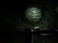
| − | + | |Image:140828_50_11_1.jpg|The way to the Geohash. I am expecting the worst... | |
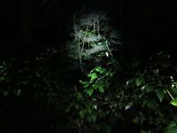
|Image:140828_50_11_2.jpg|...and here it is. The Geohash point... | |Image:140828_50_11_2.jpg|...and here it is. The Geohash point... | ||
| − | |Image:140828_50_11_3.jpg|...lies | + | |Image:140828_50_11_3.jpg|...lies 48m into this thicket. |
}} | }} | ||
| − | + | [[Category:Expeditions with photos]] | |
[[Category:Expeditions]] | [[Category:Expeditions]] | ||
[[Category:Coordinates not reached]] | [[Category:Coordinates not reached]] | ||
[[Category:Not reached - Mother Nature]] | [[Category:Not reached - Mother Nature]] | ||
| + | {{location|DE|TH|SHK}} | ||
Latest revision as of 01:10, 15 August 2019
| Thu 28 Aug 2014 in 50,11: 50.8878638, 11.5279449 geohashing.info google osm bing/os kml crox |
Location
In a small stretch of forest on Knoll mountain, between Bucha and Coppanz, Thuringia.
Participants
- Juja and Hans
Expedition
Today the point was too close to miss once again, but since I seem to be surrounded by a bunch of sloth bears I ended up being the one responsible for going to the Geohash. Anyway I had planned to go running with some friends first, which took slightly longer than expected, so when I started biking to the Geohash (and I didn't really want to, since my legs felt half-dead already) it was getting dark. But it was a mild evening (probably the last for this summer) and so I didn't feel cold at least.
I found the right way to the Geohash from Bucha, but it was overgrown with thicket and only by a lucky stroke of fate did I come home without a flat tyre. Anyway, the luck seems to have been used up with this: where the way passed the Geohash point there was thicket all around, and the point was still at almost 50 meters distance. I tried to work my way inside the mess, but I only made a few meters and it didn't seem to get any better, and since the GPS signal was also drifting heavily in the forest the attempt did not seem to make sense, I gave up and cycled back home through the darkness.
Photos
|


