Difference between revisions of "2014-09-15 47 -122"
From Geohashing
imported>Thomcat ([live picture] [http://www.openstreetmap.org/?lat=47.66370000&lon=-122.34900000&zoom=16&layers=B000FTF @47.6637,-122.3490]) |
imported>FippeBot m (Location) |
||
| (2 intermediate revisions by one other user not shown) | |||
| Line 18: | Line 18: | ||
== Expedition == | == Expedition == | ||
| − | + | Picked up my daughter, drove to the hashpoint, handed her sidewalk chalk, then started snapping pictures. Also put up a flyer, so a big "hi" if you are from the internet. | |
| − | + | This is a short walk from [[User:OtherJack|OtherJack's]] Seattle neighborhood, but he is Geohashing in other graticules. | |
| − | + | ||
| + | Interestingly, though I uploaded the photo from the exact spot (within 1 m.), the photo caption lists 30-odd meters away. I believe I tweaked the setting on camera that says "use GPS coordinates"... and clearly those are a bit off. More research to come. | ||
| + | |||
| + | Still did not visit the Woodland Park Rose Garden - one of these days! | ||
== Photos == | == Photos == | ||
| − | |||
| − | |||
| − | |||
<gallery perrow="5"> | <gallery perrow="5"> | ||
| Line 34: | Line 34: | ||
Image:2014-09-15_47_-122_thomcat_1410824137963.jpg | [http://www.openstreetmap.org/?lat=47.66370000&lon=-122.34900000&zoom=16&layers=B000FTF @47.6637,-122.3490] | Image:2014-09-15_47_-122_thomcat_1410824137963.jpg | [http://www.openstreetmap.org/?lat=47.66370000&lon=-122.34900000&zoom=16&layers=B000FTF @47.6637,-122.3490] | ||
| + | |||
| + | Image:2014-09-15_47_-122_thomcat_1410823913149.jpg | geosign [http://www.openstreetmap.org/?lat=47.66370000&lon=-122.34900000&zoom=16&layers=B000FTF @47.6637,-122.3490] | ||
</gallery> | </gallery> | ||
| Line 41: | Line 43: | ||
| − | |||
| − | |||
| − | |||
[[Category:Expeditions]] | [[Category:Expeditions]] | ||
| − | |||
[[Category:Expeditions with photos]] | [[Category:Expeditions with photos]] | ||
| − | |||
| − | |||
| − | |||
| − | |||
| − | |||
[[Category:Coordinates reached]] | [[Category:Coordinates reached]] | ||
| − | + | {{location|US|WA|KN}} | |
| − | |||
| − | |||
| − | |||
| − | |||
| − | |||
| − | |||
| − | |||
| − | |||
| − | |||
| − | |||
| − | |||
| − | |||
| − | |||
| − | |||
| − | |||
| − | |||
| − | |||
Latest revision as of 01:26, 15 August 2019
| Mon 15 Sep 2014 in Seattle: 47.6636779, -122.3485894 geohashing.info google osm bing/os kml crox |
Location
Linden Ave N, just south of the Woodland Park Rose Garden (and Zoo)
Participants
Plans
Stop by around 4:30 pm. Lots of sidewalk chalk.
Expedition
Picked up my daughter, drove to the hashpoint, handed her sidewalk chalk, then started snapping pictures. Also put up a flyer, so a big "hi" if you are from the internet.
This is a short walk from OtherJack's Seattle neighborhood, but he is Geohashing in other graticules.
Interestingly, though I uploaded the photo from the exact spot (within 1 m.), the photo caption lists 30-odd meters away. I believe I tweaked the setting on camera that says "use GPS coordinates"... and clearly those are a bit off. More research to come.
Still did not visit the Woodland Park Rose Garden - one of these days!
Photos
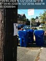
geosign @47.6637,-122.3490


