Difference between revisions of "2014-10-30 47 -122"
imported>Thomcat ([live] en route) |
imported>FippeBot m (Location) |
||
| (8 intermediate revisions by one other user not shown) | |||
| Line 18: | Line 18: | ||
== Expedition == | == Expedition == | ||
| − | + | Very long day at work - we released a version of our software (late) and there were many tasks to complete. Missing the high toll window on 520 was not going to be a major problem. While waiting for the on-ramp light, I sent | |
| + | *en route -- [[User:Thomcat|Thomcat]] ([[User talk:Thomcat|talk]]) [http://www.openstreetmap.org/?lat=47.79377664&lon=-122.21269192&zoom=16&layers=B000FTF @47.7938,-122.2127] 17:42, 30 October 2014 (PDT) | ||
| − | + | I-405 is the I-5 branch that runs through Bellevue, and it was completely choked south of the 520 interchange. So I took 520 from there, which was also completely choked, and pulled off for a grilled cheese. | |
| − | + | ||
| − | + | I did not visit the previous geohash in the area; rain has long since washed away my chalk. Seattle has managed 5.5" of rain in October, crushing the previous high of 3.5", and it's raining again today. | |
| + | |||
| + | Sandwich and shake in hand and cupholder, I continued south to the hashpoint. Parked right next to it, according to satellite photos, but today the GeoHashDroid/GPS and satellites were not in good communication. Heavy rain? A big tree, or an even bigger crane? No idea. I snapped several photos, including one of our local palindromic donut shop. | ||
| + | |||
| + | Most interesting thing I learned on this geohash? The interior of that traffic island has two gates and less than 100 square feet. Within is a little patch of dirt, a bench, and a bag distribution center. Result - a tiny urban dog park. Quite handy for the people in those apartment blocks. | ||
== Photos == | == Photos == | ||
| − | |||
| − | |||
| − | |||
<gallery perrow="5"> | <gallery perrow="5"> | ||
| + | |||
| + | Image:2014-10-30_47_-122_thomcat_1414717507819.jpg | Quick stop at Burgermaster - 10 minutes away. [http://www.openstreetmap.org/?lat=47.64220000&lon=-122.19900000&zoom=16&layers=B000FTF @47.6422,-122.1990] | ||
| + | |||
| + | Image:2014-10-30_47_-122_thomcat_1414718274084.jpg | A fountain nearby [http://www.openstreetmap.org/?lat=47.61870000&lon=-122.19800000&zoom=16&layers=B000FTF @47.6187,-122.1980] | ||
| + | |||
| + | Image:2014-10-30_47_-122_thomcat_1414718292293.jpg | Hashcar [http://www.openstreetmap.org/?lat=47.61830000&lon=-122.19800000&zoom=16&layers=B000FTF @47.6183,-122.1980] | ||
| + | |||
| + | Image:2014-10-30_47_-122_thomcat_1414718472162.jpg | A very tiny dog park [http://www.openstreetmap.org/?lat=47.61850000&lon=-122.19800000&zoom=16&layers=B000FTF @47.6185,-122.1980] | ||
| + | |||
| + | Image:2014-10-30_47_-122_thomcat_1414718619747.jpg | [http://www.openstreetmap.org/?lat=47.61830000&lon=-122.19800000&zoom=16&layers=B000FTF @47.6183,-122.1980] | ||
| + | |||
| + | Image:2014-10-30_47_-122_thomcat_1414718721436.jpg | Palindromic donuts [http://www.openstreetmap.org/?lat=47.61870000&lon=-122.19900000&zoom=16&layers=B000FTF @47.6187,-122.1990] | ||
</gallery> | </gallery> | ||
== Achievements == | == Achievements == | ||
{{#vardefine:ribbonwidth|800px}} | {{#vardefine:ribbonwidth|800px}} | ||
| − | + | {{Last man standing | |
| − | + | | latitude = 47 | longitude = -122 | date = 2014-10-30 | gender = man | name = Thomcat | |
| − | + | }} | |
| − | |||
| − | |||
[[Category:Expeditions]] | [[Category:Expeditions]] | ||
| − | |||
[[Category:Expeditions with photos]] | [[Category:Expeditions with photos]] | ||
| − | |||
| − | |||
| − | |||
| − | |||
| − | |||
[[Category:Coordinates reached]] | [[Category:Coordinates reached]] | ||
| − | + | {{location|US|WA|KN}} | |
| − | |||
| − | |||
| − | |||
| − | |||
| − | |||
| − | |||
| − | |||
| − | |||
| − | |||
| − | |||
| − | |||
| − | |||
| − | |||
| − | |||
| − | |||
| − | |||
| − | |||
Latest revision as of 01:51, 15 August 2019
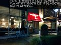
| Thu 30 Oct 2014 in Seattle: 47.6186082, -122.1980432 geohashing.info google osm bing/os kml crox |
Location
A circular drive in downtown Bellevue.
Participants
Plans
Visit sometime during the day. High toll times are 7 to 9 am and 3 to 6 pm.
Expedition
Very long day at work - we released a version of our software (late) and there were many tasks to complete. Missing the high toll window on 520 was not going to be a major problem. While waiting for the on-ramp light, I sent
- en route -- Thomcat (talk) @47.7938,-122.2127 17:42, 30 October 2014 (PDT)
I-405 is the I-5 branch that runs through Bellevue, and it was completely choked south of the 520 interchange. So I took 520 from there, which was also completely choked, and pulled off for a grilled cheese.
I did not visit the previous geohash in the area; rain has long since washed away my chalk. Seattle has managed 5.5" of rain in October, crushing the previous high of 3.5", and it's raining again today.
Sandwich and shake in hand and cupholder, I continued south to the hashpoint. Parked right next to it, according to satellite photos, but today the GeoHashDroid/GPS and satellites were not in good communication. Heavy rain? A big tree, or an even bigger crane? No idea. I snapped several photos, including one of our local palindromic donut shop.
Most interesting thing I learned on this geohash? The interior of that traffic island has two gates and less than 100 square feet. Within is a little patch of dirt, a bench, and a bag distribution center. Result - a tiny urban dog park. Quite handy for the people in those apartment blocks.
Photos
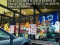
Quick stop at Burgermaster - 10 minutes away. @47.6422,-122.1990
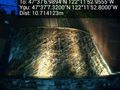
A fountain nearby @47.6187,-122.1980
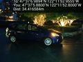
Hashcar @47.6183,-122.1980
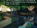
A very tiny dog park @47.6185,-122.1980
Palindromic donuts @47.6187,-122.1990


Achievements
Thomcat earned the Last man standing achievement
|