Difference between revisions of "2015-03-01 49 19"
imported>Malgond (→Down into a bog) |
imported>Malgond (→Down into a bog) |
||
| Line 85: | Line 85: | ||
Soon, we've arrived at the first of the three lines of bushes crossing our track. We've stopped in a gap in the second line, the one bordering a strip of tilled land, approximately at half distance to the geohash. We've had a sip of water and a home-made pizza-roll and continued on our way. | Soon, we've arrived at the first of the three lines of bushes crossing our track. We've stopped in a gap in the second line, the one bordering a strip of tilled land, approximately at half distance to the geohash. We've had a sip of water and a home-made pizza-roll and continued on our way. | ||
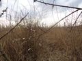
| − | Avid geohashers will know what going ''down''hill through a field means. It gets wetter and wetter. The boys had got rubber boots, but I don't have any, so all I got was a pair of old sneakers I was reluctant to throw away - so today is going to be the day, no problem. We were hopping from a clump of grass to another and another to avoid pools of water. A short way from the last line of bushes we've found signs of wild boars activity again. | + | Avid geohashers will know what going ''down''hill through a field means. It gets wetter and wetter. The boys had got rubber boots, but I don't have any, so all I got was a pair of old sneakers I was reluctant to throw away - so today is going to be the day, no problem. We were hopping from a clump of grass to another and another to avoid pools of water. A short way from the last line of bushes we've found signs of wild boars activity again: a place where they were taking a bath in a mud and a rooting site. Then there was another patch of cane on our track, this time it was thoroughly boggy and I struggled to find a way through it, weaving left and right. Finally we got out of it, most likely a little north of our track just on the traverse of an unfinished home. |
To be continued... | To be continued... | ||
Revision as of 18:46, 3 March 2015
| Sun 1 Mar 2015 in 49,19: 49.9960394, 19.8743223 geohashing.info google osm bing/os kml crox |
Contents
Location
In a field near a ditch just off Działowskiego street in the Kobierzyn district of Kraków, Poland.
Participants
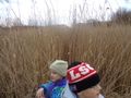
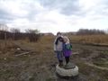
Malgond with kids.
Plans
- I don't have a GPS, but there are some reference points nearby, so I'll try to use them. I've made some measurements on Google Maps.
- Distance from a tree growing at the ditch, along and across:
- In case the tree isn't standing there any more - distance from ditch's bend:
- Distance from a tree growing at the ditch, along and across:
- I plan to earn the Juggernaut achievement. Here's a straight line from the nearest section of paved road close to my home:


Expedition
We've reached the spot, albeit not in so straight a line - boggy terrain.
Over the ditch
We have started in a street near our home. I have checked the compass and off we went through the field. The group of trees located just south of our 260° track could be clearly seen so I just headed towards what looked like the rightmost one. It turned out that there was still another, smaller tree to the right so we went to the right of it. Thorns and dense patches of high dry cane weren't going to stop us! Finally we've arrived at the ditch crossing our track. I had originally indended to jump over it, but it happened to be much wider then it used to be closer to home, so I went with the backup plan of going a little to the south of our intended track along the ditch and crossing it by the nearby bridge.
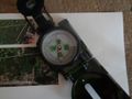
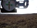
Checking our heading. It's 260°
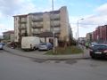
Starting point.
General direction we're heading at.
Heading 260: to the right of this tree!
Through hawthorn bushes.
Crossing a footpath on our track.
Err, actually our track goes to the right of the smaller tree.
Forests and glades of cane. Almost at the tree.
First signs of spring.
Looking back through a cane forest.
The ditch is too wide to jump over it.
Crossing the ditch by a bridge. Local church in the background.


Wild boars' amusement park
After crossing the ditch we went a short distance along the dirt road being the extension of Małysiaka street that runs along the church and looked back towards our home to re-establish ourselves on our track using the compass. Then we've turned towards our destination. The terrain was rising a little and obscuring the view with a featureless field of dry grass and low bushes. I have checked the compass again to get the general direction and we have entered an abandoned construction site that lies across the street from the church. Two disgressions are due.
- The site had been an empty field once. Several years ago it had been fenced, levelled, bushes uprooted and several legally required signs had been posted saying that a row of homes is going to be built there. Some excavations had started, then nothing happened for a long time. Today, as we happened to see, there's no trace of construction signs, the fence is in a sorry state and excavations are filled. The mysterious lighter-coloured rectangles that can bee seen on Google Maps there (see my plan) are traces of the former excavations.
- Wild boars are somewhat abundant in Poland. Sprawling cities invade into their natural habitats, and the beasts are sometimes seen roaming through suburban areas. There were many rumors of wild boars appearing within our local community, some people reported seeing them, but the scariest rumor has been that the boars are lurking in the field by the church. The last rumor we've proved to be true. A charging boar is dangerous, and even if actual attacks are very rare, poeple are afraid of them; some poeple hearing the rumor even stopped attending evening services at the church.
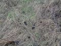
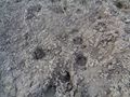
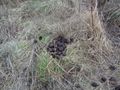
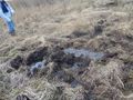
After not so many steps into the construction site I have spotted some animal droppings. At first I was not sure to which animal they belong (domestic ones have not been seen there for many years), but finding wild boar tracks left no doubt. A little further we've encoutered a truly marvellous place: boars' rooting site that was a former excavation. Human works had broken the heavy thick wild turf ovegrown with millions of tangled roots and when the hole in the ground had been filled with overthrown soil, a soft spot had been created. Wild boars root for food and for fun; this place is a perfect playground for piglets. The whole rectangle of the former excavation has been thoroughly uprooted. There were many tracks and even a likely imprint of a wild boar's nose.
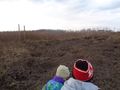
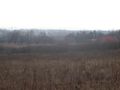
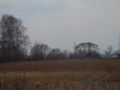
We explored the area for a while and continued on our journey by going through a hole in the fence. We walked a little uphill through the field until we've reached the highest point of our track on a spur of a hill. We've looked back for the last glance of our home and to verify that we were more-or-less on track. Looking forward, we could see the line of trees that marked a point near our destination.
Back on the track.
Abandoned construction site. HDG 260.
Wild boar droppings.
Wild boar tracks.
Wild boars' paradise.
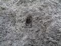
An imprint of a wild boar's nose?
More wild boar droppings.
Through a hole in the fence.
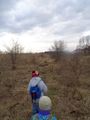
On a spur of a hill looking back. The last sight of home.
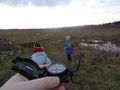
Our destination is behind that line of trees in the distance, dark shapes on gray backgroud of faraway hills on the horizon. (Using the compass as a makeshift camera sunshade.)
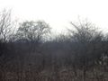
The line of trees at full zoom.


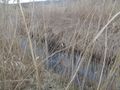
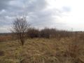
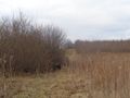
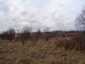
Down into a bog
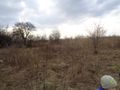
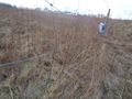
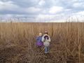
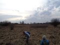
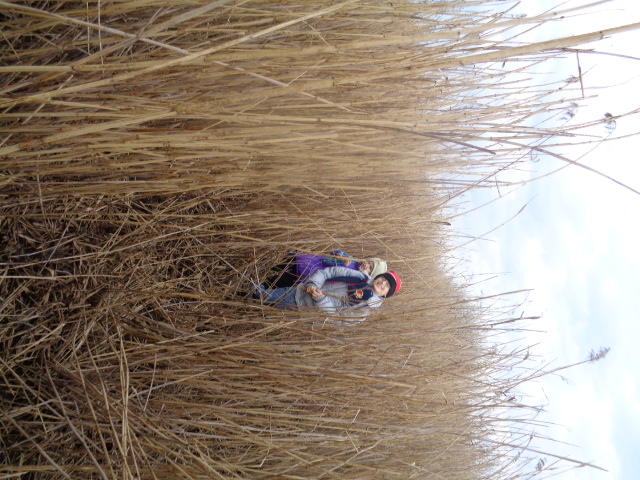
Walking slightly downhill we've encountered more hawthorn bushes and still more dry cane. Our track led us through several patches of cane and we have walked right through them, me first, treading upon and stomping the dry plants, and the boys following me along the trodden path. Interestingly, the patches often had little glades in the middle of them, where the stems where lying flat on the ground. I cannot explain why it was so, maybe some natural phenomenon that caused the plants to wither or - the more I think about it the more probable it seems - they were stomped and pressed by wild boars lying there to hide and rest... Fortunately, we haven't encountered any of these animals. Now, I regret I had not examined the ground there for any possible tracks.
Soon, we've arrived at the first of the three lines of bushes crossing our track. We've stopped in a gap in the second line, the one bordering a strip of tilled land, approximately at half distance to the geohash. We've had a sip of water and a home-made pizza-roll and continued on our way.
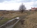
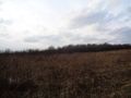
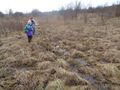
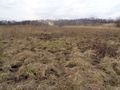
Avid geohashers will know what going downhill through a field means. It gets wetter and wetter. The boys had got rubber boots, but I don't have any, so all I got was a pair of old sneakers I was reluctant to throw away - so today is going to be the day, no problem. We were hopping from a clump of grass to another and another to avoid pools of water. A short way from the last line of bushes we've found signs of wild boars activity again: a place where they were taking a bath in a mud and a rooting site. Then there was another patch of cane on our track, this time it was thoroughly boggy and I struggled to find a way through it, weaving left and right. Finally we got out of it, most likely a little north of our track just on the traverse of an unfinished home.
To be continued...
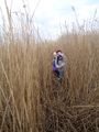
A glade in a forest of cane.
Approaching the first line of bushes crossing our track.
Through the gap of the first line of bushes, looking southwards.
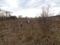
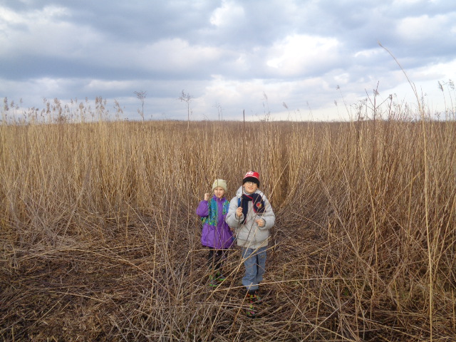
Second line of bushes. Tilled field behind them. Half the distance to the geohash.
It's getting boggy...
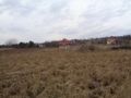
The last line of bushes, looking north. Homes nearby and the buildings of psychiatric hospital in Kobierzyn behind the tres on the hill.
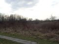
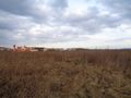
Approximately at 1 km mark of our track. The target line of trees on the horizon.
We're going right there...
Wild boars' muddy spa.
Wild boars were rooting all over the place.
A boggy sea of cane, again. My sneakers are full of muddy water.
Out of cane-forest into a bog, on the traverse of homes north of our track. Who builds homes on a bog, again?


Note: I've managed to upload all the photos with descriptions, look there if you're impatient.
Achievements
User:Malgond earned the Land geohash achievement
|
User:Malgond earned the Walk geohash Achievement
|
User:Malgond earned the No Batteries Geohash Achievement
|