Difference between revisions of "2016-04-18 52 1"
From Geohashing
imported>Sourcerer m (→Planning) |
imported>Sourcerer m ([live picture] Arrived. [http://www.openstreetmap.org/?lat=52.76064456&lon=1.51542664&zoom=16&layers=B000FTF @52.7606,1.5154]) |
||
| Line 26: | Line 26: | ||
<gallery perrow="5"> | <gallery perrow="5"> | ||
| + | |||
| + | Image:2016-04-18_52_1_Sourcerer_1461012085295.jpg | Arrived. [http://www.openstreetmap.org/?lat=52.76064456&lon=1.51542664&zoom=16&layers=B000FTF @52.7606,1.5154] | ||
</gallery> | </gallery> | ||
Revision as of 20:43, 18 April 2016
| Mon 18 Apr 2016 in Norwich, UK: 52.7606532, 1.5154285 geohashing.info google osm bing/os kml crox |
Location
A footpath point, south of Stalham, Norfolk, UK
Participants
Plans
One of three spanning midnight - 2016-04-18 52 1 - 2016-04-18 52 0 - 2016-04-19 52 0 - ETA 21:35.
Expedition
Photos
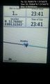
Arrived. @52.7606,1.5154

Achievements
Expeditions and Plans
| 2016-04-18 | ||
|---|---|---|
| Mannheim, Germany | Q-Owl | Between Gernsheim and Allmendfeld in the upper Rhine valley; located on a c... |
| Cambridge, United Kingdom | Sourcerer | A meadow divided into allotments near Pott Row, Norfolk, UK. |
| Norwich, United Kingdom | Sourcerer | A footpath point, south of Stalham, Norfolk, UK |
Sourcerer's Expedition Links
2016-04-17 52 1 - 2016-04-18 52 1 - 2016-04-18 52 0 - KML file download of Sourcerer's expeditions for use with Google Earth.