Difference between revisions of "2017-03-12 51 14"
imported>Danatar ([live picture]Picture [http://www.openstreetmap.org/?lat=51.16495500&lon=14.93980940&zoom=16&layers=B000FTF @51.1650,14.9398]) |
imported>FippeBot m (Location) |
||
| (3 intermediate revisions by one other user not shown) | |||
| Line 1: | Line 1: | ||
| − | + | {{meetup graticule | |
| − | |||
| − | |||
| − | |||
| − | |||
| − | |||
| − | |||
| − | |||
| − | |||
| − | |||
| − | {{meetup graticule | ||
| lat=51 | | lat=51 | ||
| lon=14 | | lon=14 | ||
| date=2017-03-12 | | date=2017-03-12 | ||
| − | }} | + | | graticule_name=Cottbus |
| + | | graticule_link=Cottbus, Germany | ||
| + | }}__NOTOC__ | ||
| + | == Location == | ||
| + | |||
| + | Today's location is on a bicycle/walking track next to a country road at Girbigsdorf, near Görlitz. | ||
| − | + | Country: Germany; state: Sachsen (Saxony, EU:DE:SN); district: Görlitz | |
| − | |||
| − | + | Weather: Clouded and windy. | |
| − | |||
| − | |||
| − | |||
| − | |||
| − | == | + | == Expedition== |
| − | + | ===[[User:Danatar|Danatar]]=== | |
| − | + | This hashpoint was far away from Dresden, but reachable and in a district-graticule-combination (Görlitz district, 51 14) I haven't been to before so I wanted to go there. I took the train from Dresden-Neustadt to Görlitz. During the ride it was sunny and I saw multiple deer. At Görlitz I started walking through run-down streets and past a large allotment garden. The sun wasn't visible any more, instead there was a cold wind. I passed the airfield and walked along the path next to the country road until I came near the hashpoint. Finding the spot was easy, it was directly on the path. Some people passed me by bike, but not many. | |
| − | |||
| Line 36: | Line 25: | ||
*Reached! -- [[User:Danatar|Danatar]] ([[User talk:Danatar|talk]]) [http://www.openstreetmap.org/?lat=51.16495290&lon=14.93980730&zoom=16&layers=B000FTF @51.1650,14.9398] 14:14, 12 March 2017 (GMT+01:00) | *Reached! -- [[User:Danatar|Danatar]] ([[User talk:Danatar|talk]]) [http://www.openstreetmap.org/?lat=51.16495290&lon=14.93980730&zoom=16&layers=B000FTF @51.1650,14.9398] 14:14, 12 March 2017 (GMT+01:00) | ||
| − | |||
| − | |||
| − | |||
| − | |||
| − | |||
| − | |||
<gallery perrow="5"> | <gallery perrow="5"> | ||
| − | |||
Image:2017-03-12_51_14_Danatar_1489324586703.jpg|Picture [http://www.openstreetmap.org/?lat=51.16495500&lon=14.93980940&zoom=16&layers=B000FTF @51.1650,14.9398] | Image:2017-03-12_51_14_Danatar_1489324586703.jpg|Picture [http://www.openstreetmap.org/?lat=51.16495500&lon=14.93980940&zoom=16&layers=B000FTF @51.1650,14.9398] | ||
</gallery> | </gallery> | ||
| − | + | After taking pictures I walked back towards Görlitz. I had enough time until the return train so I decided to make a small detour to the Görlitz city center and to Poland. I passed the hospital, the 'Holy Sepulcre' (a reproduction of the Jerusalem one from the 15th century, used as a pilgrim site) and the Saint-Peter-and-Paul church. I recognized many sights from my 2008 stay. Next to the church I took a picture of the 'Old Town Bridge' from the exact same spot as in 2008, noticing some differences but many identical things. Then I walked across the bridge to Poland for a moment. There are still no signs indicating a border. Through the old town I walked towards the train station, buying a ''Bratwurst'' with mustard in the mustard shop along the way. The train ride was quiet (after I had changed my seat away from the children). Back in Dresden the sun was shining again, but I was still feeling frozen by the time I was home. | |
| − | + | ||
| − | + | In total I walked 10.2 km. | |
| + | |||
| − | + | While taking the 'revisited' picture I noticed that the white balance had been set to 'light bulb', the later photos look much better. | |
| − | + | {{gallery|width=200|height=200|lines=2 | |
| − | + | |Image:2017-03-12_51_14_zug.jpg|train from Dresden to Görlitz | |
| + | |Image:2017-03-12_51_14_ortsschild.jpg|leaving Görlitz | ||
| + | |Image:2017-03-12_51_14_near.jpg|almost there | ||
| + | |Image:2017-03-12_51_14_gps.jpg|GPS | ||
| + | |Image:2017-03-12_51_14_hp.jpg|Coordinates reached! | ||
| + | |Image:2017-03-12_51_14_spot.jpg|the hashpoint | ||
| + | |Image:2017-03-12_51_14_pano.jpg|panorama | ||
| + | |Image:2017-03-12_51_14_revisited.jpg|same view as during my [[2008-09-07 51 15|very first expedition]], 8.5 years ago! | ||
| + | |Image:2017-03-12_51_14_blick-DE-PL.jpg|looking over the bridge to Poland | ||
| + | |Image:2017-03-12_51_14_neisse.jpg|the river Neiße is the border | ||
| + | |Image:2017-03-12_51_14_blick-PL-DE.jpg|looking over the bridge to Germany and to the St.-Peter-and-Paul church, 15th century | ||
| + | |Image:2017-03-12_51_14_rathaus-goerlitz.jpg|Görlitz town hall, 14th century | ||
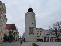
| + | |Image:2017-03-12_51_14_dickerturm.jpg|the ''Fat Tower'', 13th century | ||
| + | }} | ||
| − | |||
| − | |||
| − | |||
| − | |||
| − | |||
| − | + | ===tracklog=== | |
| + | [http://www.mygpsfiles.com/app/#https://www.dropbox.com/sh/l38ubdidvmv439v/AAAKZEp-cjltUmRNKuisXZNsa/2017/2017-03-12_51_14-triton.gpx triton tracklog] | ||
| − | |||
[[Category:Expeditions]] | [[Category:Expeditions]] | ||
| − | |||
[[Category:Expeditions with photos]] | [[Category:Expeditions with photos]] | ||
| − | |||
| − | |||
| − | |||
| − | |||
| − | |||
[[Category:Coordinates reached]] | [[Category:Coordinates reached]] | ||
| − | + | [[Category:Danatar]] | |
| − | + | {{location|DE|SN|GR}} | |
| − | |||
| − | |||
| − | |||
| − | |||
| − | |||
| − | |||
| − | |||
| − | |||
| − | |||
| − | |||
| − | [[Category: | ||
| − | |||
| − | |||
| − | |||
| − | |||
| − | |||
Latest revision as of 02:24, 7 August 2019
| Sun 12 Mar 2017 in Cottbus: 51.1649559, 14.9398019 geohashing.info google osm bing/os kml crox |
Location
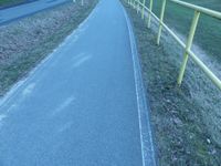
Today's location is on a bicycle/walking track next to a country road at Girbigsdorf, near Görlitz.
Country: Germany; state: Sachsen (Saxony, EU:DE:SN); district: Görlitz
Weather: Clouded and windy.
Expedition
Danatar
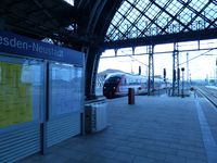
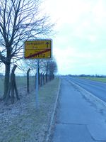
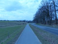
This hashpoint was far away from Dresden, but reachable and in a district-graticule-combination (Görlitz district, 51 14) I haven't been to before so I wanted to go there. I took the train from Dresden-Neustadt to Görlitz. During the ride it was sunny and I saw multiple deer. At Görlitz I started walking through run-down streets and past a large allotment garden. The sun wasn't visible any more, instead there was a cold wind. I passed the airfield and walked along the path next to the country road until I came near the hashpoint. Finding the spot was easy, it was directly on the path. Some people passed me by bike, but not many.
- Almost th
Almost there -- Danatar (talk) @51.1646,14.9416 14:10, 12 March 2017 (GMT+01:00)
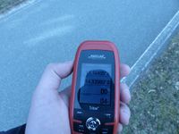
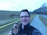
- Reached! -- Danatar (talk) @51.1650,14.9398 14:14, 12 March 2017 (GMT+01:00)
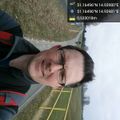
Picture @51.1650,14.9398
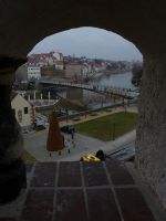
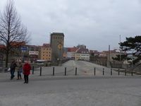
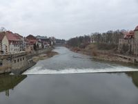
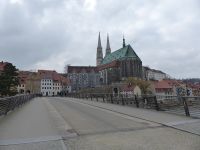
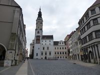
After taking pictures I walked back towards Görlitz. I had enough time until the return train so I decided to make a small detour to the Görlitz city center and to Poland. I passed the hospital, the 'Holy Sepulcre' (a reproduction of the Jerusalem one from the 15th century, used as a pilgrim site) and the Saint-Peter-and-Paul church. I recognized many sights from my 2008 stay. Next to the church I took a picture of the 'Old Town Bridge' from the exact same spot as in 2008, noticing some differences but many identical things. Then I walked across the bridge to Poland for a moment. There are still no signs indicating a border. Through the old town I walked towards the train station, buying a Bratwurst with mustard in the mustard shop along the way. The train ride was quiet (after I had changed my seat away from the children). Back in Dresden the sun was shining again, but I was still feeling frozen by the time I was home.
In total I walked 10.2 km.
While taking the 'revisited' picture I noticed that the white balance had been set to 'light bulb', the later photos look much better.
|
