Difference between revisions of "2018-02-04 43 -79"
imported>Frogman ([live picture]This is the closest interesting thing to the hashpoint.) |
m (More specific location) |
||
| (6 intermediate revisions by 2 users not shown) | |||
| Line 1: | Line 1: | ||
| + | [[Image:{{{image|2018-02-04 43 -79 frogman 1517784079375.jpg}}}|thumb|left]] | ||
| − | |||
| − | |||
| − | |||
| − | |||
| − | |||
| − | |||
| − | |||
| − | |||
| − | |||
{{meetup graticule | {{meetup graticule | ||
| lat=43 | | lat=43 | ||
| Line 19: | Line 11: | ||
== Location == | == Location == | ||
| − | + | On Allen Road a little north of Sheppard West subway station. | |
== Participants == | == Participants == | ||
| − | + | *[[User:Frogman|Frogman]] | |
| − | + | *Lily | |
== Plans == | == Plans == | ||
| − | + | I noticed that the hashpoint was very close to the subway route. Also, my coworker Lily lives nearby! The situation was ripe for travelling an hour and a half for a fun outing in inclement weather that would last fifteen minutes, tops. | |
== Expedition == | == Expedition == | ||
| − | + | Line 1 was closed between Union and St. Clair West, which meant that instead of the quick transfer at St. George I was anticipating, I had to get on a shuttle bus at Spadina northbound. Even with the closure I got to Sheppard West a bit early, so I chatted with a very friendly and very opinionated TTC employee for a while. Lily showed up and we began walking. | |
| + | |||
| + | Our first attempt at reaching the hashpoint was up a small street that parallels Allen Rd. The idea was to reach a point roughly perpendicular to the hashpoint and walk over a large berm there. Unfortunately, the berm was too steep and too slippery to get over. | ||
| + | Out second attempt was to simply walk alongside Allen Rd. to the hashpoint, which in retrospect was likely the better plan all along. The hashpoint was slightly into the road, so we waited for a break in traffic and stepped out just briefly to snap the proof-of-success picture. | ||
| − | + | Afterwards, we both went to the grocery store. But separate grocery stores, because we live an hour and a half apart. | |
| − | |||
| − | |||
== Photos == | == Photos == | ||
| Line 45: | Line 38: | ||
Image:2018-02-04_43_-79_frogman_1517784079375.jpg|This is the closest interesting thing to the hashpoint. | Image:2018-02-04_43_-79_frogman_1517784079375.jpg|This is the closest interesting thing to the hashpoint. | ||
| + | |||
| + | Image:2018-02-04_43_-79_frogman_1517784089523.jpg|Made it! | ||
| + | |||
| + | Image:2018-02-04_43_-79_frogman_1517784100863.jpg|The hashpoint. | ||
| + | |||
| + | Image:2018-02-04_43_-79_frogman_1517784115599.jpg|The geohashers. | ||
</gallery> | </gallery> | ||
| Line 51: | Line 50: | ||
<!-- Add any achievement ribbons you earned below, or remove this section --> | <!-- Add any achievement ribbons you earned below, or remove this section --> | ||
| − | + | {{Public transport geohash | |
| − | + | ||
| − | [[ | + | | latitude = 43 |
| + | | longitude = -79 | ||
| + | | date = 2018-02-04 | ||
| + | | busline = TTC | ||
| + | | name = [[User:Frogman|Frogman]] | ||
| + | | image = 2018-02-04_43_-79_frogman_1517784054302.jpg | ||
| − | + | }} | |
| + | {{drag-along | ||
| − | + | | latitude = 43 | |
| − | + | | longitude = -79 | |
| − | [[ | + | | date = 2018-02-04 |
| − | + | | partner = Lily | |
| + | | name = [[User:Frogman|Frogman]] | ||
| − | + | }} | |
| − | |||
[[Category:Expeditions]] | [[Category:Expeditions]] | ||
| − | |||
[[Category:Expeditions with photos]] | [[Category:Expeditions with photos]] | ||
| − | |||
| − | |||
| − | |||
| − | |||
| − | |||
[[Category:Coordinates reached]] | [[Category:Coordinates reached]] | ||
| − | + | {{location|CA|ON|TO}} | |
| − | |||
| − | |||
| − | |||
| − | |||
| − | |||
| − | |||
| − | |||
| − | |||
| − | |||
| − | |||
| − | |||
| − | |||
| − | |||
| − | |||
| − | |||
| − | |||
| − | |||
Latest revision as of 00:15, 10 August 2020

| Sun 4 Feb 2018 in 43,-79: 43.7527263, -79.4638342 geohashing.info google osm bing/os kml crox |
Location
On Allen Road a little north of Sheppard West subway station.
Participants
- Frogman
- Lily
Plans
I noticed that the hashpoint was very close to the subway route. Also, my coworker Lily lives nearby! The situation was ripe for travelling an hour and a half for a fun outing in inclement weather that would last fifteen minutes, tops.
Expedition
Line 1 was closed between Union and St. Clair West, which meant that instead of the quick transfer at St. George I was anticipating, I had to get on a shuttle bus at Spadina northbound. Even with the closure I got to Sheppard West a bit early, so I chatted with a very friendly and very opinionated TTC employee for a while. Lily showed up and we began walking.
Our first attempt at reaching the hashpoint was up a small street that parallels Allen Rd. The idea was to reach a point roughly perpendicular to the hashpoint and walk over a large berm there. Unfortunately, the berm was too steep and too slippery to get over.
Out second attempt was to simply walk alongside Allen Rd. to the hashpoint, which in retrospect was likely the better plan all along. The hashpoint was slightly into the road, so we waited for a break in traffic and stepped out just briefly to snap the proof-of-success picture.
Afterwards, we both went to the grocery store. But separate grocery stores, because we live an hour and a half apart.
Photos
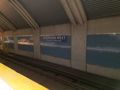
The station formerly known as Downsview
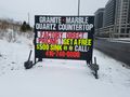
This is the closest interesting thing to the hashpoint.
Made it!
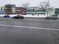
The hashpoint.
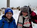
The geohashers.


Achievements
Frogman earned the Public transport geohash achievement
|
Frogman earned the Drag-along achievement
|