Difference between revisions of "2018-05-07 43 -79"
imported>Frogman ([live picture]Waiting at Kipling.) |
m (More specific location) |
||
| (12 intermediate revisions by 2 users not shown) | |||
| Line 1: | Line 1: | ||
| + | [[Image:{{{image|2018-05-07 43 -79 frogman 1525739062879.jpg}}}|thumb|left]] | ||
| − | |||
| − | |||
| − | |||
| − | |||
| − | |||
| − | |||
| − | |||
| − | |||
| − | |||
{{meetup graticule | {{meetup graticule | ||
| lat=43 | | lat=43 | ||
| Line 19: | Line 11: | ||
== Location == | == Location == | ||
| − | + | In the truck parking lot at Fort York Motel in eastern Mississauga. | |
== Participants == | == Participants == | ||
| − | + | *[[User:Frogman|Frogman]] | |
| − | + | ||
| + | == Expedition == | ||
| + | It was a beautiful day, so I decided I should spend it going to a parking lot in Mississauga. | ||
| + | |||
| + | I took Line 2 Bloor-Danforth to Kipling subway station. From there I was faced with two choices. I could have taken the MiWay bus all the way to the hashpoint. MiWay is the Mississauga municipal transit organization, and I assume that it's named after that one Frank Sinatra song that everyone hates. The other option was to take the TTC bus 112 West Mall to the Mississauga-Toronto border and walk the rest of the way. This second option was, if you consider my already-purchased monthly transit pass a sunk cost, completely free, and it gave an opportunity to take a nice walk on a nice day, so I went with that. | ||
| − | + | The bus dropped me off at the intersection of Dundas Street West and West Mall Crescent, the latter being a glorified onramp to The West Mall, a major arterial road. I crossed Etobicoke Creek to reach Mississauga. | |
| − | |||
| − | + | The walk to the hashpoint was along Dundas Street East, a major street that is west of Dundas Street West. It wasn't too hot out, but the beating sun made it feel that way. The road was lined with various strip malls and also there was a duck statue. The hashpoint itself was in the truck parking lot behind a motel. I snapped a couple of pictures and then headed back the same way I came. | |
| − | |||
| − | + | On the (very long) subway ride back I got some reading done: I am working my way through "Rectangles are Nonnegative Juntas", a wonderful paper by Göös, Lovett, Meka, Watson, and Zuckerman that is very complicated and proves, among other things, that rectangles are nonnegative juntas. | |
| − | |||
== Photos == | == Photos == | ||
| Line 43: | Line 36: | ||
Image:2018-05-07_43_-79_frogman_1525739014586.jpg|Waiting at Kipling. | Image:2018-05-07_43_-79_frogman_1525739014586.jpg|Waiting at Kipling. | ||
| + | |||
| + | Image:2018-05-07_43_-79_frogman_1525739036742.jpg|West Mall Crescent. | ||
| + | |||
| + | Image:2018-05-07_43_-79_frogman_1525739050655.jpg|A duck I met. | ||
| + | |||
| + | Image:2018-05-07_43_-79_frogman_1525739062879.jpg|The motel. | ||
| + | |||
| + | Image:2018-05-07_43_-79_frogman_1525739074014.jpg|Made it! | ||
| + | |||
| + | Image:2018-05-07_43_-79_frogman_1525739092809.jpg|Some truck trailers near the hashpoint. | ||
| + | |||
| + | Image:2018-05-07_43_-79_frogman_1525739128793.jpg|Truck parking near the hashpoint. | ||
| + | |||
| + | Image:2018-05-07_43_-79_frogman_1525739137556.jpg|Me! | ||
| + | |||
| + | Image:2018-05-07_43_-79_frogman_1525739177703.jpg|Etobicoke Creek, the western border of Toronto. | ||
| + | |||
| + | Image:2018-05-07_43_-79_frogman_1525739190613.jpg|Back in Toronto! | ||
| + | |||
| + | Image:2018-05-07_43_-79_frogman_1525739206232.jpg|Rectangles are nonnegative juntas. | ||
</gallery> | </gallery> | ||
== Achievements == | == Achievements == | ||
{{#vardefine:ribbonwidth|800px}} | {{#vardefine:ribbonwidth|800px}} | ||
| − | |||
| − | + | {{Public transport geohash | |
| − | |||
| − | |||
| − | + | | latitude = 43 | |
| + | | longitude = -79 | ||
| + | | date = 2018-05-07 | ||
| + | | busline = the TTC | ||
| + | | name = [[User:Frogman|Frogman]] | ||
| + | | image = 2018-05-07_43_-79_frogman_1525739014586.jpg | ||
| − | + | }} | |
| − | |||
| − | |||
| − | |||
| − | |||
| − | |||
| − | |||
[[Category:Expeditions]] | [[Category:Expeditions]] | ||
| − | |||
[[Category:Expeditions with photos]] | [[Category:Expeditions with photos]] | ||
| − | |||
| − | |||
| − | |||
| − | |||
| − | |||
[[Category:Coordinates reached]] | [[Category:Coordinates reached]] | ||
| − | + | {{location|CA|ON|PL}} | |
| − | |||
| − | |||
| − | |||
| − | |||
| − | |||
| − | |||
| − | |||
| − | |||
| − | |||
| − | |||
| − | |||
| − | |||
| − | |||
| − | |||
| − | |||
| − | |||
| − | |||
Latest revision as of 00:16, 10 August 2020

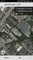
| Mon 7 May 2018 in 43,-79: 43.6197319, -79.5702482 geohashing.info google osm bing/os kml crox |
Location
In the truck parking lot at Fort York Motel in eastern Mississauga.
Participants
Expedition
It was a beautiful day, so I decided I should spend it going to a parking lot in Mississauga.
I took Line 2 Bloor-Danforth to Kipling subway station. From there I was faced with two choices. I could have taken the MiWay bus all the way to the hashpoint. MiWay is the Mississauga municipal transit organization, and I assume that it's named after that one Frank Sinatra song that everyone hates. The other option was to take the TTC bus 112 West Mall to the Mississauga-Toronto border and walk the rest of the way. This second option was, if you consider my already-purchased monthly transit pass a sunk cost, completely free, and it gave an opportunity to take a nice walk on a nice day, so I went with that.
The bus dropped me off at the intersection of Dundas Street West and West Mall Crescent, the latter being a glorified onramp to The West Mall, a major arterial road. I crossed Etobicoke Creek to reach Mississauga.
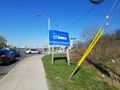
The walk to the hashpoint was along Dundas Street East, a major street that is west of Dundas Street West. It wasn't too hot out, but the beating sun made it feel that way. The road was lined with various strip malls and also there was a duck statue. The hashpoint itself was in the truck parking lot behind a motel. I snapped a couple of pictures and then headed back the same way I came.
On the (very long) subway ride back I got some reading done: I am working my way through "Rectangles are Nonnegative Juntas", a wonderful paper by Göös, Lovett, Meka, Watson, and Zuckerman that is very complicated and proves, among other things, that rectangles are nonnegative juntas.
Photos
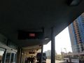
Headed west!
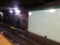
Waiting at Kipling.
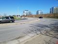
West Mall Crescent.
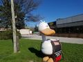
A duck I met.
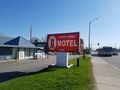
The motel.
Made it!
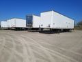
Some truck trailers near the hashpoint.
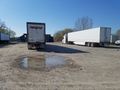
Truck parking near the hashpoint.
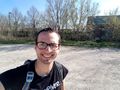
Me!
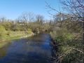
Etobicoke Creek, the western border of Toronto.
Back in Toronto!
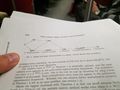
Rectangles are nonnegative juntas.


Achievements
Frogman earned the Public transport geohash achievement
|