Difference between revisions of "2019-05-12 48 11"
imported>Claralucia9 ([live picture]Looking around) |
m (Username changed) |
||
| (10 intermediate revisions by 3 users not shown) | |||
| Line 19: | Line 19: | ||
== Location == | == Location == | ||
| − | + | close to a fishing lake just outside of Dornach in the north east of Munich | |
== Participants == | == Participants == | ||
| − | + | [[User:Clearlucid9|Claralucia9]] ([[User talk:Clearlucid9|talk]]) | |
| − | |||
== Plans == | == Plans == | ||
| Line 29: | Line 28: | ||
== Expedition == | == Expedition == | ||
| − | + | It's been raining cats and dogs this morning, but that's no excuse to pass on a geohash I've been eying since yesterday. So I drove as close as I could (also Google navigate insisted that it's possible to drive through the gravel plant...) and set out on a short walk, holding on to my umbrella in the increasing winds. There was a geocache (https://coord.info/GC2TW0W) less then 75m from the hash - so I went there first. The hash itself was between some trees an I got a little wet trying to find the right spot. Managed to get within less than 1m. | |
| + | Afterwards another geocache and then back home. | ||
== Tracklog == | == Tracklog == | ||
| Line 35: | Line 35: | ||
== Photos == | == Photos == | ||
| − | + | ||
| − | |||
| − | |||
<gallery perrow="5"> | <gallery perrow="5"> | ||
| Line 44: | Line 42: | ||
Image:2019-05-12_48_11_Claralucia9_1557639887686.jpg|Me at the spot | Image:2019-05-12_48_11_Claralucia9_1557639887686.jpg|Me at the spot | ||
| − | Image:2019-05- | + | Image:2019-05-12_48_11_Claralucia9_1557639939391.jpg|Trees |
| + | |||
| + | Image:2019-05-12_48_11_Claralucia9_1557639961743.jpg|More trees | ||
| + | |||
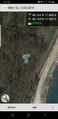
| + | Image:2019-05-12_48_11_Claralucia9_1557640003692.jpg|Distance from the neighboring geocache | ||
</gallery> | </gallery> | ||
== Achievements == | == Achievements == | ||
{{#vardefine:ribbonwidth|800px}} | {{#vardefine:ribbonwidth|800px}} | ||
| − | + | {{hash collision|latitude=48|longitude=11|date=2019-05-12|name=[[User:Clearlucid9|claralucia9]]|id=GC2TW0W|distance=75m|honor=mention}} | |
| − | |||
| − | |||
| − | |||
| − | [[ | ||
| − | |||
| − | |||
| − | |||
| − | |||
| − | |||
| − | |||
| − | |||
| − | |||
| − | |||
| − | |||
[[Category:Expeditions]] | [[Category:Expeditions]] | ||
| − | |||
[[Category:Expeditions with photos]] | [[Category:Expeditions with photos]] | ||
| − | + | {{location|DE|BY|M}} | |
| − | |||
| − | |||
| − | {{location}} | ||
| − | |||
| − | |||
| − | |||
[[Category:Coordinates reached]] | [[Category:Coordinates reached]] | ||
| − | |||
| − | |||
| − | |||
| − | |||
| − | |||
| − | |||
| − | |||
| − | |||
| − | |||
| − | |||
| − | |||
| − | |||
| − | |||
| − | |||
| − | |||
| − | |||
| − | |||
| − | |||
Latest revision as of 12:38, 31 October 2021
| Sun 12 May 2019 in 48,11: 48.1651961, 11.6856301 geohashing.info google osm bing/os kml crox |
Location
close to a fishing lake just outside of Dornach in the north east of Munich
Participants
Plans
Expedition
It's been raining cats and dogs this morning, but that's no excuse to pass on a geohash I've been eying since yesterday. So I drove as close as I could (also Google navigate insisted that it's possible to drive through the gravel plant...) and set out on a short walk, holding on to my umbrella in the increasing winds. There was a geocache (https://coord.info/GC2TW0W) less then 75m from the hash - so I went there first. The hash itself was between some trees an I got a little wet trying to find the right spot. Managed to get within less than 1m. Afterwards another geocache and then back home.
Tracklog
Photos
As close as can be

Me at the spot
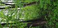
Trees
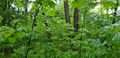
More trees
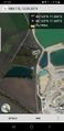
Distance from the neighboring geocache


Achievements
claralucia9 earned the Hash collision honorable mention
|