Difference between revisions of "2020-07-08 50 8"
m (Location) |
|||
| Line 27: | Line 27: | ||
== Photos == | == Photos == | ||
| − | |||
| − | |||
| − | |||
| − | |||
<gallery perrow="5"> | <gallery perrow="5"> | ||
| + | Image:2020-07-08_50_8_pfaffenpfad.jpg | Random sign along the way | ||
| + | Image:2020-07-08_50_8_water.jpg | Passing over a bridge along the way | ||
| + | Image:2020-07-08_50_8_pretty_and_deadly.jpg | Deadly but pretty | ||
| + | Image:2020-07-08_50_8_coordinates_reached.png | Coordinates reached | ||
| + | Image:2020-07-08_50_8_stupid_grin.jpg | Stupid grin | ||
| + | Image:2020-07-08_50_8_the_hash.jpg | Looking at the hash | ||
</gallery> | </gallery> | ||
Revision as of 21:07, 8 July 2020
| Wed 8 Jul 2020 in 50,8: 50.1955134, 8.3608746 geohashing.info google osm bing/os kml crox |
Location
Middle of the woods but not far.
Participants
Expedition
It's about time we went hashing again, it's been way too long.
This one was conveniently located at about 4 km walking distance so we (well Mampfred did) decided to go for it in the afternoon.
As usual, the whole think was utterly uneventful. We had to use some trails and as usual had to go up and down a few times but eventually we found the hash about 100 meters of the track and quickly snaped some photos before heading back home.
A shout out goes to a yet nameless colleague of Mampfred that really really should try geohashing at some point -- you know who you are :D
Note that the tracklog is gonna be rubbish, I definitely need to upgrade my GPS, that thing goes bonkers and jumps around like crazy these days.
Tracklog
TODO
Photos
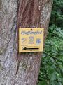
Random sign along the way
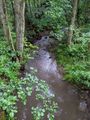
Passing over a bridge along the way
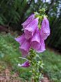
Deadly but pretty

Coordinates reached

Stupid grin
Looking at the hash


