Difference between revisions of "2021-02-23 52 9"
(new report) |
m (user categories) |
||
| Line 50: | Line 50: | ||
[[Category:Expeditions with photos]] | [[Category:Expeditions with photos]] | ||
{{location|DE|NI|HM}} | {{location|DE|NI|HM}} | ||
| − | + | {{user categories|user=Fippe|bike=13|train=82|foot=15}} | |
Revision as of 00:23, 6 January 2022
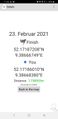
| Tue 23 Feb 2021 in Hannover: 52.1718721, 9.3866675 geohashing.info google osm bing/os kml crox |
Location
This Geohash is located on the Hohe Egge near Klein Süntel.
Participants
Expedition
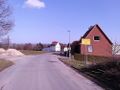
I took the bike to the Bismarckstraße station and took the S-Bahn to Bad Münder. From there, I walked the rest of the distance up the Süntel mountains via a village called Klein Süntel.
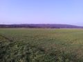
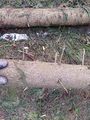
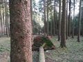
The Süntel's peak at a mighty 440 meters is the Hohe Egge, and that is where the geohash is located. The exact location turned out to be on a fallen tree not far from a path. I recorded proof there.
At the peak, there is a tower with a restaurant to feed hungry hikers, but during the pandemic it is closed. I still got a nice view of the valley from a nearby bench. The way leading to the bench is unknown to Google Maps, but not to OSM.
Afterwards, I walked back to the station via Bad Münder proper, took the S-Bahn back to the Bismarckstraße station, and the bike back home.
Photos
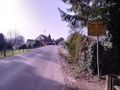
In Bad Münder
The Süntel mountains
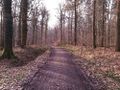
On the way to the Geohash
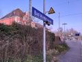
In Klein Süntel
Proof
The Geohash
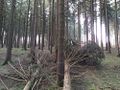
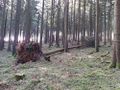
Surroundings
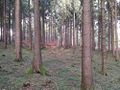
Surroundings
Surroundings
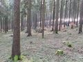
Surroundings
The site of the Geohash: A fallen tree
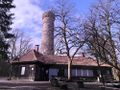
The tower
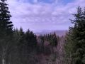
The view from the bench
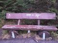
The bench
Back in Bad Münder


Achievements
Fippe earned the Land geohash achievement
|