Difference between revisions of "2021-02-27 52 4"
(Created page with "{{subst:Expedition |lat = 52 |lon = 4 |date = 2021-02-27 }}") |
m (Location) |
||
| (10 intermediate revisions by 3 users not shown) | |||
| Line 14: | Line 14: | ||
__NOTOC__ | __NOTOC__ | ||
== Location == | == Location == | ||
| − | + | The hashpoint was on (the side of?) a small road (Waterlinie) very near exit 8 of motorway A9, only about 27km from [[User:Palmpje|Palmpje's]] house. The exit is the one to take to visit the Bazaar, a huge indoor market in Beverwijk. Obvisouly there will not be many people now because of Covid-19 restrictions. | |
== Participants == | == Participants == | ||
| − | + | [[User:Palmpje|Palmpje]] | |
| − | |||
== Plans == | == Plans == | ||
| − | + | Drive there and first find a bunch of geocaches in a park at the other side of the motorway. Then make sure to be at the hashpoint at hash-o-clock. At the hashpoint itself the car can be parked on the side of the road, so easy access. | |
== Expedition == | == Expedition == | ||
| − | + | All went as planned and Palmpje was at the hashpoint at 15:45-ish. First he found the exact spot, managing a very satisfying 0m on his GPSr. Yeah! Some twigs where found lying around and used to spell XKCD on the grass / mud at the side of the road. Then pictures where taken, including one with a tower (of course). Palmpje then waited until 16:00 but nobody else arrived. So a short trip was made to find a Letterbox cache about 200m away. This cache was placed by a former colleague of Palmpje - but both of us are no longer working at that particular company. Returning to the car, nobody else was there so Palmpje departed and went to find a few more geocaches. | |
== Tracklog == | == Tracklog == | ||
| Line 30: | Line 29: | ||
== Photos == | == Photos == | ||
| − | |||
| − | |||
| − | |||
<gallery perrow="5"> | <gallery perrow="5"> | ||
| + | File:2021-02-27_ZeroMeter.jpg | Zero meter | ||
| + | File:2021-02-27_52_4_Marker.jpg | Marks the spot | ||
| + | File:2021-02-27_52_4_North.jpg | North | ||
| + | File:2021-02-27_52_4_East.jpg | East | ||
| + | File:2021-02-27_52_4_South.jpg | South | ||
| + | File:2021-02-27_52_4_West.jpg | West | ||
| + | File:2021-02-27_52_4_Tower.jpg | Tower | ||
</gallery> | </gallery> | ||
== Achievements == | == Achievements == | ||
{{#vardefine:ribbonwidth|800px}} | {{#vardefine:ribbonwidth|800px}} | ||
| − | + | {{land geohash | latitude = 52 | longitude = 4 | date = 2021-02-27 | name = [[User:Palmpje|Palmpje]]}} | |
| − | |||
| − | |||
| − | |||
| − | |||
| − | |||
| − | |||
| − | |||
| − | |||
| − | |||
| − | |||
| − | |||
| − | |||
| − | |||
| − | |||
[[Category:Expeditions]] | [[Category:Expeditions]] | ||
| − | |||
[[Category:Expeditions with photos]] | [[Category:Expeditions with photos]] | ||
| − | |||
| − | |||
| − | |||
| − | |||
| − | |||
[[Category:Coordinates reached]] | [[Category:Coordinates reached]] | ||
| − | + | {{location|NL|NH}} | |
| − | |||
| − | |||
| − | |||
| − | |||
| − | |||
| − | |||
| − | |||
| − | |||
| − | |||
| − | |||
| − | |||
| − | |||
| − | |||
| − | |||
| − | |||
| − | |||
| − | |||
Latest revision as of 14:42, 5 March 2021
| Sat 27 Feb 2021 in 52,4: 52.4750496, 4.6846505 geohashing.info google osm bing/os kml crox |
Location
The hashpoint was on (the side of?) a small road (Waterlinie) very near exit 8 of motorway A9, only about 27km from Palmpje's house. The exit is the one to take to visit the Bazaar, a huge indoor market in Beverwijk. Obvisouly there will not be many people now because of Covid-19 restrictions.
Participants
Plans
Drive there and first find a bunch of geocaches in a park at the other side of the motorway. Then make sure to be at the hashpoint at hash-o-clock. At the hashpoint itself the car can be parked on the side of the road, so easy access.
Expedition
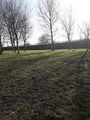
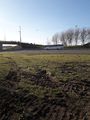
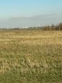
All went as planned and Palmpje was at the hashpoint at 15:45-ish. First he found the exact spot, managing a very satisfying 0m on his GPSr. Yeah! Some twigs where found lying around and used to spell XKCD on the grass / mud at the side of the road. Then pictures where taken, including one with a tower (of course). Palmpje then waited until 16:00 but nobody else arrived. So a short trip was made to find a Letterbox cache about 200m away. This cache was placed by a former colleague of Palmpje - but both of us are no longer working at that particular company. Returning to the car, nobody else was there so Palmpje departed and went to find a few more geocaches.
Tracklog
Photos
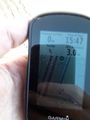
Zero meter
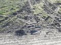
Marks the spot
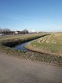
North
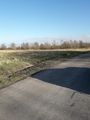
East
South
West
Tower


Achievements
Palmpje earned the Land geohash achievement
|