Difference between revisions of "2021-07-17 47 11"
(Created page with "{{subst:Expedition}}") |
|||
| Line 1: | Line 1: | ||
| − | + | {{meetup graticule | |
| − | |||
| − | |||
| − | |||
| − | |||
| − | |||
| − | |||
| − | |||
| − | |||
| lat={{#explode:{{SUBPAGENAME}}| |1}} | | lat={{#explode:{{SUBPAGENAME}}| |1}} | ||
| lon={{#explode:{{SUBPAGENAME}}| |2}} | | lon={{#explode:{{SUBPAGENAME}}| |2}} | ||
| date={{#explode:{{SUBPAGENAME}}| |0}} | | date={{#explode:{{SUBPAGENAME}}| |0}} | ||
| − | }} | + | }} |
__NOTOC__ | __NOTOC__ | ||
== Location == | == Location == | ||
| − | + | On a pasture in [https://en.wikipedia.org/wiki/M%C3%BCnster,_Tyrol Münster]. | |
== Participants == | == Participants == | ||
| − | + | [[User:Dirimwar|Dirimwar]] ([[User talk:Dirimwar|talk]]) | |
| − | |||
== Plans == | == Plans == | ||
| − | + | See [[2021-07-17 47 10#Plans]]. | |
== Expedition == | == Expedition == | ||
| − | + | After returning to Innsbruck from the [[2021-07-17 47 10|47 10 hashpoint]], I jumped straight on the 15:35 S4 train to Kufstein. A pleasant 40 minute ride later, I hopped off at Münster-Wiesing station and made my way to the north-east. | |
| + | |||
| + | Much to my dismay, it was actually raining this time, and most of the walk was spent next to the main road. I was pleasantly surprised by the consideration most drivers showed me - I didn't get splashed at all on my way to the hashpoint! (The way back was a different story - apparently you have to look drivers in the eyes to make them recognize you as a person.) | ||
| + | |||
| + | When I got to the pasture, I was happy to see that the cows were home and that it wasn't fenced off. I walked along the edge straight over the hashpoint, took a view pics of the surroundings and a proof screenshot, and continued on to the west back onto the main road. | ||
| + | |||
| + | I had some time left until my train back would leave, so I weathered a shower in a nearby bus stop before walking back to the station (and getting soaked by several cars). At the station, I changed into dry socks and concluded my adventure for that day. All in all, a nice set of first geohashes :) | ||
== Tracklog == | == Tracklog == | ||
| − | + | {{tracklog|2021-07-17 47 11 Dirimwar.gpx}} | |
| − | == Photos == | + | == Photos == |
| − | |||
| − | |||
| − | |||
<gallery perrow="5"> | <gallery perrow="5"> | ||
| + | File:2021-07-17 47 11 Proof.png | Proof | ||
| + | File:2021-07-17 47 11 East.jpg | View to the east from the hashpoint | ||
| + | File:2021-07-17 47 11 South.jpg | View to the south | ||
</gallery> | </gallery> | ||
== Achievements == | == Achievements == | ||
{{#vardefine:ribbonwidth|800px}} | {{#vardefine:ribbonwidth|800px}} | ||
| − | |||
| − | + | {{Two to the N achievement | |
| − | + | | count = 1 | |
| − | [[ | + | | date = 2021-07-17 |
| + | | latitude = 47 | ||
| + | | longitude = 11 | ||
| + | | name = [[User:Dirimwar|Dirimwar]] | ||
| + | | reached = true | ||
| + | }} | ||
| − | + | {{Multihash | |
| + | | latitude1 = 47 | ||
| + | | longitude1 = 10 | ||
| + | | latitude2 = 47 | ||
| + | | longitude2 = 11 | ||
| + | | date = 2021-07-17 | ||
| + | | name = [[User:Dirimwar|Dirimwar]] | ||
| + | }} | ||
| − | + | {{A Tale of Two Hashes challenge | |
| − | + | | latitude = 47 | |
| − | [[ | + | | longitude = 11 |
| − | + | | date = 2021-07-17 | |
| + | | name = [[User:Dirimwar|Dirimwar]] | ||
| + | | place = Münster | ||
| + | }} | ||
| − | |||
| − | |||
| − | |||
[[Category:Expeditions]] | [[Category:Expeditions]] | ||
| − | |||
[[Category:Expeditions with photos]] | [[Category:Expeditions with photos]] | ||
| − | |||
| − | |||
| − | |||
| − | |||
| − | |||
[[Category:Coordinates reached]] | [[Category:Coordinates reached]] | ||
| − | |||
| − | |||
| − | |||
| − | |||
| − | |||
| − | |||
| − | |||
| − | |||
| − | |||
| − | |||
| − | |||
| − | |||
| − | |||
| − | |||
| − | |||
| − | |||
| − | |||
| − | |||
Revision as of 13:34, 18 July 2021
| Sat 17 Jul 2021 in 47,11: 47.4157251, 11.8332640 geohashing.info google osm bing/os kml crox |
Location
On a pasture in Münster.
Participants
Plans
Expedition
After returning to Innsbruck from the 47 10 hashpoint, I jumped straight on the 15:35 S4 train to Kufstein. A pleasant 40 minute ride later, I hopped off at Münster-Wiesing station and made my way to the north-east.
Much to my dismay, it was actually raining this time, and most of the walk was spent next to the main road. I was pleasantly surprised by the consideration most drivers showed me - I didn't get splashed at all on my way to the hashpoint! (The way back was a different story - apparently you have to look drivers in the eyes to make them recognize you as a person.)
When I got to the pasture, I was happy to see that the cows were home and that it wasn't fenced off. I walked along the edge straight over the hashpoint, took a view pics of the surroundings and a proof screenshot, and continued on to the west back onto the main road.
I had some time left until my train back would leave, so I weathered a shower in a nearby bus stop before walking back to the station (and getting soaked by several cars). At the station, I changed into dry socks and concluded my adventure for that day. All in all, a nice set of first geohashes :)
Tracklog
Photos
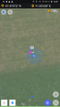
Proof
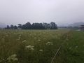
View to the east from the hashpoint
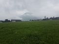
View to the south


Achievements

Dirimwar earned the Multihash Achievement
|
