2022-03-06 40 -4
Contents
Location
On the steep slope of a hill, behind a barbwire fence, in an area with no mobile network coverage.
Participants
Plans
The geohash was close to the large reservoir Embalse del Borguillo, which has very nice beaches. The beaches in the Sun and the blue and green of the water have kind of a Caribbean touch. I had visited the reservoir a couple of times and I had passed by it on the way back from expedition 2021-06-06_40_-4, but I did not stop and take photos. So this time, the plan was to first reach the geohash, which seemed to be located only a few hundred meters from a road, and stop at the reservoir on the way back to take some photos there.
Expedition
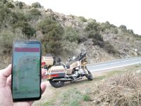
The weather was not particularly nice, with temperatures peaking at 12°C in the afternoon and mostly overcast skies. When I passed by the reservoir on the way to the geohash, I noticed that the water level was very low and with the overcast skies it did not really show its Caribbean side. Approaching the geohash, I could conveniently park the Goldwing by the side of the road near the point closest to the geohash. So far, so good.
