Difference between revisions of "2022-08-02 47 -122"
([live picture]Speed 100 km/hr) |
|||
| Line 1: | Line 1: | ||
| − | + | {{meetup graticule | |
| − | |||
| − | |||
| − | |||
| − | |||
| − | |||
| − | |||
| − | |||
| − | |||
| lat=47 | | lat=47 | ||
| lon=-122 | | lon=-122 | ||
| date=2022-08-02 | | date=2022-08-02 | ||
| + | | graticule_name=Seattle | ||
| + | | graticule_link=Seattle, Washington | ||
}}<!-- edit as necessary --> | }}<!-- edit as necessary --> | ||
__NOTOC__ | __NOTOC__ | ||
== Location == | == Location == | ||
| − | + | Westbound lanes of highway 518, between I-5 and Burien | |
== Participants == | == Participants == | ||
| − | + | * [[User:Thomcat|Thomcat]] | |
| − | -- | + | |
| + | == Expedition == | ||
| + | Story time :) | ||
| + | |||
| + | I woke up at 4:30 am in Milan, or more specifically the Sheraton airport hotel at Malpensa. Tuesday was a travel day to return to the USA. The original plan was to drive home to drop off luggage then drive to Olympia for a family thing. | ||
| + | |||
| + | The actual flight was Milan to Frankfurt, then Frankfurt to Seattle. On the second leg, the captain informed us there was no fly-net internet available on this 747, which I'm sure made some of the folks upstairs unhappy. Me, I had a book to read :) | ||
| + | |||
| + | After landing and customs, I headed home - not once checking today's hashpoints. I mean, I knew global wasn't here, but beyond that, I was [[Curse_of_Unawareness|unaware]]... | ||
| + | |||
| + | In a few moments of downtime in Olympia, I idly checked the hashpoint. The nearest was in 47,-123, and looked like wilderness, so no trip there. But wait, what did that mean in the home graticule? The hashpoint was in the westbound lanes of highway 518, which I had traveled just hours earlier. | ||
| + | |||
| + | I put together a quick expedition plan, stopping for a caffeinated beverage. Something about having woken up 24 hours earlier was starting to nag at me. While there I was nearly bitten by the Unawareness raptor. | ||
| − | + | The actual expedition was pretty straightforward. This is a highway, and I decided not to pull over or do any hashdance. I would cleverly poise my fingers on the screen capture and drive through at 60ish MPH (aka 100 KPH). In the screen shot, I managed to get to single digits on accuracy, definite success for a speed racer. Was I the last one standing? Time will tell. | |
| − | |||
| − | + | I then reached home again and several hours of uninterrupted sleep. | |
| − | |||
== Tracklog == | == Tracklog == | ||
| Line 43: | Line 47: | ||
{{#vardefine:ribbonwidth|800px}} | {{#vardefine:ribbonwidth|800px}} | ||
<!-- Add any achievement ribbons you earned below, or remove this section --> | <!-- Add any achievement ribbons you earned below, or remove this section --> | ||
| + | {{Last man standing | ||
| + | | latitude = 47 | ||
| + | | longitude = -122 | ||
| + | | date = 2022-08-02 | ||
| + | | gender = man | ||
| + | | name = Thomcat | ||
| + | }} | ||
| − | |||
| − | |||
| − | |||
| − | |||
| − | |||
| − | |||
| − | |||
| − | |||
| − | |||
| − | |||
| − | |||
| − | |||
| − | |||
| − | |||
[[Category:Expeditions]] | [[Category:Expeditions]] | ||
| − | |||
[[Category:Expeditions with photos]] | [[Category:Expeditions with photos]] | ||
| − | |||
| − | |||
| − | |||
| − | |||
| − | |||
[[Category:Coordinates reached]] | [[Category:Coordinates reached]] | ||
| − | + | {{location|US|WA|KN}} | |
| − | |||
| − | |||
| − | |||
| − | |||
| − | |||
| − | |||
| − | |||
| − | |||
| − | |||
| − | |||
| − | |||
| − | |||
| − | |||
| − | |||
| − | |||
| − | |||
| − | |||
Revision as of 13:59, 3 August 2022
| Tue 2 Aug 2022 in Seattle: 47.4689765, -122.3080935 geohashing.info google osm bing/os kml crox |
Location
Westbound lanes of highway 518, between I-5 and Burien
Participants
Expedition
Story time :)
I woke up at 4:30 am in Milan, or more specifically the Sheraton airport hotel at Malpensa. Tuesday was a travel day to return to the USA. The original plan was to drive home to drop off luggage then drive to Olympia for a family thing.
The actual flight was Milan to Frankfurt, then Frankfurt to Seattle. On the second leg, the captain informed us there was no fly-net internet available on this 747, which I'm sure made some of the folks upstairs unhappy. Me, I had a book to read :)
After landing and customs, I headed home - not once checking today's hashpoints. I mean, I knew global wasn't here, but beyond that, I was unaware...
In a few moments of downtime in Olympia, I idly checked the hashpoint. The nearest was in 47,-123, and looked like wilderness, so no trip there. But wait, what did that mean in the home graticule? The hashpoint was in the westbound lanes of highway 518, which I had traveled just hours earlier.
I put together a quick expedition plan, stopping for a caffeinated beverage. Something about having woken up 24 hours earlier was starting to nag at me. While there I was nearly bitten by the Unawareness raptor.
The actual expedition was pretty straightforward. This is a highway, and I decided not to pull over or do any hashdance. I would cleverly poise my fingers on the screen capture and drive through at 60ish MPH (aka 100 KPH). In the screen shot, I managed to get to single digits on accuracy, definite success for a speed racer. Was I the last one standing? Time will tell.
I then reached home again and several hours of uninterrupted sleep.
Tracklog
Photos
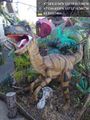
Curse Raptor @47.0457,-122.8721
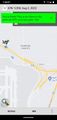
Speed 100 km/hr


Achievements
Thomcat earned the Last man standing achievement
|