Difference between revisions of "2022-12-15 42 -71"
From Geohashing
m (Location) |
|||
| (2 intermediate revisions by 2 users not shown) | |||
| Line 36: | Line 36: | ||
--> | --> | ||
<gallery perrow="5"> | <gallery perrow="5"> | ||
| + | |||
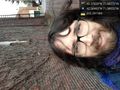
| + | Image:2022-12-15_42_-71_JesseFTW_1671123549360.jpg|Requisite Silly Grin at hashpoint [https://openstreetmap.org/?mlat=42.36963100&mlon=-71.08053470&zoom=16 @42.3696,-71.0805] | ||
</gallery> | </gallery> | ||
| Line 43: | Line 45: | ||
__NOTOC__ | __NOTOC__ | ||
| − | |||
| − | |||
| − | |||
| − | |||
| − | |||
| − | |||
| − | |||
| − | |||
| − | |||
| − | |||
| − | |||
| − | |||
| − | |||
| − | |||
[[Category:Expeditions]] | [[Category:Expeditions]] | ||
| − | |||
[[Category:Expeditions with photos]] | [[Category:Expeditions with photos]] | ||
| − | + | [[Category:Coordinates reached]] <!--The photo displays coordinates that don't match the Geohash, however, the background looks exactly like Google Streetview imagery of the Geohash's surroundings, so I think that this Geohash was reached. -Fippe--> | |
| − | + | {{location|US|MA|MI}} | |
| − | |||
| − | |||
| − | |||
| − | [[Category:Coordinates reached]] | ||
| − | |||
| − | |||
| − | |||
| − | |||
| − | |||
| − | |||
| − | |||
| − | |||
| − | |||
| − | |||
| − | |||
| − | |||
| − | |||
| − | |||
| − | |||
| − | |||
| − | |||
| − | |||
Latest revision as of 11:42, 15 January 2023
| Thu 15 Dec 2022 in 42,-71: 42.3703878, -71.0827225 geohashing.info google osm bing/os kml crox |
Location
100 Otis St., Cambridge, MA
Participants
JesseFTW (talk) 16:18, 15 December 2022 (UTC)
Plans
An easy walk for me (finally!), so I plan to walk there, take a few pictures, and head back.
Expedition
Tracklog
Photos
Requisite Silly Grin at hashpoint @42.3696,-71.0805
