Difference between revisions of "2023-01-29 48 11"
From Geohashing
([live] Been there, details follow) |
|||
| Line 1: | Line 1: | ||
| − | + | {{meetup graticule | |
| − | |||
| − | |||
| − | |||
| − | |||
| − | |||
| − | |||
| − | |||
| − | |||
| lat=48 | | lat=48 | ||
| lon=11 | | lon=11 | ||
| Line 13: | Line 5: | ||
}}<!-- edit as necessary --> | }}<!-- edit as necessary --> | ||
== Location == | == Location == | ||
| − | + | On the road of a residential area in Ottendichl near Munich | |
== Participants == | == Participants == | ||
| − | + | * [[User:Solli|Solli]] | |
| − | |||
== Plans == | == Plans == | ||
| − | + | There was not much planning involved. I realized that the hash was nearby and easily reachable, so I went there. | |
== Expedition == | == Expedition == | ||
| − | + | The hashpoint appeared to be on the road of a residential area, so I drove there. As it turned out, it was acutally on a parking lot. All I had to do was park the car there, take the usual pictures and drive on. So yet another drive-in hash, I should really make a ribbon for that. | |
| − | |||
| − | |||
| − | |||
| − | |||
| − | |||
== Photos == | == Photos == | ||
| − | |||
| − | |||
| − | |||
<gallery perrow="5"> | <gallery perrow="5"> | ||
| + | Image:2023-01-29_48_11_Solli_01.jpg | Proof | ||
| + | Image:2023-01-29_48_11_Solli_02.jpg | View from the hashpoint | ||
| + | Image:2023-01-29_48_11_Solli_03.jpg | Stupid Grin™ | ||
</gallery> | </gallery> | ||
| + | |||
== Achievements == | == Achievements == | ||
| − | {{#vardefine:ribbonwidth| | + | {{#vardefine:ribbonwidth|800px}} |
| − | + | {{land geohash | |
| + | | latitude = 48 | ||
| + | | longitude = 11 | ||
| + | | date = 2023-01-29 | ||
| + | | name = Solli | ||
| + | }} | ||
| − | + | {{gratuitous ribbon | |
| − | + | | color = red | |
| − | + | | icon = Electric_car.png | |
| − | + | | latitude = 48 | |
| + | | longitude = 11 | ||
| + | | date = 2023-01-29 | ||
| + | | achievement = Electric Vehicle Achievement | ||
| + | | description = travelling to and from the Geohash in an electric vehicle | ||
| + | | name = Solli | ||
| + | }} | ||
| − | |||
| − | |||
| − | |||
| − | |||
| − | |||
| − | |||
| − | |||
| − | |||
| − | |||
| − | |||
[[Category:Expeditions]] | [[Category:Expeditions]] | ||
| − | |||
[[Category:Expeditions with photos]] | [[Category:Expeditions with photos]] | ||
| − | |||
| − | |||
| − | |||
| − | |||
| − | |||
[[Category:Coordinates reached]] | [[Category:Coordinates reached]] | ||
| − | + | {{location|DE|BY|M|city=false}} | |
| − | |||
| − | |||
| − | |||
| − | |||
| − | |||
| − | |||
| − | |||
| − | |||
| − | |||
| − | |||
| − | |||
| − | |||
| − | |||
| − | |||
| − | |||
| − | |||
| − | |||
Revision as of 13:23, 30 January 2023
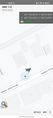
| Sun 29 Jan 2023 in 48,11: 48.1322382, 11.7369333 geohashing.info google osm bing/os kml crox |
Location
On the road of a residential area in Ottendichl near Munich
Participants
Plans
There was not much planning involved. I realized that the hash was nearby and easily reachable, so I went there.
Expedition
The hashpoint appeared to be on the road of a residential area, so I drove there. As it turned out, it was acutally on a parking lot. All I had to do was park the car there, take the usual pictures and drive on. So yet another drive-in hash, I should really make a ribbon for that.
Photos
Proof

View from the hashpoint

Stupid Grin™


Achievements
Solli earned the Land geohash achievement
|
Solli earned the Electric Vehicle Achievement
|