Difference between revisions of "2023-03-02 53 -2"
From Geohashing
([live picture]View from the hash [https://openstreetmap.org/?mlat=53.54504630&mlon=-2.77477480&zoom=16 @53.5450,-2.7748]) |
m (Location) |
||
| (2 intermediate revisions by 2 users not shown) | |||
| Line 14: | Line 14: | ||
== Location == | == Location == | ||
<!-- where you've surveyed the hash to be --> | <!-- where you've surveyed the hash to be --> | ||
| + | At the end of Ormskirk Road, Skelmersdale | ||
== Participants == | == Participants == | ||
| + | * [[User:Angel|Angel]] ([[User talk:Angel|talk]]) | ||
<!-- who attended: If you link to your wiki user name in this section, your expedition will be picked up by the various statistics generated for geohashing. You may use three tildes ~ as a shortcut to automatically insert the user signature of the account you are editing with. | <!-- who attended: If you link to your wiki user name in this section, your expedition will be picked up by the various statistics generated for geohashing. You may use three tildes ~ as a shortcut to automatically insert the user signature of the account you are editing with. | ||
--> | --> | ||
== Plans == | == Plans == | ||
| + | Head to the hash, and maybe take the scenic route back. | ||
<!-- what were the original plans --> | <!-- what were the original plans --> | ||
== Expedition == | == Expedition == | ||
<!-- how it all turned out. your narrative goes here. --> | <!-- how it all turned out. your narrative goes here. --> | ||
| + | Shortly after leaving home, I got sent a coupon code for a free coffee, so made a little detour. Otherwise, the hash was pretty easy to find. | ||
== Tracklog == | == Tracklog == | ||
<!-- if your GPS device keeps a log, you may use Template:Tracklog, post a link here, or both --> | <!-- if your GPS device keeps a log, you may use Template:Tracklog, post a link here, or both --> | ||
| + | Map and photos visible [https://www.relive.cc/view/vdvm3PRg5x6 on Relive]. | ||
== Photos == | == Photos == | ||
| Line 44: | Line 49: | ||
{{#vardefine:ribbonwidth|100%}} | {{#vardefine:ribbonwidth|100%}} | ||
<!-- Add any achievement ribbons you earned below, or remove this section --> | <!-- Add any achievement ribbons you earned below, or remove this section --> | ||
| + | * Think I got Tron and Deja Vu; need to check when I have more time. | ||
__NOTOC__ | __NOTOC__ | ||
| − | |||
| − | |||
| − | |||
| − | |||
| − | |||
| − | |||
| − | |||
| − | |||
| − | |||
| − | |||
| − | |||
| − | |||
| − | |||
| − | |||
[[Category:Expeditions]] | [[Category:Expeditions]] | ||
| − | + | [[Category:Expeditions with photos]] | |
| − | [[Category:Expeditions with photos]] | ||
| − | |||
| − | |||
| − | |||
| − | |||
| − | |||
[[Category:Coordinates reached]] | [[Category:Coordinates reached]] | ||
| − | + | {{location|GB|ENG|LAN}} | |
| − | |||
| − | |||
| − | |||
| − | |||
| − | |||
| − | |||
| − | |||
| − | |||
| − | |||
| − | |||
| − | |||
| − | |||
| − | |||
| − | |||
| − | |||
| − | |||
| − | |||
Latest revision as of 17:43, 7 March 2023
| Thu 2 Mar 2023 in 53,-2: 53.5450205, -2.7747877 geohashing.info google osm bing/os kml crox |
Location
At the end of Ormskirk Road, Skelmersdale
Participants
Plans
Head to the hash, and maybe take the scenic route back.
Expedition
Shortly after leaving home, I got sent a coupon code for a free coffee, so made a little detour. Otherwise, the hash was pretty easy to find.
Tracklog
Map and photos visible on Relive.
Photos
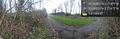
"I think it's that way" … going to see how close I can get without checking the map again. @53.5399,-2.7469
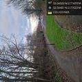
A guess about hash location based on my memory of looking at the map this morning @53.5448,-2.7752
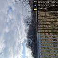
View from the hash @53.5450,-2.7748


Achievements
- Think I got Tron and Deja Vu; need to check when I have more time.