Difference between revisions of "2023-04-09 48 7"
(→Location) |
(Coordinates reached) |
||
| Line 12: | Line 12: | ||
== Plans == | == Plans == | ||
[[User:Baarde|Baarde]] will cycle there in the afternoon. He expects to arrive around 16:00. | [[User:Baarde|Baarde]] will cycle there in the afternoon. He expects to arrive around 16:00. | ||
| + | |||
| + | == Expedition == | ||
| + | As [[2022-04-25 48 7|I previously said]], some French municipalities are oddly shaped and their boundaries make no sense. Today was a perfect example. While the geohash is located near the outskirts of Illhausern, it (as well a the surroundings fields and even a couple of houses), is technically part of Colmar, which is more than 10 kilometers away. | ||
| + | |||
| + | I left home in the afternoon and cycled from Sélestat to Illhaeusern. The coordinates were in a ploughed field. No plant was growing yet, so I casually walked to the hashpoint. | ||
| + | |||
| + | After recording proof, I continued toward Colmar and then took the EuroVelo 5 to go back home. | ||
| + | |||
| + | == Photos == | ||
| + | <gallery> | ||
| + | File:2023-04-09 48 7 01.jpg | Cycling to Colmar | ||
| + | File:2023-04-09 48 7 02.jpg | Near the geohash | ||
| + | File:2023-04-09 48 7 03.png | Coordinates reached | ||
| + | File:2023-04-09 48 7 04.jpg | Surroundings (North) | ||
| + | File:2023-04-09 48 7 05.jpg | Surroundings (South) | ||
| + | File:2023-04-09 48 7 06.jpg | Surroundings (West) | ||
| + | File:2023-04-09 48 7 07.jpg | Stupid grin | ||
| + | File:2023-04-09 48 7 08.jpg | 45 minutes later, in Colmar | ||
| + | </gallery> | ||
| + | |||
| + | == Achievements == | ||
| + | {{#vardefine:ribbonwidth|100%}} | ||
| + | {{land geohash | ||
| + | | latitude = 48 | ||
| + | | longitude = 7 | ||
| + | | date = 2023-04-09 | ||
| + | | name = [[User:Baarde|Baarde]] | ||
| + | }} | ||
| + | {{bicycle geohash | ||
| + | | latitude = 48 | ||
| + | | longitude = 7 | ||
| + | | date = 2023-04-09 | ||
| + | | name = [[User:Baarde|Baarde]] | ||
| + | | distance = 57 km | ||
| + | | bothways = true | ||
| + | }} | ||
__NOTOC__ | __NOTOC__ | ||
[[Category:Expeditions]] | [[Category:Expeditions]] | ||
| + | [[Category:Coordinates reached]] | ||
| + | [[Category:Expeditions with photos]] | ||
{{location|FR|68}} | {{location|FR|68}} | ||
Latest revision as of 20:13, 11 April 2023
| Sun 9 Apr 2023 in 48,7: 48.1781862, 7.4340348 geohashing.info google osm bing/os kml crox |
Location
In a field between Colmar and Illhaeusern.
Participants
Plans
Baarde will cycle there in the afternoon. He expects to arrive around 16:00.
Expedition
As I previously said, some French municipalities are oddly shaped and their boundaries make no sense. Today was a perfect example. While the geohash is located near the outskirts of Illhausern, it (as well a the surroundings fields and even a couple of houses), is technically part of Colmar, which is more than 10 kilometers away.
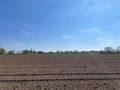
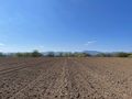
I left home in the afternoon and cycled from Sélestat to Illhaeusern. The coordinates were in a ploughed field. No plant was growing yet, so I casually walked to the hashpoint.
After recording proof, I continued toward Colmar and then took the EuroVelo 5 to go back home.
Photos
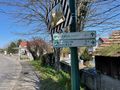
Cycling to Colmar
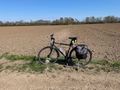
Near the geohash
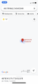
Coordinates reached
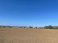
Surroundings (North)
Surroundings (South)
Surroundings (West)
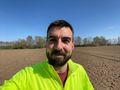
Stupid grin
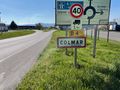
45 minutes later, in Colmar


Achievements
Baarde earned the Land geohash achievement
|
Baarde earned the Bicycle geohash achievement
|