Difference between revisions of "2023-08-16 51 13"
([live] Coordinates reached!) |
|||
| Line 12: | Line 12: | ||
Country: Germany; state: Sachsen (Saxony, EU:DE:SN); district: Dresden; Stadtbezirk: Altstadt; Stadtteil (city district): Innere Altstadt | Country: Germany; state: Sachsen (Saxony, EU:DE:SN); district: Dresden; Stadtbezirk: Altstadt; Stadtteil (city district): Innere Altstadt | ||
| − | Weather: | + | Weather: clouded, warm and muggy |
== [[User:Danatar|Danatar]] == | == [[User:Danatar|Danatar]] == | ||
| Line 22: | Line 22: | ||
The [[Juggernaut achievement]] is doable, although one corner is very close to the allowed distance from the straight line; perhaps I can cross through the school yard to avoid that corner. You can expect History<sup>TM</sup> and Art<sup>WTF</sup> and Architecture<sup>OMG</sup> along the route. | The [[Juggernaut achievement]] is doable, although one corner is very close to the allowed distance from the straight line; perhaps I can cross through the school yard to avoid that corner. You can expect History<sup>TM</sup> and Art<sup>WTF</sup> and Architecture<sup>OMG</sup> along the route. | ||
| − | [[ | + | === Expedition === |
| + | <!-- | ||
| + | I started walking | ||
| + | |||
| + | |||
| + | ...--> | ||
| + | |||
| + | *Coordinates reached! -- [[User:Danatar|Danatar]] ([[User talk:Danatar|talk]]) [https://openstreetmap.org/?mlat=51.05394790&mlon=13.73409200&zoom=16 @51.0539,13.7341] 13:18, 16 August 2023 (GMT+02:00) | ||
| + | |||
| + | ... | ||
{{gallery|width=200|height=200|lines=2 | {{gallery|width=200|height=200|lines=2 | ||
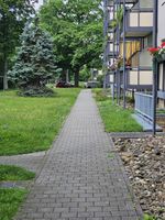
| − | |Image:2023-08- | + | |Image:2023-08-16_51_13_rueck_wallot1.jpg|along backyard track |
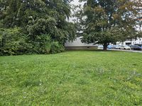
| + | |Image:2023-08-16_51_13_rueck_wallot2.jpg|across a meadow | ||
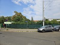
| + | |Image:2023-08-16_51_13_rueck_juggernautknapp.jpg|dangerous part of juggernaut (picture taken on way back) | ||
| + | |Image:2023-08-16_51_13_rueck_beiSP1.jpg|along side of building (picture taken on way back) | ||
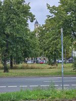
| + | |Image:2023-08-16_51_13_hin_gruen.jpg|through a courtyard | ||
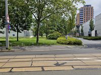
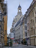
| + | |Image:2023-08-16_51_13_hin_petersburger.jpg|straight across road towards ''Frauenkirche'' | ||
| + | |Image:2023-08-16_51_13_hin_nebenpolizei.jpg| | ||
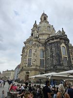
| + | |Image:2023-08-16_51_13_hin_frauenkirche.jpg|right past ''Frauenkirche'' | ||
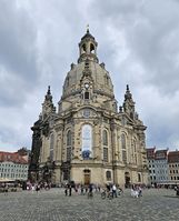
| + | |Image:2023-08-16_51_13_rueck_frauenkirche.jpg|better view of ''Frauenkirche'' (on way back) | ||
| + | |Image:2023-08-16_51_13_hin_fuerstenzug.jpg|along ''Fürstenzug'' | ||
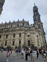
| + | |Image:2023-08-16_51_13_hin_hofkirche.jpg|past the cathedral | ||
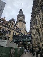
| + | |Image:2023-08-16_51_13_hin_uebergang.jpg|rainproof (and peasant-proof) royal shortcut between cathedral and palace | ||
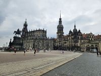
| + | |Image:2023-08-16_51_13_hin_zwingersemper.jpg|not far now, looking at ''Zwinger'' and ''Semperoper'' | ||
| + | |Image:2023-08-16_51_13_rueck_hofkircheschloss.jpg|looking back at cathedral and palace | ||
| + | |Image:2023-08-16_51_13_hin_pano1.jpg|panorama in very touristy location | ||
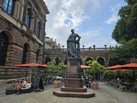
| + | |Image:2023-08-16_51_13_near1.jpg|hashpoint ahead | ||
| + | |Image:2023-08-16_51_13_near2.jpg|view from the café's stairs, spot somewhere here | ||
| + | |Image:2023-08-16_51_13_gps1.jpg|waiting for the spot to come to me | ||
| + | |Image:2023-08-16_51_13_gps2.jpg|GPS near the spot | ||
| + | |Image:2023-08-16_51_13_gps3.jpg|GPS in identical but different location near the spot | ||
| + | |Image:2023-08-16_51_13_geohashdroid.jpg|geohashdroid screenshot came nearest | ||
| + | |Image:2023-08-16_51_13_pano2.jpg|panorama near the hashpoint | ||
| + | |Image:2023-08-16_51_13_rueck_zwingerinnen.jpg|construction/restoration inside the ''Zwinger'' | ||
| + | |Image:2023-08-16_51_13_juggernaut.jpg|juggernaut map | ||
}} | }} | ||
| − | ===tracklog=== | + | ===tracklog===<!-- |
| − | {{tracklog | willfollow.gpx}} | + | {{tracklog | willfollow.gpx}}--> |
[[Category:Expeditions]] | [[Category:Expeditions]] | ||
[[Category:Expeditions with photos]] | [[Category:Expeditions with photos]] | ||
| − | [[Category:Coordinates reached]] | + | [[Category:Coordinates reached]] |
[[Category:Danatar]] | [[Category:Danatar]] | ||
{{location|DE|SN|DD}} | {{location|DE|SN|DD}} | ||
| − | |||
Revision as of 17:20, 16 August 2023
| Wed 16 Aug 2023 in Dresden: 51.0539522, 13.7341169 geohashing.info google osm bing/os kml crox |
Location
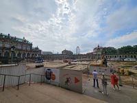
Today's location is directly next to the Zwinger, a Baroque (built 1710-1728) palatial complex and one of the most important historic locations in Dresden. In the part of the building nearest to the hashpoint, the "Old Masters" art gallery is situated. On the other side of the hashpoint you can find the Semperoper opera house, another very important building.
Country: Germany; state: Sachsen (Saxony, EU:DE:SN); district: Dresden; Stadtbezirk: Altstadt; Stadtteil (city district): Innere Altstadt
Weather: clouded, warm and muggy
Danatar
Planning
This location should be very easy to reach, as long as there are no construction works blocking it. I'll visit it either in the morning or in the early afternoon.
I think I have not been to the exact spot before, but I've been to the Zwinger (last time was on 2023-06-15, with a guest) and to the Semperoper (last time was on 2023-06-16 for a ballet). During the intermission, we had a drink less than 50 meters from the hashpoint.
The Juggernaut achievement is doable, although one corner is very close to the allowed distance from the straight line; perhaps I can cross through the school yard to avoid that corner. You can expect HistoryTM and ArtWTF and ArchitectureOMG along the route.
Expedition
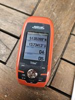
- Coordinates reached! -- Danatar (talk) @51.0539,13.7341 13:18, 16 August 2023 (GMT+02:00)
...
|
