Difference between revisions of "2023-11-29 58 5"
From Geohashing
(→Photos) |
(→Photos) |
||
| Line 41: | Line 41: | ||
Image:2023-11-29_58_5_Pica42_1701244198600.jpg|Verdalen [https://openstreetmap.org/?mlat=58.78667160&mlon=5.61446910&zoom=16 @58.7867,5.6145] | Image:2023-11-29_58_5_Pica42_1701244198600.jpg|Verdalen [https://openstreetmap.org/?mlat=58.78667160&mlon=5.61446910&zoom=16 @58.7867,5.6145] | ||
Image:20231129 58 5 SE.jpg|thumb|View to the southeast | Image:20231129 58 5 SE.jpg|thumb|View to the southeast | ||
| − | + | Image:20231129 58 5 NE.jpg|thumb|View to the northeast | |
Revision as of 19:18, 29 November 2023
| Wed 29 Nov 2023 in 58,5: 58.7865517, 5.6144423 geohashing.info google osm bing/os kml crox |

Location
Near a road in Verdalen, Klepp, Norway
Participants
Plans
Expedition
Tracklog
Photos

Verdalen @58.7867,5.6145
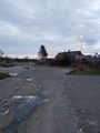
View to the southeast
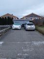
View to the northeast


Achievements
Pica42 earned the Land geohash achievement
|
pica42 earned the Walk geohash Achievement
|