Difference between revisions of "2024-02-18 -35 138"
(Created page with "{{subst:Expedition}}") |
(new expedition) |
||
| Line 18: | Line 18: | ||
<!-- who attended: If you link to your wiki user name in this section, your expedition will be picked up by the various statistics generated for geohashing. You may use three tildes ~ as a shortcut to automatically insert the user signature of the account you are editing with. | <!-- who attended: If you link to your wiki user name in this section, your expedition will be picked up by the various statistics generated for geohashing. You may use three tildes ~ as a shortcut to automatically insert the user signature of the account you are editing with. | ||
--> | --> | ||
| + | [[User:XXOs|XXOs]] ([[User talk:XXOs|talk]]) | ||
| + | |||
| + | [[User:XXOs|XXOs]]'s dad | ||
== Plans == | == Plans == | ||
<!-- what were the original plans --> | <!-- what were the original plans --> | ||
| + | The reasoning for doing this geohash was basically the same as [[2024-01-14 -34 138|my last one]] - I still need more (night) hours for my driver's license, and again my father was available and the geohash was (probably) accessible. | ||
== Expedition == | == Expedition == | ||
<!-- how it all turned out. your narrative goes here. --> | <!-- how it all turned out. your narrative goes here. --> | ||
| + | The drive to this hashpoint was slightly more eventful than last time! By which I mean there were roadworks on the [[wikipedia:South Eastern Freeway|South Eastern Freeway]], and so I had to travel at 40km/h rather than the usual 80-100km/h. | ||
| − | + | After a little under an hour of driving, we reached the hashpoint. Well, ''almost''. The point was about 200 metres down a [[wikipedia:Fire trail|fire track]] which we weren't allowed to drive down, so we had to walk the last stretch. It wasn't too bad, but my dad was wearing sandals (not the best walking shoes) and there was an annoying amount of bugs. | |
| − | |||
| + | I almost didn't reach the hash, as it was very slightly on someone's property, but it was close enough to the fence that I could successfully claim it. | ||
| + | |||
| + | <!-- == Tracklog == | ||
| + | if your GPS device keeps a log, you may use Template:Tracklog, post a link here, or both --> | ||
== Photos == | == Photos == | ||
| + | (I've figured out how to keep the photo metadata from my phone this time) | ||
<!-- Insert pictures between the gallery tags using the following format: | <!-- Insert pictures between the gallery tags using the following format: | ||
Image:2020-##-## ## ## Alpha.jpg | Witty Comment | Image:2020-##-## ## ## Alpha.jpg | Witty Comment | ||
--> | --> | ||
| − | <gallery perrow=" | + | <gallery perrow="6"> |
| + | Image:2024-02-18 -35 138 firetrack start.JPEG | Start of the firetrack (+ my shadow) | ||
| + | Image:2024-02-18 -35 138 scrap metal.JPEG | Random pile of (probably) scrap metal | ||
| + | Image:2024-02-18 -35 138 therm.JPEG | [[User:XXOs/Therm|Therm]] at the hash | ||
| + | Image:2024-02-18 -35 138 google mapped.PNG | I really need to get a dedicated [[GPS receivers|GPS reciever]] | ||
| + | Image:2024-02-18 -35 138 watch and therm.JPEG | remembered to take a picture of my watch this time | ||
| + | Image:2024-02-18 -35 138 road signs.JPEG | Road signs to [[wikipedia:Macclesfield, South Australia|Macclesfield]], [[wikipedia:Strathalbyn, South Australia|Strathalbyn]], and [[wikipedia:Mount Barker, South Australia|Mt Barker]] | ||
</gallery> | </gallery> | ||
| Line 38: | Line 53: | ||
{{#vardefine:ribbonwidth|100%}} | {{#vardefine:ribbonwidth|100%}} | ||
<!-- Add any achievement ribbons you earned below, or remove this section --> | <!-- Add any achievement ribbons you earned below, or remove this section --> | ||
| + | {{Two to the N achievement|count=3|date=2024-02-18|latitude=-35|longitude=138|name=[[User:XXOs|XXOs]]}} | ||
| + | {{Radio Yerevan|achievement=[[User:XXOs/progress#Scale:_City|Regional geohashing achievement]]|date=2024-02-18|latitude=-35|longitude=138 | ||
| + | |detail=the hash point is technically not in the city of Adelaide, and any definitions of "Greater Adelaide" either don't include it or include more than just [[-34,138]] and [[-35,138]]}} | ||
__NOTOC__ | __NOTOC__ | ||
| Line 46: | Line 64: | ||
<!-- ==REQUEST FOR TWITTER BOT== Please leave either the New report or the Expedition planning category in as long as you work on it. This helps the twitter bot a lot with announcing the right outcome at the right moment. --> | <!-- ==REQUEST FOR TWITTER BOT== Please leave either the New report or the Expedition planning category in as long as you work on it. This helps the twitter bot a lot with announcing the right outcome at the right moment. --> | ||
| − | |||
| − | |||
| − | |||
| − | |||
| − | |||
| − | |||
| − | |||
| − | |||
[[Category:Expeditions]] | [[Category:Expeditions]] | ||
| − | |||
[[Category:Expeditions with photos]] | [[Category:Expeditions with photos]] | ||
| − | |||
| − | |||
| − | |||
| − | |||
| − | |||
[[Category:Coordinates reached]] | [[Category:Coordinates reached]] | ||
| − | |||
| − | |||
| − | |||
| − | |||
| − | |||
| − | |||
| − | |||
| − | |||
| − | |||
| − | |||
| − | |||
| − | |||
| − | |||
| − | |||
| − | |||
| − | |||
| − | |||
| − | |||
Revision as of 01:57, 19 February 2024
| Sun 18 Feb 2024 in -35,138: -35.1123376, 138.8348436 geohashing.info google osm bing/os kml crox |
Location
Participants
XXOs's dad
Plans
The reasoning for doing this geohash was basically the same as my last one - I still need more (night) hours for my driver's license, and again my father was available and the geohash was (probably) accessible.
Expedition
The drive to this hashpoint was slightly more eventful than last time! By which I mean there were roadworks on the South Eastern Freeway, and so I had to travel at 40km/h rather than the usual 80-100km/h.
After a little under an hour of driving, we reached the hashpoint. Well, almost. The point was about 200 metres down a fire track which we weren't allowed to drive down, so we had to walk the last stretch. It wasn't too bad, but my dad was wearing sandals (not the best walking shoes) and there was an annoying amount of bugs.
I almost didn't reach the hash, as it was very slightly on someone's property, but it was close enough to the fence that I could successfully claim it.
Photos
(I've figured out how to keep the photo metadata from my phone this time)
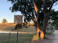
Start of the firetrack (+ my shadow)
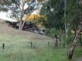
Random pile of (probably) scrap metal
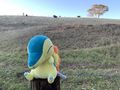
Therm at the hash

I really need to get a dedicated GPS reciever
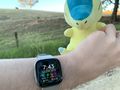
remembered to take a picture of my watch this time
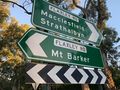
Road signs to Macclesfield, Strathalbyn, and Mt Barker


Achievements

Is it true that this user earned the Regional geohashing achievement?
|