Difference between revisions of "2024-02-29 47 -122"
([live picture]Leaving the office [https://openstreetmap.org/?mlat=47.79837897&mlon=-122.21056297&zoom=16 @47.7984,-122.2106]) |
([live picture]Armory [https://openstreetmap.org/?mlat=47.79150097&mlon=-122.23608400&zoom=16 @47.7915,-122.2361]) |
||
| Line 38: | Line 38: | ||
Image:2024-02-29_47_-122_thomcat_1709248365447.jpg|Leaving the office [https://openstreetmap.org/?mlat=47.79837897&mlon=-122.21056297&zoom=16 @47.7984,-122.2106] | Image:2024-02-29_47_-122_thomcat_1709248365447.jpg|Leaving the office [https://openstreetmap.org/?mlat=47.79837897&mlon=-122.21056297&zoom=16 @47.7984,-122.2106] | ||
| + | |||
| + | Image:2024-02-29_47_-122_thomcat_1709248779987.jpg|Armory [https://openstreetmap.org/?mlat=47.79150097&mlon=-122.23608400&zoom=16 @47.7915,-122.2361] | ||
</gallery> | </gallery> | ||
Latest revision as of 23:19, 29 February 2024
| Thu 29 Feb 2024 in Seattle: 47.7928141, -122.2361341 geohashing.info google osm bing/os kml crox |
Location
A cul de sac in Bothell WA, west and uphill from Canyon Park
Participants
Plans
Stop by on the way to work, again after work
Expedition
Leap day!
The geohash point is on my way to work, and not on private property, a double win. I dropped a note on discord and headed to the spot, parking nearly on the point.
I looked at the phone a few, trying to find the delayed photo setting. Failing that, I stepped out in the light rain and took a phone - which was posted sideways, of course. Might as well try another experiment, and posted again with phone gps settings instead of picture gps - still sideways. With that I continued to work.
Tracklog
Photos

Geohasher from picture @47.7928,-122.2362

Geohasher from current @47.7928,-122.2362

Geohasher vertical
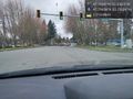
Leaving the office @47.7984,-122.2106
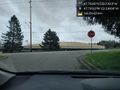
Armory @47.7915,-122.2361


