Difference between revisions of "2024-03-06 -37 145"
(Created page with "{{meetup graticule|date=2024-03-06|lat=-37|lon=145}} ==Location== In bushland, 30m from Sugarloaf lookout, near Kinglake. ==Participants== *Stevage *User:L...") |
|||
| Line 62: | Line 62: | ||
==Photos== | ==Photos== | ||
<gallery heights="300px" mode="packed"> | <gallery heights="300px" mode="packed"> | ||
| − | File:Screenshot 2024-03-07 at 9.24.36 am.png|Possible routes | + | File:Screenshot 2024-03-07 at 9.24.36 am.png|Possible routes. Blue is Mernda/Whittlesea, Green is Hurstbridge/Kinglake, and red is a psychotic, extremely steep and rutted four wheel drive track I briefly considered. |
| − | File:2024-03-06 -37 145 Lachie5.jpg | + | File:2024-03-06 -37 145 Lachie5.jpg|Success! |
File:2024-03-06 -37 145 Lachie4.jpg | File:2024-03-06 -37 145 Lachie4.jpg | ||
File:2024-03-06 -37 145 Lachie3.jpg | File:2024-03-06 -37 145 Lachie3.jpg | ||
| − | File:2024-03-06 -37 145 Lachie2.jpg | + | File:2024-03-06 -37 145 Lachie2.jpg|Mernda. |
| − | File:2024-03-06 -37 145 Lachie1.jpg | + | File:2024-03-06 -37 145 Lachie1.jpg|Lachie's bountiful snacks. |
| − | File:PXL_20240306_112733540.jpg | + | File:PXL_20240306_112733540.jpg|Wiped out. |
| − | File:PXL_20240306_091749664.jpg | + | File:PXL_20240306_091749664.jpg|Success! |
| − | File:PXL_20240306_091358868.jpg | + | File:PXL_20240306_091358868.jpg|More lookout. |
| − | File:PXL_20240306_091200612.jpg | + | File:PXL_20240306_091200612.jpg|Lookout underwhelming Lachie. |
| − | File:PXL_20240306_091155969.jpg | + | File:PXL_20240306_091155969.jpg|Underwhelming lookout. |
| − | File:PXL_20240306_091136476.jpg | + | File:PXL_20240306_091136476.jpg|Underwhelming lookout. |
| − | File:PXL_20240306_085416687.jpg | + | File:PXL_20240306_085416687.jpg|Tired but hanging in there. |
| − | File:PXL_20240306_085221962.jpg | + | File:PXL_20240306_085221962.jpg|Lachie admires the sunset. |
| − | File:PXL_20240306_084948623.MP.jpg | + | File:PXL_20240306_084948623.MP.jpg|Sunset as we turn towards the lookout. |
| − | File:PXL_20240306_080512247.jpg | + | File:PXL_20240306_080512247.jpg|This might be why there were no cars. |
| − | File:PXL_20240306_080254497.jpg | + | File:PXL_20240306_080254497.jpg|I really love Humevale Road. |
| − | File:PXL_20240306_075236411.jpg | + | File:PXL_20240306_075236411.jpg|Humevale Road is lovely. |
| − | File:PXL_20240306_074108498.jpg | + | File:PXL_20240306_074108498.jpg|Starting up Humevale Road. |
| − | File:PXL_20240306_070533726.jpg | + | File:PXL_20240306_070533726.jpg|Our way is blocked, halfway to Whittlesea. |
</gallery> | </gallery> | ||
Revision as of 23:03, 6 March 2024
| Wed 6 Mar 2024 in -37,145: -37.5315285, 145.2427314 geohashing.info google osm bing/os kml crox |
Location
In bushland, 30m from Sugarloaf lookout, near Kinglake.
Participants
Expedition
What an intriguing location. High on the Kinglake range, almost exactly at a prominent lookout on Mount Sugarloaf. For once, a bush geohash is graced with an actual landmark, not just "somewhere in the bush, kind of near a track, 10 kilometres from ...". And I'm on a good run of more energetic expeditions lately, so, I'm excited.
Lachie is potentially keen but only after work. However, I'm busy in the evening, visiting a friend, so I pack my bike in the morning and wheel it to the front door, ready to face a long hard ride in a forecast heat of 28C.
Just then I get two messages. First, a message from the tax department notifying me of an unpaid debt. (This isn't relevant to the story, but sometimes I like to include irrelevant details.) More pertinently, my friend has belatedly realised she has the afternoon at home without her son, and do I want to come earlier and help repot some plants?
I take a moment to change gears, and pay my debts (ok, it was slightly relevant - this bit wouldn't make sense if I hadn't told you about that message), I grab a pair of gardening gloves (will this turn out to be relevant? who knows!) and head over.
After an enjoyable couple of hours "helping" transition the balcony garden from summer vegetables to autumn crops (mostly consisting of watching from a comfortable chair while offering lazy but over-confident opinions), I head off to wait for Lachie.
But an ice cream intervenes, as it tends to, and a moment of panic about fitting two bikes on crowded peak-hour trains, so board an earlier train to while away an hour in the boring dystopia of Mernda. Picture an oversized futuristic-looking train station next to a dull shopping centre calling itself "Mernda village centre". Except even the town planners and shopping centre designers can't even pretend to believe in public transport enough to face the shopping centre towards the giant train station next door, so you have to walk all the way around to enter via the carpark.
My mission is to acquire some beer for our anticipated success, but amidst the confusion of strange beer pricing and a total lack of anything darker than a pale ale, I make some questionable decisions. But Lachie is gracious about them once he arrives, and we set off.
But first, a note about route choices. Remarkably, the point fell almost equidistant between two excellent routes. We could start at Hurstbridge and proceed up the classic, and very popular, Kinglake climb, a series of small climbs before a rather pretty climb with a number of excellent views out from the range but on a fairly busy road. Or, from Mernda, a long, flat approach via Whittlesea to the almost car-free miracle of a sealed road that is Humevale Road - a single, steady climb to the top. We opted for the latter, and that's why we're at Mernda. In the boring dystopia. Getting out of there as fast as possible.
We start with a rough bike path I have a vague memory of. It turns out it was once a minor train line, so immediately Lachie embarks upon one of his current passion projects - a carefully reasoned semantic analysis of what counts as a "rail trail". This takes us all the way through said possible rail trail, out onto the busy road, which thanks to a recent bike lane upgrade, is vaguely bearable.
No need to stop in Whittlesea. Lachie is well supplied for food. An earnest attempt to acquire two potato cakes and two dim sims somehow left him with five potato cakes, three dim sims. And a chicken schnitzel. He won't be going hungry.
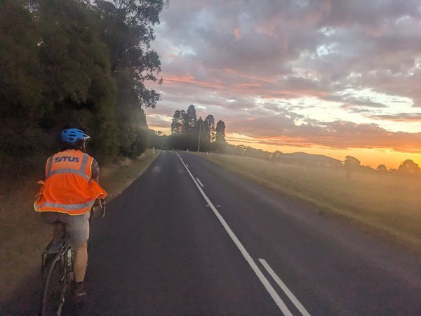
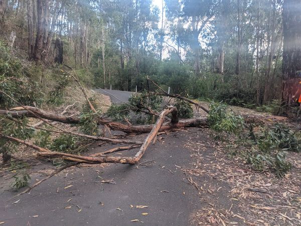
The climb up Humevale Road is everything we each remembered. Except a tree across the road, that definitely wasn't there when I last came up here in 2020. We reminisce about past cycle tours, and compare notes on two-person cycle tours we have been on.
Towards the top I stop an oncoming four-wheel drive to warn him about the tree. He thanks me, turns around, and moments later we see him jogging downhill, earbuds in. We can't figure it out.
It's getting late, and for the first time I consider that we may not get to the lookout before dark. It's a sad thought. But I'm getting tired as we slog along the main road, and there's not much I can do to hurry up.
I suddenly realise I'm starting to really flag, and am probably about to get what cyclists refer to as "the bonk" - the energy crash that happens when you ride too hard for too long without eating.
We pull over, and Lachie watches with bemusement while I systematically retrieve and assess the merits of each and every one of the 11 museli bars stashed on my bike, before deciding I don't like the look of any of them. "We've been here a while, and you haven't eaten anything", he remarks, a testament to the fading light - I've already gobbled down a banana and a brownie, before hoeing into the pizza slice I had forgotten about until then.
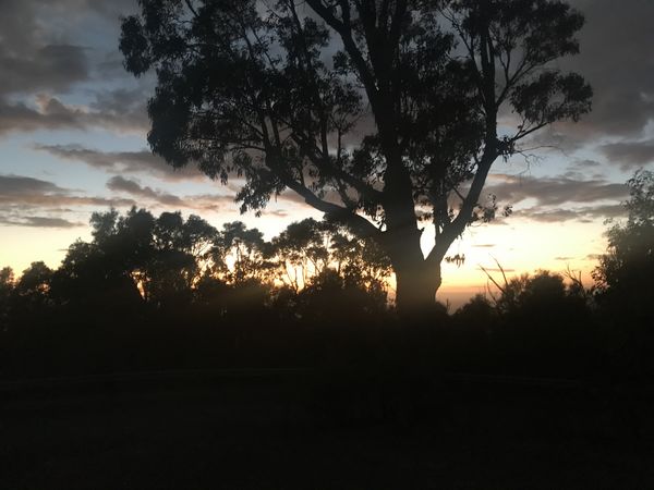
I'm back. We're good. We go on. The turn-off we want to take has a suspicious "No through road" sign, which we're very skeptical of, but not in a mood to take chances, so we continue to the main road for the lookout. Through the trees an incredible sunset is now taking place. It'd be great to be at the lookout for it, but we're still 5km away.
We push through the very small town of Pheasant's Creek, a number of tiny climbs and descents keeping us occupied, until finally we arrive at the lookout.
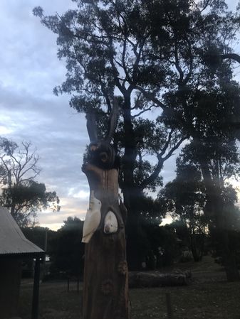
It is...not what we anticipated. Secretly we had each hoped for a tower. Even a modest raised platform with good views. Instead, nestled within a loop in the road, there is a gravel embankment, from which we can mostly just see a wall of trees. Suddenly I'm less disappointed that it's almost dark.
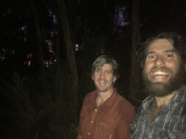
It's 30 metres to the hash. We grab our beers, saunter over to the edge of an alarmingly steep drop and tell the ground to "hold my beer" as we bash in.
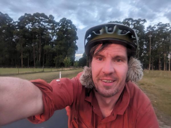
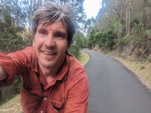
The point is easily reached, but can we take a selfie? For reasons unknown, my phone really does not want to engage the flash. We faff about. Lachie gets a photo. I eventually make it work. We clamber back out. Beers!
It's getting cold, and I'm a bit nervous about having enough energy to get home, so we don't linger. We've checked the last train time, and we're looking pretty comfortable.
A Mernda return would be the easier option but is slightly outweighed by the novelty of the Kinglake descent. The roads should be pretty quiet by now.
As we're about to start the descent, it's getting really chilly. I stop to put on a jacket. If only I'd brought some long fingered gloves. Alas.
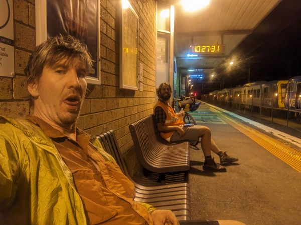
Ah - dear reader, you're a clever one aren't you. This whole time, you didn't forget that I planted the nugget about the gardening gloves, did you? And neither did I. On they went, for a comfortable and very pleasant descent all the way to Hurstbridge. It's a 40 minute wait for the next train, and the pubs are already closed. It's a long wait.
We each half pass out on the train, until Lachie gets off at Alphington to go and collect a laptop before a long ride home.
I get home at midnight.
Photos
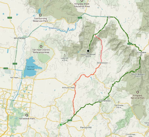
Possible routes. Blue is Mernda/Whittlesea, Green is Hurstbridge/Kinglake, and red is a psychotic, extremely steep and rutted four wheel drive track I briefly considered.
Success!
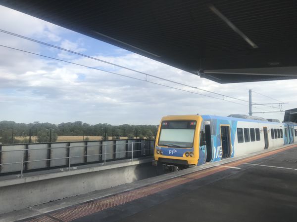
Mernda.
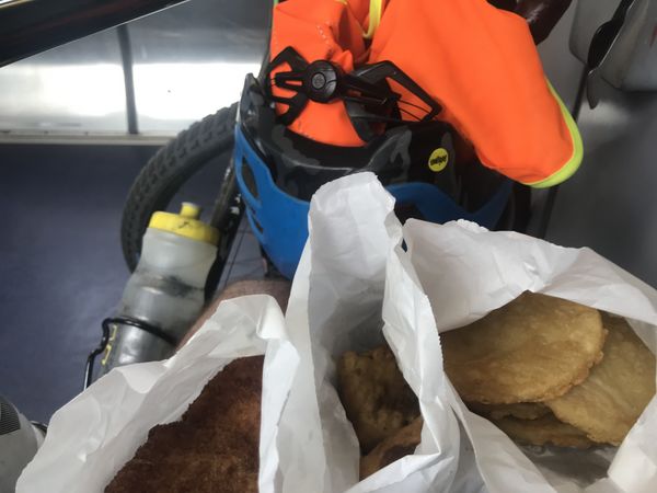
Lachie's bountiful snacks.
Wiped out.
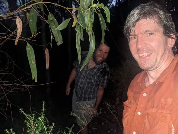
Success!
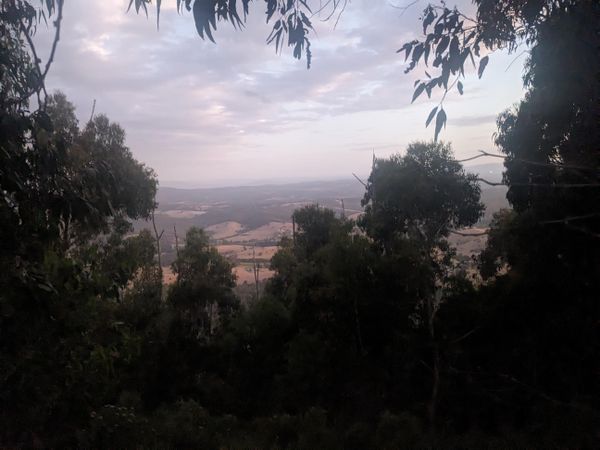
More lookout.
Lookout underwhelming Lachie.
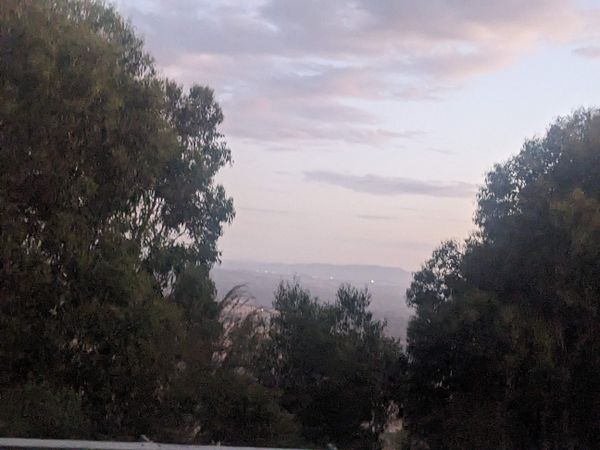
Underwhelming lookout.
Underwhelming lookout.
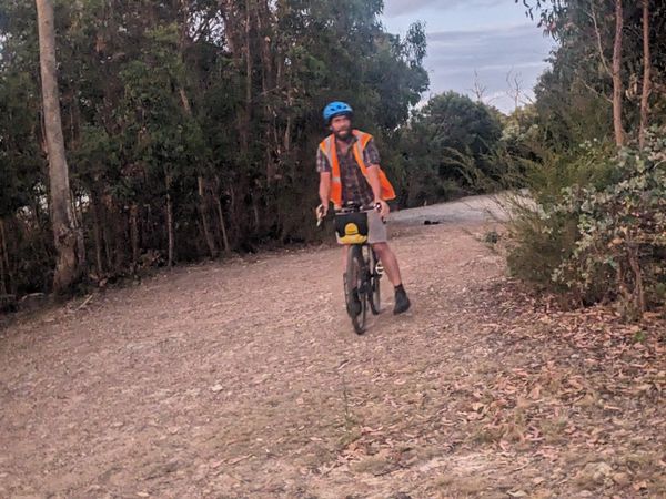
Tired but hanging in there.
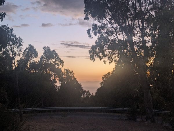
Lachie admires the sunset.
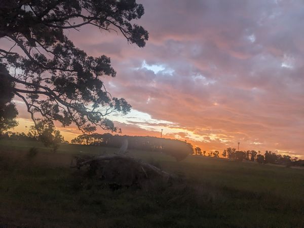
Sunset as we turn towards the lookout.
This might be why there were no cars.
I really love Humevale Road.
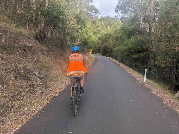
Humevale Road is lovely.
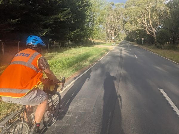
Starting up Humevale Road.
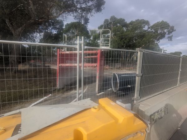
Our way is blocked, halfway to Whittlesea.


Achievements
Stevage and Lachie earned the Bicycle geohash achievement
|