Difference between revisions of "Atlantic City, New Jersey"
imported>Jevanyn (→7/31/08) |
imported>Jevanyn (→7/15/08) |
||
| Line 67: | Line 67: | ||
=== 7/15/08 === | === 7/15/08 === | ||
| − | Near Rattler Road, Upton. Just outside | + | Near Rattler Road, Upton. Just outside Lebanon State Forest. |
=== 7/14/08 === | === 7/14/08 === | ||
Revision as of 16:09, 31 July 2008
| Philadelphia, PA (North) | Newark | New York, NY |
| Philadelphia, PA (South) | Atlantic City, New Jersey | – |
| Salisbury, MD | Cape May | – |
[[Category:Meetup in {{{lat}}} {{{lon}}}| ]]
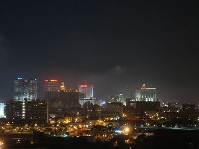
The Atlantic City graticule is at 39 N, -74 W. It encloses nearly all of South Jersey, including the majority of the Jersey Shore, from Dover Beaches and Seaside Heights to North Wildwood. Roughly a third of this graticule is in the Atlantic Ocean. A small chunk of Delaware Bay is also enclosed.
Contents
Places in this Graticule
- Atlantic City, NJ
- Wharton State Forest
- Toms River, NJ
- Ocean City, NJ
- Marlton, NJ (A suburb of Camden)
- near Philadelphia, PA
- Fort Dix, NJ (split)
- Edwin B. Forsythe National Wildlife Refuge
Local Geohashers
Daily Locations
Older locations have been archived.
7/31/08
![]() Near the mouth of Lacote Creek, at the north end of Forsythe NWR, near Port Republic. Looks like lots of boat landings near Route 9 / New York Road.
Near the mouth of Lacote Creek, at the north end of Forsythe NWR, near Port Republic. Looks like lots of boat landings near Route 9 / New York Road.
7/29/08
![]() Just west of South Jersey Regional Airport, between Springville and Fostertown.
Just west of South Jersey Regional Airport, between Springville and Fostertown.
7/28/08
![]() Silver Bay just west of Dover Beaches North.
Silver Bay just west of Dover Beaches North.
7/27/08
![]() Barnegat Bay, near the Swedge Wildlife Management Area.
Barnegat Bay, near the Swedge Wildlife Management Area.
7/26/08 - Saturday
![]() About 4 miles off the coast from Brigantine.
About 4 miles off the coast from Brigantine.
7/25/08
Wetlands east of the Manahawkin Wildlife Management Area. (Because in New Jersey, even the wildlife can be promoted into management positions.)
7/22/08
Near Route 47 and Hands Mill Road, Delmont.
7/20/08
Wetlands between Avalon and Great Sound.
7/19/08 - Saturday
Close to Reeds Beach, in the rough between Hideaway Campground and the coast.
7/17/08
Near Charles Street, near Glen Cove and Bayville. Note: There is no Lewis Street. Look for Serpentine Drive on Route 9, south of the boat shop.
7/16/08
Wetlands near Somers Cove, off East Great Creek Road, Oceanville. Close to Forsythe NWR.
7/15/08
Near Rattler Road, Upton. Just outside Lebanon State Forest.
7/14/08
Goshen, between Routes 47 and 657 (Court House/South Dennis Road).
7/11/08
Wetlands near the Great Bay River, downriver from Lower Bank.
7/10/08
Off Port Elizabeth/Cumberland Road, near Ormund. Way out in the woods. Mondo bonus points for difficulty if you get there without a GPS.
