Difference between revisions of "Bendigo, Australia"
From Geohashing
imported>MykaDragonBlue m (→Gallery: another photo for the galleryness trip) |
imported>ReletBot m (Updated graticule template with information from All Graticules, using standard format.) |
||
| Line 2: | Line 2: | ||
| map = <map lat="-36" lon="144" /> | | map = <map lat="-36" lon="144" /> | ||
| nw = [[Swan Hill, Australia|Swan Hill]] | | nw = [[Swan Hill, Australia|Swan Hill]] | ||
| − | | n = [[ | + | | n = [[Denilliquin, Australia|Denilliquin]] |
| − | | ne = [[ | + | | ne = [[Cobram, Australia|Cobram]] |
| w = [[St Arnaud, Australia|St Arnaud]] | | w = [[St Arnaud, Australia|St Arnaud]] | ||
| name = [[Bendigo, Australia|Bendigo]] | | name = [[Bendigo, Australia|Bendigo]] | ||
Revision as of 22:15, 16 May 2009
| Swan Hill | Denilliquin | Cobram |
| St Arnaud | Bendigo | Shepparton |
| Ballarat | Melbourne | Melbourne |
[[Category:Meetup in {{{lat}}} {{{lon}}}| ]]
Bendigo, Australia
Bendigo (graticule -36, 144) is a city in the centre of Victoria, Australia. Bendigo is located about 150Km north of melbourne. Bendigo sits in the South Western corner of it's Graticule.
The Bendigo Graticule extends North to encompass Pyramid Hill in its north west corner, and the paired towns of Echuca/Moama in it's North East. The South East corner covers about half of the Puckapunyal Army Base bear Heathcote.
The Climate in this graticule is much less fickle than that of the Melbourne region to the south.
Geohashers
mykaDragonBlue may hash here occasionally.
Current Expeditions
Past Expeditions
- Saturday 2009-03-07 -36 144 - Failure - No Trespassing
- Sunday 2009-03-15 -36 144 - Success
- Sunday 2009-05-03 -36 144 - Success - Even though it was in a lake
Gallery
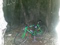
My bike inside the camp tree thing near Sedgwick
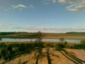
Lake Eppalock from the High Water Line

