Difference between revisions of "Coos Bay, Oregon"
imported>Excellentdude m |
m (per Renaming Proposal) |
||
| (22 intermediate revisions by 7 users not shown) | |||
| Line 1: | Line 1: | ||
| − | The {{PAGENAME}} [[graticule]] is located around | + | {{graticule |
| + | | lat= 43 | ||
| + | | lon= -124 | ||
| + | | nw = [[44,-125]] | ||
| + | | n = [[Newport, Oregon|Newport]] | ||
| + | | ne = [[Eugene, Oregon|Eugene]] | ||
| + | | w = [[43,-125]] | ||
| + | | name = [[Coos Bay, Oregon|Coos Bay]] | ||
| + | | e = [[Roseburg, Oregon|Roseburg]] | ||
| + | | sw = [[42,-125]] | ||
| + | | s = [[Brookings, Oregon|Brookings]] | ||
| + | | se = [[Grants Pass, Oregon|Grants Pass]] | ||
| + | }} | ||
| + | |||
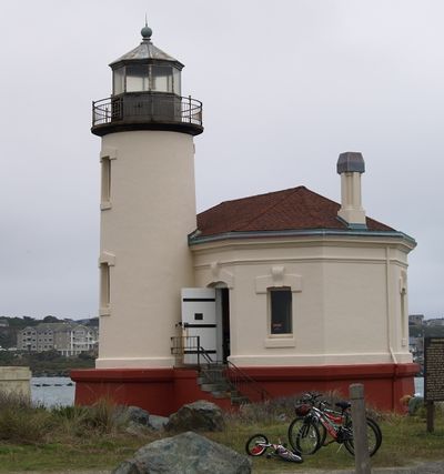
| + | [[Image:Bandon Lighthouse.jpg|400px|Coos County's iconic Coquille River Lighthouse, north of Bandon in Bullards Beach State Park.]] | ||
| + | |||
| + | |||
| + | The {{PAGENAME}} [[graticule]] is located around {{Today's location|lat=43|lon=-124|text=latitude 43, longitude -124}}. Roughly 3/4 of this graticule is covered by the Pacific Ocean. Behind a usually wide strip of coastal dunes, forested hills inland are intercut by narrow agricultural valleys. The twin cities of Coos Bay and North Bend make up the largest population center, but the graticule is home to several other towns as well, including Reedsport, Florence, Bandon, Myrtle Point, and Coquille, the seat of Coos County. | ||
| + | |||
| + | |||
| + | == Expedition History == | ||
| − | + | === [[2010-12-24 43 -124]] In a tidal flat just off of East Bay Drive. === | |
| − | + | ||
| − | + | [[User:Michael5000|Michael5000]] & [[User:Mrs.5000|Mrs.5000]] come back 364 days later for the first ever successful geohash of the graticule and of Coos County! | |
| − | + | ||
| − | + | {{Graticule unlocked | |
| − | + | | latitude = 43 | |
| − | + | | longitude = -124 | |
| − | + | | date = 2010-12-24 | |
| − | + | | name = [[User:Michael5000|Michael5000]] & [[User:Mrs.5000|Mrs.5000]] | |
| − | + | | image = 2010-12-24 43 -124 group photo.jpg | |
}} | }} | ||
| − | == | + | |
| − | + | ||
| − | [[Category:Inactive | + | === [[2009-12-25 43 -124]] North of Myrtle Point off of Sitkum Lane. === |
| + | |||
| + | [[User:Michael5000|Michael5000]] & [[User:Mrs.5000|Mrs.5000]] in an Expedition Thwarted by private land and an impassable gully. | ||
| + | |||
| + | == Local Geohashers == | ||
| + | [[User:popop|popop]] (Living in Coos Bay) | ||
| + | |||
| + | [[Category:Inactive graticules]] | ||
| + | [[Category:Oregon]] | ||
Revision as of 04:13, 20 March 2024
| 44,-125 | Newport | Eugene |
| 43,-125 | Coos Bay | Roseburg |
| 42,-125 | Brookings | Grants Pass |
|
Today's location: not yet announced | ||
The Coos Bay, Oregon graticule is located around latitude 43, longitude -124. Roughly 3/4 of this graticule is covered by the Pacific Ocean. Behind a usually wide strip of coastal dunes, forested hills inland are intercut by narrow agricultural valleys. The twin cities of Coos Bay and North Bend make up the largest population center, but the graticule is home to several other towns as well, including Reedsport, Florence, Bandon, Myrtle Point, and Coquille, the seat of Coos County.
Contents
Expedition History
2010-12-24 43 -124 In a tidal flat just off of East Bay Drive.
Michael5000 & Mrs.5000 come back 364 days later for the first ever successful geohash of the graticule and of Coos County!
Michael5000 & Mrs.5000 earned the Graticule Unlocked Achievement
|
2009-12-25 43 -124 North of Myrtle Point off of Sitkum Lane.
Michael5000 & Mrs.5000 in an Expedition Thwarted by private land and an impassable gully.
Local Geohashers
popop (Living in Coos Bay)
