Pudasjärvi West, Finland
From Geohashing
|
Latest Coordinates and Map Quick-Links | |
|---|---|
| Friday 2024-05-24 | 65.2647876, 26.9709664 |
| Rovaniemi | Vanttauskoski | Kemijärvi |
| Oulu | Pudasjärvi West | Pudasjärvi East |
| Kempele | Vaala | Kajaani |
|
Today's location: geohashing.info google osm bing/os kml crox | ||
This graticule is located at 65,26. Today's location
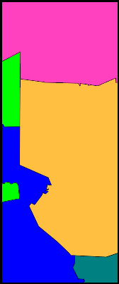
The graticule is named after Pudasjärvi, the centrum of which is split in half by the E27° meridian. The centrum, named Kurenalus, is the largest urban area and has a population of about 4000. Other urban areas are Ranua, Vesala and Ylikiiminki. A large fraction of the graticule is bog, and there are several peat production areas all over.
Regions in the graticule
| Name | Geohash probability |
|---|---|
| ■ North Ostrobothnia | 72.8% |
| ■ Lapland | 27.2% |
Municipalities in the graticule
| Name | Geohash probability |
|---|---|
| ■ Pudasjärvi | 45.4% |
| ■ Ranua | 27.2% |
| ■ Oulu | 19.1% |
| ■ Ii | 4.8% |
| ■ Utajärvi | 3.4% |
Local Geohashers
None
Meetups
- 2023-02-08 65 26 In Niemiharju, Ylikiiminki. Reached successfully by Kripakko

