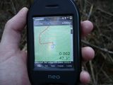
2008-10-20 52 13

| Mon 20 Oct 2008 in 52,13: 52.6689202, 13.0933991 geohashing.info google osm bing/os kml crox |
Participants
- relet and his sturdy bicycle.
Expedition
Day five of the consecutive geohash. Having recovered from my typers neuritis, I assumed it safe to ride my bike again. Even more so, as today's hash lay in the forests to the north east of Berlin. I have passed by that area before on a longer bike hash, and knew the road well.
I just had to wait for a parcel to arrive at my place, then left at half past one in the afternoon. There was much less wind than the last time, and I took a picture of the helicopter at the firefighter museum I meant to photograph the other day. Things progressed smoothly until Marwitz, where I had to leave the charted land to cross a few fields towards the forest. Fortunately there was a path - albeit very rocky - which led in the general direction. Apparently, there is some restaurant of a name someplace in the forest. One car was going the same direction.
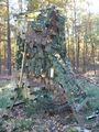
In the forest, the tracks became worse. Moreover, I often chose the more direct route over the better accessible one, to keep closer to the hash's heading. I saw lots of camouflaged hunting stands (I wonder why they have to camo them here, and not elsewhere - I wouldn't think that wooden stands stand out in the forest that much.) One's net featured a funny sign, saying that in order to find your camouflage net after you have hidden something below, the net had some marker. I wasn't sure if the sign itself was the marker, or anything else.
Eventually, I reached the hash. It was in a forest of Scots pines, and marked by a heap of wood. I took some of the wood to form the letters XKCD. Then, I went on to hide a geocache I had brought. Since there are many wild boars in the forest, it's not exactly safe to store it near the ground - hence, I had to backtrack a bit, until I found the perfect climbing tree. That's geohashflashcache #9, for the record.
I took a different route back, mainly because there were some more interesting caches on the way. And by the time I had discovered some, I figured I could as well take the other road. I cycled alongside another cyclist during most of the way back, which was a rather interesting experiment for me: He used lots of bicycle paths, and rarely stopped at red lights. I usually don't use cycle lanes (they're not mandatory, and quite dangerous at intersections) and generally behave like a motorist (stopping at red lights, turning left directly instead of making a hook turn, etc.). Nonetheless we travelled the whole trip up until Jungfernheide station (rather close to where I was heading to) basically together.
Last photo shows me salty, exhausted, but happy.
Tracklog
Photos
- helicopter crossed my path at an intersection.
- the long, rocky road to hashity.
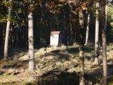
- the hunting posts in this area were camouflaged.
- but how to find a camouflaged hunting post? that's how! smart hunters!
- the long, loggy road to hashity.
- someones trailer?
- kept bumping into these.
- bike waiting while I strolled through the forest.
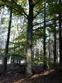
- at the hash, in the forest.
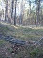
- there was wood.
- and trenches.
- logs make for good hashmarks.
- stupid grin and autumn forest.
- a cache.
- looking down on the forest.
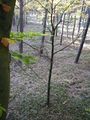
- autumn trees.
- tired biker, back at home.
Gallery
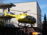
helicopter crossed my path at an intersection.
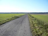
the long, rocky road to hashity.
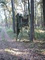
the hunting posts in this area were camouflaged.
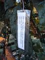
but how to find a camouflaged hunting post? that's how! smart hunters!
the long, loggy road to hashity.
someones trailer?
kept bumping into these.

bike waiting while I strolled through the forest.
at the hash, in the forest.
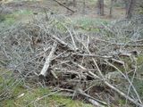
there was wood.
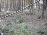
and trenches.
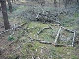
logs make for good hashmarks.
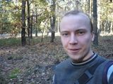
stupid grin and autumn forest.
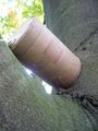
a cache.
looking down on the forest.
autumn trees.

tired biker, back at home.


