2009-03-11 50 4
| Wed 11 Mar 2009 in 50,4: 50.0756037, 4.1407393 geohashing.info google osm bing/os kml crox |
Participants
Plans
relet had to present a project in front of the European Commission in Brussels. Brussels is a virgin graticule. Hence, he was eagerly waiting for a day where he would have a) time b) energy and c) the hash within reach. That day would not come, so he had to go for a slightly longer return trip. :)
So, I admit: There have been better reachable hashes in the graticule while I have been there. Both on the day I arrived, and on the next day which would also have given me the opportunity to achieve a Birthday Geohash. Ah, well. There will be more chances to get that. I was simply too tired or too lazy to get me moving. Now, this Wednesday was reserved for my return trip. That means, I could have collected a few hashes on the way, and visited one specific geohasher as well.
However, Brussels was the only graticule on this path that was still virgin. And zbot being the bitch it is, lay the hash right in the bottom left corner, yielding the maximum detour possible.
But if I just got up early enough, I could collect this hash, and still be in time to meet arvid in 52,7 at about 2pm...
Expedition
...and who could resist this kind of logic? I got up at 6am. I had parked my car in front of the hostel (I prefer hostels to hotels: You may have to share your bathroom, but you get free wifi, friendly people who care about the place, and great breakfast for half the price or less) on the previous evening (this is not self-evident, as parking fees amount to 13 Euros/half day during daytime). Everything was set to go.
I got out of town without major problems (think of: narrow, windy one way streets and a navigation system that invents a few turns when they are not) and was set for a road trip towards the Trélon Forest. I had to pass Charleroi, where the OpenStreetMay surveying ended, reach Beaumont (which had to be south of that) and from there cross the border at one of three possible roads. Roughly in Beaumont I started up my "other" GPS and navigated in nibbles (or snakes, if you prefer) mode: Bring the red line to the apple.
The French way of signposting directions was not very helpful in that task: I saw many small roadsigns indicating villages and towns sometimes closer and sometimes farther away. The other oddity was a (perfectly logic) roundabout: The first exit said "Other directions". I had to circle it once to decide that I would not want to go in any of the signposted directions, but in the other direction.
I still was following major roads.. the hash point was indicated to be some 12.5 km away - and the distance was increasing again. All the time I was struggling between giving in to call this my Stupidity Distance and take the next way left that was not obviously a field or forest track, or to continue following the ones that had posted directions. A few minutes later, I turned around with the firm decision to go back to the township I just had passed and take the next better street in direction of the hash.
Turns out the next better street had a sign pointing towards "TRÉLON". It just wasn't visible from the other side. relet:1 - Stupidity:0.
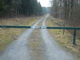
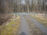
The road brought me within some 2km of the hash, and I even found the right turn to the one closest to the hash on the maps. The satellite survey showed a few forest tracks leading near the hash. The first one was quickly reached. It was a quite decent (chippings) road even. It was just barred with a boom, and a big sign.
This translates as: "You are in a private forest. Access: - subject to authorization - disallowed in time of hunts. Together, let's keep our forest clean and calm. Vehicles, Mountainbikes and Quads disallowed. Authorizations for horse riders available at..." I looked up the hunting times on google: apparently its forbidden to enter the forest Nov-Feb on weekends. The tourism board of the region did not exclude pedestrians from their hunting forests at other times though. I figured it was fine to enter for a pedestrian on a Wednesday in March.
However, parking was also not welcome here, as another handwritten sign pointed out. So I continued my way to check the next entrance.
Next along the road came a parking place with a few benches even.
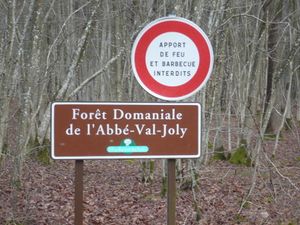
- This one actually allows passage to the parking place. It just says "Bringing fire or barbecues disallowed".
Directly opposite the place, there was a forest track of slightly lower quality. I figured, since I was on foot now anyway, I could take this one just as well. Turns out it was a bath of mud, dug up by the hooves of a passing company of horses. Oh, but the forest ground looked nice. I could just take the straight line.
Stupidity: 1, relet: 1
And the straight line inevitably resulted in wet, muddy, if not swampy places whenever I tried it. In the end, I pretty much scrambled alongside the road. But the experience of this untouched forest was totally worth it. (Most forests in DE are rather well-maintained by the forest authority and the local foresters. Untouched wilderness happens only in natural reserves at most, or in major public places in the city)
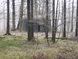
- They had bunkers, too - I wonder what for - I did not look inside though..
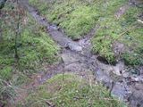
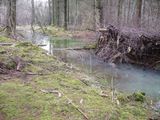
- Did I mention the wetness?
The ditches were of a very nice blue, and actually all crossable.
- Paths trodden on by many horses, tend to get wet and muddy, too (That's why I did not stick much to the paths visible on the screenshots - literally)
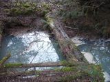
- An old bridge
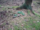
- Huntsmen are not cleansy people. But I wonder if these bottles have some kind of purpose.
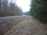
- I met an actual road after eventually having found a way to cross the forest directly. That should have been the first forest track I encountered. I wonder why I hadn't taken one of these two instead.
From there on, things got significantly easier. Tracks were still horse-hoof-beaten and thus muddy, but bearably so. I reached a crossing, and from there on led another track into a different kind of forest.
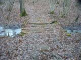
- A slightly newer bridge
- And a different forest
- Hash point reached - and the path I took - The second level stupidity distance may have been less than 20m.
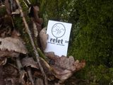
- I left my card
- Stupid grin - check.
- The streets even have names
- I ended up at the other end of the second roadblock on my way back.
- First hash in Brussels, Belgium graticule
- Qualifies as border geohash, as I had to cross the French border without having to be there anyway
- By the time I was back it was 10am.. I realized that I would probably not meet User:arvid in time. :(
- That's mostly because navigation system s*cked. It only knew the major roads and cities in Belgium and France.
- It also tremendously underestimated the time I would need to reach any destination.
Well, next up were a speed racer in Belgium, and a village next right on the road, so everything *could* happen very quickly.
And so I continued at: 2009-03-11 51 5
Tracklog
http://www.everytrail.com/view_trip.php?trip_id=146372
