2009-05-03 52 13

| Sun 3 May 2009 in 52,13: 52.8703338, 13.5135538 geohashing.info google osm bing/os kml crox |
Contents
[hide]Participants
Plans
This time, we were going to conquer the rough north of the graticule. We had packed for all eventualities: a kayak, snow shoes, bear bells, tiger trumpets, two large cans of raptor repellent, waterproof clothing, climbing gear, scuba equipment, and enough money and glass pearls to bribe the natives. Hours of meticulous planning later, we were certain that this expedition would take all the hours of the day, and a few years of our lives. But geohashers that we are, nothing could make us deviate now.
Expedition
On the road to Copenhaguen (almost)
As expected, we had the most wonderful sunny weather for our Sunday's bike trip. We took the local trains in Humboldthain, which would bring us to the regional trains at Karow. From there, a small private train would venture on towards some small villages in the north. Ours was a 'stop on demand', and this time for real. Just in time, we found the right button to press only to discover that a good twenty passengers would also want to leave the train at this stop. (some tourist information admired by lyx)
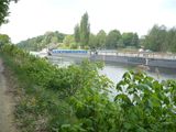
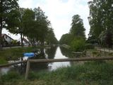
The rest of our trip would lead us along parts of the Oder-Havel bicycle route, and the Berlin-Copenhaguen bicycle route, and - for most of the time - along the waterways that are the Finow channel and the Langer Trödel ("long rummage"). The former being a busy route for container ships from Poland to Berlin (for wood, coal and building materials mostly), the latter being the old channel that has existed since the 17th century, and was then used to haul ("treideln") boats.
Rape and murder!
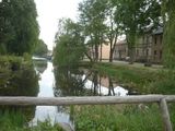
Starting at the train station, we first rode along some well-paved bike paths towards and across the village of Zepernschleuse. The village stretches almost exclusively along the Long Rummage channel, with the old houses still indicating the original wares that were once sold. (The church had a nice clock face, but it's hardly visible on this picture) Here, we had to cross the Rummage once, for a short detour towards the geohash.
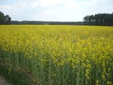
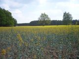
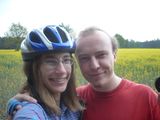
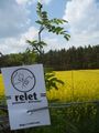
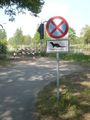
As it happens, we had to disregard signs forbidding our passage. The posted bicycle route we wanted to take was posted closed "for vehicles of all kind". We safely assumed, as everyone else does, that bicycles are not vehicles, but a mere fancy of pedestrians to take more room in the streets, and soon reached the hash in a field of rape (of the canola kind). We came as close as 50m on the road, and 48m on the other side of the field without trampling anything significantly. We took a stupid grin picture, left a marker and a hash card (of the visiting kind) and returned to the Oder Havel cycling route.
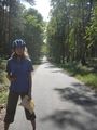
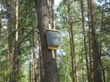
As we quickly discovered, the two cycling routes were indeed the well-paved autobahns of cycling. Three meters wide, restricted roads for bicycle traffic during most of the time. They led us always between the Finow channel and the Rummage, but for most of the time through the forests. Riding along them was almost boring, but the shade and the sounds of the forest made it a very agreeable ride. The birds had locked up most of their summer residences, but we found a geo-reference point.
What? You're asking yourself where the murder happened? Did I not mention the mosquitoes yet? ... After a first attempt at a lunch break, we decided to skip this project and munch on an apple while continuing our ride, leaving a trail of bodies on the roadside.
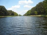
We had a longer break on the shore of a lake which we reached later, and cooled our feet.
A Very Merry Ferry
Then we reached a ferry. We felt a lot like our grand heroes from Vancouver, riding on our bike through the very north of our graticule, and now even this. Actually, the map did not indicate that there would be a ferry. We actually expected a bridge. Well this is that, and here we are on the most impressive ferry you may ever have seen. It had capacities for maybe eight passengers and six bicycles. Our captain mentioned that there once had been a bridge, but that it was bombed before the Russians came. And that they would rebuild it, maybe two years from now.
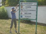
We continued our way on the other side of the channel. We admired the large watergates, which would possibly have to cater for the equally large cargo vessels we had seen earlier, and an otter crossing. There were no otters unfortunately, just a parking restriction for this reason. Our trip ended at the main station of Oranienburg, which, as we learned, is a partner city of the one where lyx is born.
Tracklog
http://www.everytrail.com/view_trip.php?trip_id=195931
Photos
inline.
Gallery
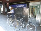
Humboldthain
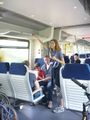
the right button to press
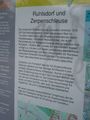
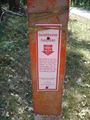
some tourist information
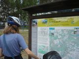
admired by lyx
Finow channel
The village stretches
old houses
The church
cross the Rummage once
rape
48m on the other side
a stupid grin picture
a marker
a hash card (of the visiting kind)
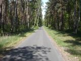
well-paved autobahns of cycling
almost boring
The birds had locked up most of their summer residences
geo-reference point
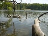
the shore of a lake
cooled our feet
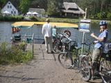
impressive ferry you may ever have seen
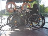
six bicycles
there once had been a bridge
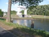
large watergates
an otter crossing
the one where lyx is born


