2010-01-09 45 -122
| Sat 9 Jan 2010 in 45,-122: 45.3445266, -122.7865796 geohashing.info google osm bing/os kml crox |
Contents
[hide]Location
In a street between a small farm and the perimeter of the Coffee Creek Correctional Facility, near Tualatin, Oregon.
Participants
Plans
for Jim
I sent out a message to the local geohashers mailing list, but no one else was able to join me
I printed out a map from Google Maps, and wrote down some directions just in case. Oh yes, and I programmed the GPS. I also grabbed info about several nearby Geocaches, figuring the hashpoint looked too easy to get to and I might as well add some frustration to the afternoon.
for Michael5000
I was aware that there was an accessible hashpoint in the Southwest today, so after working on a house project until the early evening I decided to combine a night Expedition with a visit to my parents. Over dinner, it occurred to me that it might be fun to try for the "Tron" Achievement, in which you can't cross your own path. My first general route would have involved driving on the the wrong side of the street at the actual hashpoint. After a while, though, I thought of an even better plan with less likelihood of getting myself killed.
Expedition
Jim
This area was actually a little bit familiar to me, as one of my local groups does training at a nearby facility. So, I pretty much drove there and then kept on driving. I turned onto the road and drove slowly, watching the GPS count down. And then it started to count up. I pulled over and finally found a place to park and walked back. I found the hashpoint right at the end of the driveway of a nearby house. Someone there was rinsing out some sort of large plastic containers, which I think were for grapes, actually.
I took some pictures and waited around to see if anyone else showed up, and then started to program in the geocaching points I had found. After that, and listening to the end of the podcast I had, I went off to work on errands. On my way out, it suddenly dawned on me that the hashpoint was in the street and I had driven through it. That means I can drive through it at a good clip. Speed Racer!
So, I went back to drive though the hashpoint. However, I couldn't drive and photgraph at the same time, so I'll have to use my tracklog as proof, since my GPS does record speed.
More info to follow. I'll save this and hope to avoid an edit conflict with Michael5000
Michael5000's Expedition
I left the neighborhood northbound on 39th Avenue, got on I-84, then looped over the Fremont Bridge to get to Highway 26 so I wouldn't cut off my route back home. My intention was to take 26 to 217, but as I went through the tunnel I thought I remembered (correctly, it turns out) that this would mean a "cloverleaf" exit, and I'd be forced over my own path. So, I took the Highway 8 exit and made it onto 217 with my "Tron" attempt still alive.
As I got closer to the hashpoint, I became a little disoriented in the unfamiliar area. I wove through a suburban area and headed down a dead end street, but was able to make a U-turn without crossing my path, and eventually located the route I was looking for, Grahams Ferry Road.
Once on Clay Street, I crossed the hashpoint Speed-Racer style, and then got ready to turn around in a wide spot in the road. Unfortunately, Clay Street is pretty narrow, and I didn't have enough room to complete the turn. My "Tron" attempt was in jeopardy! But with no traffic around and seeing pavement coming right up to the curb, I shifted down into first and acted out the old bumper sticker: "if you don't like the way I drive, stay off the sidewalk."
The rest of the journey was pretty uneventful, except that the nearby on-ramp to I-5 turned out to be cloverleaf-style. I zipped right by it, drove a few blocks into a deserted commercial area, and made yet another blatant U-turn in order to get the simpler on-ramp and head towards home.
On the way back, I stopped in the Multnomah village area to visit my parents. A stickler might say that this invalidates the "Tron" Achievement, but I consider that part of the trip outside of geohashing rules -- the time between when I stopped the truck and when I started it again (to move forwards, not crossing the path I had taken on the way in) doesn't count. I returned back to the neighborhood via downtown and the Morrison Bridge.
But after all that, I found this very specific point in the Tron achievement Description:
- you cannot go into any dead-end streets and back out of them again (even accidentally)
This is a pretty strict rule, since it's entirely possible to go into and out of a dead-end street without literally crossing your path. But rules are rules. Sigh...

Tracklog
I'll need to upload part of it as proof of my Speed Racer.
Photos
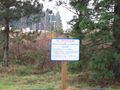
Luckily, the hashpoint isn't in that direction
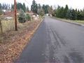
This is what the sign was trying to protect
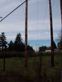
Recursive power?
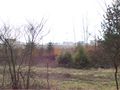
A view of the hashpoint itself
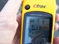
The GPS at the hashpoint


Achievements
Jim and Michael5000 earned the Land geohash achievement
|
Jim earned the Speed racer achievement
|
Michael5000 earned the Speed racer achievement
|