2010-05-03 40 -111
| Mon 3 May 2010 in 40,-111: 40.2427043, -111.9893408 geohashing.info google osm bing/os kml crox |
Contents
[hide]Location
Usually points in the Salt Lake City hash box (yes, it is a hash box) are unreachable or just really really hard to reach. We have two major lakes and two mountain ranges which cross through the center of the box. But this one seemed relatively simple (notice the word relatively, please). So I went. I was going to take a couple friends but school got in the way.
Participants
Expedition
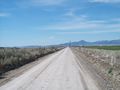
I used Google maps to find the right route. This was a mistake. I knew the major roads, and Google was pretty good with that, but when it came to the last five miles there was a glitch or something similar which decided that a scenic detour would be the most enjoyable option. It was, but it was a rough detour.
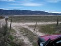
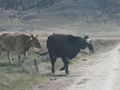
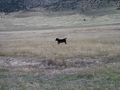
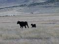
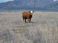
The point, if you've looked at the map by now, is located in the foothills of a couple small mountains (really just hills, but they could be called mountains from the right angle). It is also in the middle of a free range cow farm. By the way, free range means public accessible for those reading who aren't ranchers. According to Google, the best way to get there was via a couple of rough and often bumpy dirt roads which crossed various cow pastures and were often covered in dung. I followed that dirt route--which was only five miles but took almost an hour--all the way to the point. When I finally had to abandon my car by the side of the road to hike the rest of the way to the point, it smelled like a cow, was spotted with enough dirt to look like a cow, and all the other cows were starting to look strangely at it.
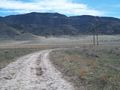
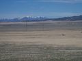
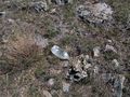
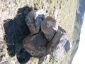
The hash point was only a small jog up the side of the mountain, no more than a third or half of a mile. It was slightly elevated over the rest of the valley, so it was pretty scenic. I took a lot of pictures of empty fields and small randomly placed houses--pointless, but exciting. I had to circumnavigate a field of large rocks to make it to the point, which gave me an idea. Instead of an artificial sign (which would only be blown away within a month), I made a large pile of rocks. Not that large, actually, only about 7 or 8 in all, but they were big. I dropped one on my foot and it cracked slightly (I'm awful at these modifiers, sorry). It wasn't much, but enough to cause me to hop around for a couple seconds. I finished the pile nonetheless, and made sure it was visible up to a mile away. To do that I hiked up the mountain a bit more (it looked so inviting, I had to), and looked back. The view was even more spectacular and my pile was visible as a dark dot on among the hills.
I tried jogging back down the side of the hill to my car, but my foot started complaining, so I walked. Driving back, I decided not to go on the rough dirt roads but took a better-looking gravel road which lead me straight back to the main road. It took five minutes. I laughed at that. I met the people I was supposed to go up with as I went back. They missed it, but we got to laugh at all my cow photos. This was a successful hash. I can't prove that I reached the coordinates, but if you look at the satellite imagery in perhaps ten years, maybe my pile will be visible. It's too early to tell.
One of the gates to a range
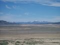
Halfway

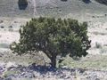
The first tree seen
The marker from a distance (it IS there)


Awards
Mabeuf earned the GeoTrash Geohash Achievement
|