2011-04-01 52 1
| Fri 1 Apr 2011 in Norwich: 52.0760312, 1.3007916 geohashing.info google osm bing/os kml crox |
Contents
[hide]Location
Beside Martlesham Creek north east of the church. It's near Woodbridge, Suffolk, UK.
Participants
Expedition
There was convenient parking near the church. The 1.5 km walk, logged at wikiloc, was on well-trodden dry paths. There were fine views over the tidal creek and many boats were stranded in the mud because the tide was out. Part of the walk was through mature woodland with violets and daffodils at their best. It was a beautiful mild spring evening.
Photo Gallery
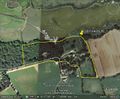
Google Earth Path
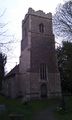
The Church
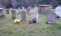
The Graveyard
Footpath Signs
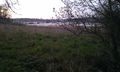
Martlesham Creek
Martlesham Creek
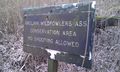
The Sign at the Hashpoint
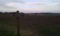
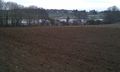
The View from the Hashpoint
Another View at the Hashpoint
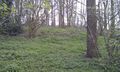
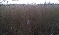
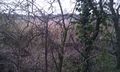
Woodland by the Hashpoint
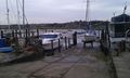
Moorings near the Hashpoint
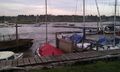
Moorings near the Hashpoint
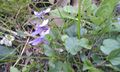
Violets in the Woodland
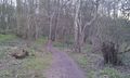
The Woodland Path
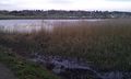
Martlesham Creek


Achievements
Sourcerer earned the April Fool's Geohash
|
Expeditions and Plans
| 2011-04-01 | ||
|---|---|---|
| Toccoa, Georgia | tomkf61 | On north side of Highway 17 (Toccoa Bypass), 4.75 kilometers from Toccoa, G... |
| Plovdiv, Bulgaria | Kisolre | Near Radilovo village. |
| Portland, Oregon | kydlt, The lovely Kate | At the park at the Sandy River delta, at exit 18 of I-84 |
| Frankfurt am Main, Germany | LadyBB | A field between Wiesbaden-Bierstadt and-Wiesbaden-Igstadt |
| Norwich, United Kingdom | Sourcerer | Beside Martlesham Creek north east of the church. It's near Woodbridge, Suf... |
Sourcerer's Expedition Links
2011-03-22 52 1 - 2011-04-01 52 1 - 2011-04-03 52 1 - KML file download of Sourcerer's expeditions for use with Google Earth.