2012-02-10 37 -121
| Fri 10 Feb 2012 in 37,-121: 37.2881705, -121.8459130 geohashing.info google osm bing/os kml crox |
Location
On the edge of a raised divider on Monterey Highway near Capitol Expressway. Traffic is just starting to get more heavy.
- 37.28817°, -121.845913° or
- N37°17.2902', W121°50.7547' or
- N37°17'17.41", W121°50'45.28"
https://geohashing.info/s/2012-02-10/37,-122
Participants
Plans
Grab some grub and then off to business! Didn't really plan for any achievements. --PacoBell 19:12, 10 February 2012 (EST)
Expedition
- Whodathunkit that the hash would land within 5 miles of my house for a second consecutive day? Last year, I'd be lucky to see it that close even once a MONTH! Well, I wasn't able to make it out yesterday, but I nailed it today. By the time I got to the hash location, I was feeling somewhat peckish, so I paid a visit to the closest burger joint across the street. It's called Dairy Belle Freeze. Despite its namesake, I decided against buying one of their apparently famous milkshakes due to the havok dairy tends to wreak on my nether regions. A simple burger-fry combo with an orange soda quelled my hunger. Afterward, I ventured down the crosswalk at the intersection to the raised median divider on Monterey (I would have jaywalked, but there were literally four cop cars that just pulled out of a nearby inn). The hash point was just at the edge of the median and it was there that I proceeded to attempt a sweet panoramic shot using the Android app Pano ( https://market.android.com/details?id=com.debaclesoftware.pano ). It was taking a while to stitch, so instead of hanging around the middle of the street, I headed back to the hashmobile. By the time I had arrived, Pano seemed done and I clicked on a checkmarked button
that I thought would save my photo...big mistake. It just deleted it and prepared for another photo. DOH! I'm sure there's an achievement for that somewhere =P Realizing the fact that I had just lost my only proof,(turns out I didn't actually lose the file!) I scrambled to download a GPS tracker/logger from Market ( https://market.android.com/details?id=com.mendhak.gpslogger ) so I could swing a quick U-ey along Monterey on my way back home and log the requisite GPX/KML tracks. Success! Lesson learned: Patience really IS a virtue! -- PacoBell 15:12, 10 February 2012 (PST)
Tracklog
http://www.wikiloc.com/wikiloc/view.do?&id=2480131
Photos
Yes, I realize the info box from Geohash Droid shows I'm way off base because I uploaded them while at home. I'll try to upload them on site next time.
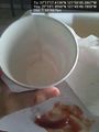
Refills here are 50 cents. Yeah...no.
TAKE NO PRISONERS!!!
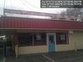
The Dairy Belle Freeze: home of the ridiculously courteous Asian owners and purveyors of all manner of lactose-infused delectibles.

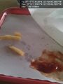
Oh, wait, there it is! WHEW!
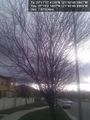
I returned to the soothing vista of cherry blossoms drifting gently from a tree by my house.


Achievements
PacoBell earned the Land geohash achievement
|
PacoBell earned the Speed racer achievement
|