2012-02-29 59 9
| Wed 29 Feb 2012 in 59,9: 59.7230499, 9.5646499 geohashing.info google osm bing/os kml crox |
Location
In one of the mining areas near Kongsberg, Norway
Today's battleship location is: F 8
Participants
- relet 05:43, 29 February 2012 (EST)
Plans
Hit the hash in the evening, leave in the morning.
Expedition
Live news
- In the bus to Oslo. It has come to this. -- relet @60.1664,10.2583 14:59, 29 februar 2012 (GMT+01:00)
- Step two: in the train to Kongsberg... -- relet @59.9109,10.7521 17:11, 29 februar 2012 (GMT+01:00)
- A small creek quickly turned into a non neglectable canyon. -- relet @59.7176,9.5631 20:56, 29 februar 2012 (GMT+01:00)
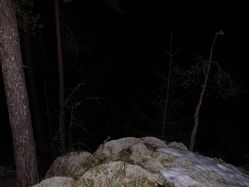
- Coordinates reached! -- relet @59.7231,9.5645 21:57, 29 februar 2012 (GMT+01:00)
- Back in Kongsberg, missed the bus after five hours of sleep in the forest, but caught a train and a connection that should get me to work on time.
If my shoes weren't completely wet, I would have thought there is something wrong with this expedition. -- relet @59.6720,9.6511 06:04, 01 mars 2012 (GMT+01:00)
The aftermath
After reaching Hønefoss 07:57, taking a long hot shower, tending to my feet, and clocking in at work 08:51 this feels like an all-around success. That is all the more impressive to me, considering how many moments of sudden motivation drop there were during the walk. Arriving in a small, but bustling town, with no bus leading back, I felt like I wouldn't even reach the end of civilization to find a place to camp in peace. With the snow wet from rain, I questioned the idea of camping per se. Stumbling onto a three star youth hostel... walking along a dark windy road with just a tiny reflector on my arm (why, I won't use the precious batteries in my headlight, won't I?!)... seeing that it all goes *uphill*... on ice... taking the wrong turn and ending up on a farm at night... fortunately, there's always this "well, at least you can take a look and turn around afterwards" thing that makes me keep going.
At about 800m distance I noticed the hash would be on the other side of a pretty impressive stream. Now I had the option to follow the road further on, or follow the other side of the stream along a steep, icy, densely forested hillside. That would yield a new record stupidity distance of 800m. Unquestionably, I decided for the latter. With me climbing further up, the creek soon turned into a rather impressive canyon, and I decided that I may not have taken the wise, but the right choice. A lot of stumbling and retarding moments later, I discovered the hash on the top of a small hill, in the snow. I was tired like hell, my shoes were wet, and it was at least an hour later than I had hoped for. I would also have to take that way back tomorrow. So I rolled out my sleeping bag, ate a quick midnight snack, and fell asleep.
The way back was quicker (It went downhill, and I found a snowier, but straighter path. Since my shoes were wet anyway, I could just as well follow the open patches of snow instead of sticking to the forest), but I still managed to miss my 05:36 bus by ten minutes. I hadn't considered that most of the 8km walking yesterday were not that last uphill part, and still took a good bit of time. Fortunately, that made me find a faster and cheaper connection that would reach my place a whole five minutes later.
Tracklog
Photos
|
Achievements
This user earned the Camping geohash achievement
|
This user earned the Leap geohash achievement 2012
|


