Location
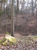
In the middle of the forest on Nonnenberg, near Luftschiff (a.k.a. Burgrabis, don't ask me where those names come from).
At the edge of a field near Graitschen bei Bürgel.
Participants
- Juja, Benjy and Frankie Mouse
"Blinded by Science" Expedition
Prologue
Friday evening - as usual, I look up the coordinates. Chatting with Manu goes something like this:
Manu: "Those nasty little coordinates. Right next to Jena when I'm not here."
Me: "Oh right, now that's a nice place! Should make for a good Saturday trip..."
Manu: "Okay, at least you are going."
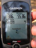
So we agreed that the point was near Jena and that was it. Obviously Manu used another lookup tool than I did and maybe I took drugs or worked too much or something, anyway I obviously hallucinated a wrong set of coordinates on anthill/OSM: the true coordinates were near Graitschen, the ones I happily added to my Saturday biking route were near Luftschiff (50.90388/11.66733 - obviously not just an invented alternative location - why else would it have been so hard to get there? And can anybody tell me where these come from?).
The long story short
Because it would have been far too easy to cycle not even 10 kms to the hash point on a free day with lovely weather, I started the tour visiting three retro hashes I had missed that seemed to be interesting and, in fact, too good to miss as well. (Retro hashing criteria by Juja: interesting spots with exciting and unknown areas around that obviously didn't qualify for afterwork hashes at the time - in fact, I probably wouldn't have reached any of them if I had tried it in darkness.)
After reaching the last of those points near Thalbürgel I cycled home on known roads to Schöngleina, where I stood near the airport for a while, had "lunch" (cereal bar and sugared water) and watched some paragliders preparing, starting and also landing soon after that (were they just practising or did they really have bad flying conditions?). From there on I followed my route to the imaginary hashpoint which - of course - lay on top of a hill and in the middle of more or less thicket (nearly 300m from the nearest way OSM knew). While I stumbled through the woods (biking shoes are not quite perfect for climbing hills) I found a whole lot of unmapped ways - someone should get busy up there, and I'm a little bit afraid it might be me after all. After a while I had found the exact spot, took some photos and tried to use the new-found ways back to my bike which spared me at least some of the trouble. When I cycled back home I also found the really easy way to the point, so next time I'll know.
To enjoy the nice weather a little longer I even took another quick detour via Fürstenbrunnen (dozens of people were standing around there; it's the no. 1 place for weekend walks obviously) and Steinkreuz and finally cycled back home. At the end of the day my odometer showed 75 kms, so I was really happy and satisfied - imagine my frustration when Reinhard first commented that I had seen the wrong point for today and, even more, that I had passed the actual point by maybe 3 kms on my tour!
Epilogue
What do I learn from today's expedition?
- The tour was nice, so maybe I should stop being so upset about following the wrong numbers.
- The points are all random and inaccessible, so does it really matter which random inaccessible point I pick? I don't meet other hashers anyway.
- When I want to do a less senseless expedition, the right approach would not necessarily be to enter the right coordinates, but to track all those forestways around Luftschiff for OSM, because this uncharted area is practically full of "Here be dragons".
| At the airport of Schöngleina.
|
| Paraglider landing just in front of me and my bike.
|
| Ok, seriously: up there it is. I should've known.
|
| Geohash guard I found in the middle of the forest.
|
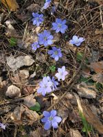
| Liverworts I also found nearby.
|
| The point is located next to a wood pile...
|
| ...and actually, directly on a way.
|
| Benjy and Frankie playing in the wood.
|
| Grinning and clueless Geohasher.
|
| Back down to my waiting bike...
|
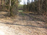
| ...et voilà, this would have been the easy way!
|
|
Retro Expedition on 2012-03-27
This incredibly stupid expedition started to haunt me in my nightmares, so I needed to see the real point of Saturday at least a few days late. But after the internet has sent me a wrong set of coordinates on Friday and today's expedition I almost believe I wasn't meant to see this place - though I can't tell what's so damn secret or special about it.
I started after work and also the mischief started then: first a woman suddenly stepped in my way and I almost ran her over, so she had a good reason to shout and curse after me. Only minutes later a car obviously hadn't noticed that I had been next to it on the cycleway for quite some while and it suddenly turned right without looking and almost ran me over. Touché fate, so let's start Geohashing. I cycled peacefully and without meeting cars or pedestrians to Graitschen from where I followed OSM: the way to the hash point was a little bit imaginary, but still I could ride my bike right to the point where I took some photos.
To make the little easy tour a bit more interesting I decided to go home via Alter Gleisberg, so I had a nice ascent ahead of me (sometimes so steep I had to walk my bike). The view is lovely from up there, but the way down on the other side isn't much better, only a narrow footpath with lots of roots and bumps on it - could be fun, but certainly not with bike shoes and a high saddle for long-distance rides. Anyway I reached the valley all safe and sound and now I had to hurry home because I also had an evening appointment with my friend. Enter Murphy's Law: you're in a hurry and have neither bike tools nor spare tube nor pump with you because you only wanted to do a tiny little 25-km-trip? Gotcha! At Jenaprießnitz I first noticed that there was a strange noise from my front tyre, for a while I thought it was only some dirt but entering Jena (well, at least I was only 1.5 kms from home) my tyre developed its own life and didn't react on road turns quite as usual. Then I noticed it was also rapidly changing shape and was obviously getting flat. Hooray. This could have been the easiest hash of my life, and has instead blown up to one of the most absurd ones...
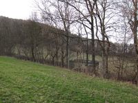
| A rotten hut next to the point. Maybe here were the hidden treasures I should be kept from?
|
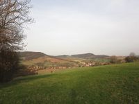
| View from the hashpoint back down to Graitschen.
|
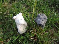
| Benjy and Frankie were with me again.
|
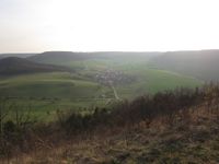
| View from Alter Gleisberg down to Jenalöbnitz.
|
| The nasty thorn that caused my flat tyre.
|
|


