2016-07-02 40 -73
| Sat 2 Jul 2016 in 40,-73: 40.8704471, -73.9248640 geohashing.info google osm bing/os kml crox |
Location
Inwood Hill Park, upper Manhattan, "in" the "woods" (hee hee)
Participants
Plans
OtherJack: Largely working this weekend but the plan was to bike there and make it around 4pm, for a break. It isn't far.
Expedition
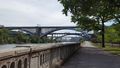
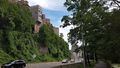
OtherJack: Was working so intently I nearly forgot about this hash till about 3:30, so ended up a little late. Also late because the route I took uptown turned out to be really cool and I kept stopping to take pictures. In particular this tiny narrow bike/pedestrian path ends up taking you from Harlem over a bunch of freeway ramps and then right onto the side of the Harlem River for a couple miles, under the High Bridge from 2016-01-03 41 -73 and across from 2015-09-20 40 -73 and the Bronx. Just a little (fenced) ribbon of asphalt between the expressway and the river. Would not go this way at night.
After that the trail opened up into a more typical grassy area, lots of locals were out grilling and partying. But when the trail ended, Dyckman Street turned out to be all torn up for repaving, forcing me to go even slower. Finally I got to the closest Inwood Hill Park entry point to the hash and parked my bike to a signpost, it was already 4:10 or something.
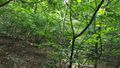
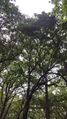
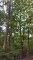
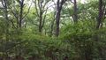
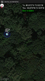
The park turned out to be more a wild, half-overgrown, steep forest than the manicured, populated expanse I was expecting... some of the trails clearly hadn't been paved in a while and had vegetation growing into them. They also didn't really match what was marked on google maps / geohashdroid... luckily I was able to figure out the way though, and reached the optimal point on the trail network in five minutes or so. I'm getting weak, I used to look at city park maps when attempting these kinds of hashes! Much better than Google usually.
The optimal point was still 30m from the hash, but also very luckily, the forest was much less overgrown here, just a few widely spaced understory shrubs. Elsewhere in the park it would have been extremely inconvenient in shorts. After only a few minutes of zigzaggy, crouched, downhill hashdancing I found the spot, by a small fallen log.
On the ride back I took another way never before taken, the rambling northern leg of the Hudson River path. More super cool photos ensued!
Sputnik: Started out at about 5pm - would have liked to have gone earlier but was at work most of the day. I left from the Mount Sinai Hospital and took the M3 to the A train, walking from the 207 Street station to the hash point (public transit achievement!) I went barefoot the whole way and brought with me my ace ring and a supply of Luna Bars (hobbit achievement! My ace ring was particularly appropriate for this as it's engraved with the writing from the One Ring, pictures below) My GPS acted up a bit as I reached the optimal point on the trail, but eventually it started behaving and I was able to find the spot. I had never been to Inwood before, and like OtherJack was expecting more landscaping and more people (I guess I was expecting Central Park?) but really enjoyed the wildness of it. A nice day for a walk in the woods.
Photos

The High Bridge again!

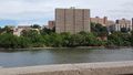
1970s Paradise in the Bronx! actually really amazing buildings, I'm not sarcastic
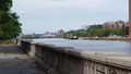
More bridges downriver
More-typical Bronx
Upriver
Looking west from same spot
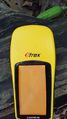
Proof... the lighting wasn't great but it says 4.19 feet (1.28 m)
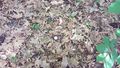
Egg? No, golf ball
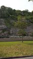
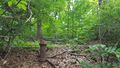
Hashpoint surroundings
Random fire hydrant in the middle of the woods! Only in New York?
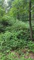
What the hashpoint thankfully did *not* look like
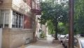
Neighborhood. There was jazz guitar coming from one of the windows
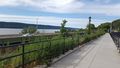
View from the Hudson path
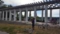
Also on the Hudson path!

The Old Man of Washington Heights looks over the highway?


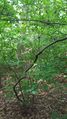
The trail that runs past the hash point. So pretty :D

The hash point!


Setting forth, with ring, food, and bare feet.

Reaching the hash point, still barefoot.

Arriving on the A train


Achievements
OtherJack earned the Bicycle geohash achievement
|
Sputnik earned the Hobbit Achievement
|
Sputnik earned the Public transport geohash achievement
|
By the way
turns out OtherJack and Sputnik know each other IRL! But neither had any idea the other one hashed. OtherJack was tipped off by Sputnik's description of the ring used for her hobbit ribbon and her workplace.