2017-04-02 -37 145
| Sun 2 Apr 2017 in -37,145: -37.9407021, 145.0263431 geohashing.info google osm bing/os kml crox |
Location
Right outfield of Moorabbin Baseball Club field, Victoria, Australia
Participants
- Thunk (talk)
- Felix Dance (talk)
Expedition
thunk
Well, it's best summarized below. Also refer to the images section and tracklog.
- Pre-Opening Day hash on a baseball field. It'll be walk till you drop as I procrastinate on Sunday with a slow expedition. -- Thunk (talk) 09:34, 1 April 2017 (GMT+00:00)
- Good morning everyone. I'm off on this rather long walk. Let's see how long it can be. -- Thunk (talk) @-37.9108,145.1356 22:02, 1 April 2017 (GMT+00:00)
- Time for the traditional Australian 'brekky'. It's not just a matter of the local customs but me needing to actually eat. -- Thunk (talk) @-37.9255,145.1197 22:33, 1 April 2017 (GMT+00:00)
- Ow...Ow...Ow...
34 km is quite enough for one day. -- Thunk (talk) @-37.8128,144.9676 04:49, 2 April 2017 (GMT+00:00)
- It turns out that after I wrote that, I started feeling restless again. So on another whim, I started walking the 17 km from South Yarra station to my temporary hideaway. The first 5 km were relatively all right, but exhaustion soon set in, and I was at my limits by the time I completed my journey. The total distance on foot is currently unclear due to GPS jitters but is likely greater than 50 km.
And considering how sore I was for two days afterwards, it probably wasn't worth it. Though proper shoe choice left me with only one large blister on my right foot (and only a very small one on the left foot).
Felix Dance
- Hampton geohash success! -- Felix Dance (talk) @-37.9407,145.0263 12:45, 2 April 2017 (GMT+10:00)
Some explanation: I was out in Fairfield after riding in the Mike Hall memorial ride along the Yarra - a tribute to Indian Pacific Wheel Race competitor and car-crash fatality victim Mike Hall - when I discovered the hash. I left the Abbotsford Convent cafe and headed south towards Hampton along Church/Chapel Streets, picking up an Astor calendar along the way (heavy Melbourne referencing).
After a fair ride along the Nepean Highway, I turned off and arrived at the park nestled between Hampton East and Moorabin. The sun was sunny so I took a nap on the grass - a hashnap. But soon I was back on the bike and riding directly north into the tailwind, all the way up Burke Rd, a tour of the Eastern suburbs, to a first birthday party in Ivanhoe. I'll work out my total distance in a bit, but it must be about 60 Kms, or about 90 for the day.
Tracklog
Photos
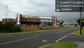
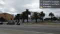
So that's where they play this footy... @-37.9364,145.0426
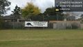
And here we are. @-37.9407,145.0263
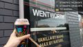
Squishy time!
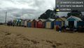
Why stop at the hash?
And I've reached St. Kilda. Which will give out first--my legs or my phone battery? @-37.8693,144.9757
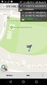
GPS proof - 0.66m away @-37.9407,145.0263
- Error creating thumbnail: Unable to save thumbnail to destination
Me with bike at the hash @-37.9407,145.0263


Achievements
thunk earned the Walk geohash Achievement
|
thunk earned the 7 Star GeoSquishy Achievement
|
thunk achieved level 2 of the Minesweeper Geohash achievement
|