2021-12-26 42 -78
| Sun 26 Dec 2021 in 42,-78: 42.1075265, -78.7059686 geohashing.info google osm bing/os kml crox |
Contents
[hide]Location
Allegany State Park in the Art Roscoe Ski area
Participants
- Pedalpusher
- J
- Simon the dog
- Myka the dog
Expedition
My girlfriend, J, is participating in the Winter Hiking Challenge again which just started. They have been putting a trail at Allegany on the list for the past couple challenges and the Winter 2021 trail is Osgood which is right down the road from the hash. I figured we could do a 2-for-1 deal here and she's been dying to hike the past couple weekends since we've been busy doing other things. We haven't gotten much snow in the area yet, so the Cross-country ski trails shouldn't be closed to us either.
We got to Allegany and the Osgood trail around 12:30 and prepared to hike up and down the mountain on the short (2.5 mile/4 KM) trail. The landmark was the trailmarker at the very top and it was easy to find. After completing that hike, we made our way to the ski trails around 13:30 and walked in toward the hash. I figured since we already did a good hike, we could get to the Hash and then continue on as long as we wanted before turning around to go back to the car. There wasn't any snow on the ground so obviously there wasn't any skiers and no one really parks at the bottom of the mountain in this area anyway so I really didn't expect to see any hikers.
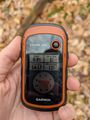
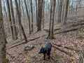
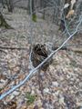
About halfway to the hash, I turned on my GPS, but it had a lot of trouble picking up a good signal. By the time we reached the hash, I still only had 2 satellites locked in and not enough for a reading. I pulled out my phone to use the HashDroid app, but because I didn't have a signal, I had a blank screen with my blue dot location. I was able to get a good reading on my phone, but was not happy with it. Fortunately, just as I was about to turn off the GPS, it picked up the additional satellites and started tracking. I did another GPS dance and ended up pretty much where I originally marked the Hash. Getting some pictures of the area, we made our way back to the trail and continued on for another 15 minutes before turning around.
Less than a mile to the car, I stopped to pick up a green sandwich bag that someone had dropped for a GeoTrash Geohash. I didn't want to grab it earlier because it was a little muddy and gross but knew we would be passing back this way. Getting back to the car, J reported that we ended up walking 6.2 miles/10 KM total for the day.
Tomorrow's geohash also lands in Allegany in the same area but on the other side of the trails for a potential consecutive hash.
Photos
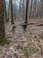
The dogs and their 'sticks' on the Osgood trail.
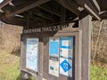
Osgood trailhead.

Made it, but not satisfied with this.
Fortunately, the GPS started tracking and I got a second reading to verify.
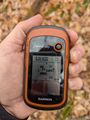
Accuracy.

The dogs at the hash.

Standard Stupid Grins.
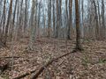
View from the Hash toward the trail we came from (NE)
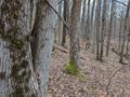
View across the creek and you can kind of make out the other trail before it connects up (SW).
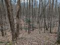
View SE and toward the trail intersection.
View NW and upstream.
Walking back to the trail, I saw an old bird nest in a tiny tree.
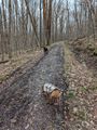
The dogs and the ski trail.
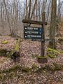
On the way back to the car, a sign at a trail intersection.
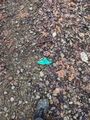
Picking up the Geotrash on the way back.


Ribbons
This user earned the Land geohash achievement
|
Pedalpusher earned the GeoTrash Geohash Achievement
|