2023-01-20 52 10
| Fri 20 Jan 2023 in 52,10: 52.9053708, 10.0451842 geohashing.info google osm bing/os kml crox |
Location
This Geohash is located next to a path in Jerusalem.
Participants
Plans
This was going to be a tough one, since it is pretty far away and I since I was busy during the day, I could only start the expedition after sunset. I'm looking forward to more daylight in summer. But it is a rare non-military Heidekreis Geohash in the Braunschweig graticule, which I want to reach since it would complete both my regional geohashing achievement for Heidekreis and my reverse regional achievement on district level for the Braunschweig graticule. Plus, I'm intrigued by the place being called Jerusalem.
How was I going to get there? Munster is the closest train station. (Don't be fooled by the Beckedorf–Munster and the Celle–Soltau railways, those haven't carried passengers since the 1970s, otherwise Poitzen or Wietzendorf would be great options.) However, Munster and Jerusalem are separated by the Munster South military training area. I could cycle around it, but that would be a constant fight against Google Maps trying to lure me into the military area, and since it would be dark I could easily miss signs warning me of deadly dangers, like those that warned me to go to 2022-10-29 52 10.
I decided to go to Soltau instead, which has several advantages. A direct train connection with Hannover, and if I cycle from there to Jerusalem, the route, while getting close to Munster South and the Bergen military training area, at least does not go through them. It was however going to be more than 20 kilometers one-way, so that would be a bit of an evening workout.
Expedition
In the evening, I started by cycling to the Messe/Laatzen station and took the train via Hannover Central to Soltau and continued to cycle from there. It was dry, but pretty cold, probably sub-zero, but I didn't take the temperature. I cycled through Bassel, Wietzendorf proper and Halmern before entering a forest that would lead me to Jerusalem.
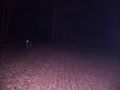
Google Maps does not label this place Jerusalem, but OSM and other sources do. I didn't manage to find out why it is called Jerusalem. It seems to just be a single building, with a swing on its front lawn. There were no lights on, but garbage cans were placed on the street, so I suppose someone does live there. When I reached the path next to the house, I was almost at the destination. After a few steps, I located the coordinates and recorded proof. I wanted to do a break, but my time budget was tight - it had taken me 1.5 hours to get here, and the train would leave in another 1.5 hours, and I did not want to wait an hour for the next one, so I started cycling back.
I was two minutes too late at the train station, but thankfully, the train was ten minutes late. I was exhausted and hungry, and very glad for the sandwiches I had packed, which I could eat now. I fell asleep in the train, but was woken up shortly before arriving in Hannover. From the central station, I cycled to Kröpcke and took the tram back home from there.
Photos
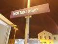
In Soltau
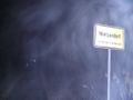
Entering Wietzendorf
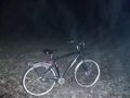
My bicycle near the Geohash

Proof
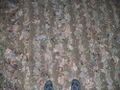
The Geohash
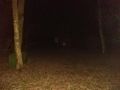
Surroundings

Surroundings

Surroundings
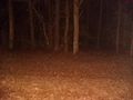
Surroundings
Jerusalem


Ribbons
Fippe earned the Land geohash achievement
|
Fippe issued a challenge for the Tale of Two Hashes achievement
|
Fippe earned the Regional geohashing achievement
|
Fippe earned the Reverse regional achievement
|
- Meetup on 2023-01-20
- Meetup in 52 10
- Land geohash achievement
- A Tale of Two Hashes challenge
- Regional geohashing achievement
- Reverse regional achievement
- Expeditions
- Coordinates reached
- Expeditions with photos
- Meetup in Landkreis Heidekreis
- Expeditions by Fippe
- Fippe's expeditions by bike
- Fippe's expeditions by train
- Fippe's expeditions by tram