| Coos Bay | Roseburg | Oakridge |
| Brookings | Grants Pass | Medford |
| Crescent City, California | Happy Camp, California | Yreka, California |
|
Today's location: not yet announced | ||
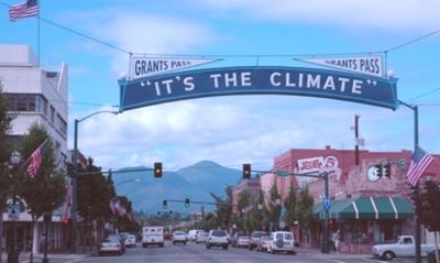
The Grants Pass, Oregon graticule is at latitude 42, longitude -123. Most of the terrain in this graticule is rugged, hilly forest, making most hashpoints difficult to reach. The small towns of Riddle, Canyonville, Glendale, and Gold Hill, as well as the somewhat larger town of Grants Pass, are all connected by Interstate 5 to the north and east of the graticule. Off of the freeway, the town of Cave Junction is the only settlement of any size. The most promenent landmark in the graticule is Oregon Caves National Monument.
Activities
- 2013-08-16 42 -123 -- Frogman (talk) and family fail to reach a hashpoint on a BLM road off of 42.
- 2012-08-23 42 -123 -- Kydlt reached a hashpoint outside an unfriendly bike shop in Kerby.
- 2010-08-12 42 -123 -- Michael5000 and Mrs.5000 reach a hashpoint near a side road off the Applegate Valley.
Notable Events
- 2008-07-13 Robyn and Wade inaugerated this graticule when they knocked off a speed hash on Granite Hill Road, just north of Grants Pass.
