Difference between revisions of "2010-05-29 51 -1"
imported>Sermoa m (update categories) |
imported>FippeBot m (Location) |
||
| (5 intermediate revisions by one other user not shown) | |||
| Line 24: | Line 24: | ||
* [[User:Mapaholic|Mapaholic]] | * [[User:Mapaholic|Mapaholic]] | ||
* [[User:Bluecont|Bluecont]] | * [[User:Bluecont|Bluecont]] | ||
| − | * [[User:DavidMiller|DavidMiller]] | + | * [[User:DavidMiller|DavidMiller]] and kids |
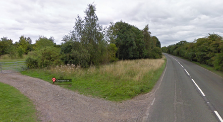
[[Image:2010-05-29 51 -1 streetview.png | thumb | left | 442px | The geohash according to Google Streetview. Looks like a nice place to stop! :)]] | [[Image:2010-05-29 51 -1 streetview.png | thumb | left | 442px | The geohash according to Google Streetview. Looks like a nice place to stop! :)]] | ||
| Line 30: | Line 30: | ||
<br style='clear:left;' /> | <br style='clear:left;' /> | ||
| + | |||
== Plans == | == Plans == | ||
<!-- what were the original plans --> | <!-- what were the original plans --> | ||
| Line 89: | Line 90: | ||
== Achievements == | == Achievements == | ||
| − | {{#vardefine:ribbonwidth| | + | {{#vardefine:ribbonwidth|700px}} |
<!-- Add any achievement ribbons you earned below, or remove this section --> | <!-- Add any achievement ribbons you earned below, or remove this section --> | ||
| + | {{Meet-up | ||
| + | | latitude = 51 | ||
| + | | longitude = -1 | ||
| + | | date = 2010-05-29 | ||
| + | | name = [[User:Bluecont|Bluecont]] | ||
| + | | other = [[User:Sermoa|Sermoa]], [[User:Mapaholic|Mapaholic]] and [[User:DavidMiller|DavidMiller]] | ||
| + | | image = 2010-05-29 51 -1 5140.JPG | ||
| + | }} | ||
| + | |||
| + | {{XKCD Centurion | ||
| + | | count = 6 | ||
| + | | name = [[User:Sermoa|Sermoa]] | ||
| + | }} | ||
| + | |||
| + | {{XKCD Centurion | ||
| + | | count = 3 | ||
| + | | name = [[User:Mapaholic|Mapaholic]] and [[User:DavidMiller|DavidMiller]] | ||
| + | }} | ||
| + | |||
| + | {{consecutive geohash | ||
| + | | count = 2 | ||
| + | | latitude = 51 | ||
| + | | longitude = -1 | ||
| + | | date = 2010-05-28 | ||
| + | | name = [[User:Sermoa|Sermoa]] and [[User:Mapaholic|Mapaholic]] | ||
| + | }} | ||
| + | |||
| + | {{Public transport geohash | ||
| + | | latitude = 51 | ||
| + | | longitude = -1 | ||
| + | | date = 2010-05-29 | ||
| + | | name = [[User:Sermoa|Sermoa]], [[User:Mapaholic|Mapaholic]] and [[User:DavidMiller|DavidMiller]] | ||
| + | | busline = train | ||
| + | | image = 2010-05-29 51 -1 5129.JPG | ||
| + | }} | ||
| Line 96: | Line 132: | ||
[[Category:Expeditions with photos]] | [[Category:Expeditions with photos]] | ||
[[Category:Coordinates reached]] | [[Category:Coordinates reached]] | ||
| + | {{location|GB|ENG|HAM}} | ||
Latest revision as of 02:14, 9 August 2019
| Have you seen our geohashing marker? We'd love to hear from you! Click here to say "hi" and tell us what you've seen!
Curious about what geohashing is? Read more! |  |
| Sat 29 May 2010 in 51,-1: 51.1849007, -1.2697917 geohashing.info google osm bing/os kml crox |
Location
Micheldever, Hampshire, UK (on the side of a road very near the train station!)
Participants
- Sermoa
- Mapaholic
- Bluecont
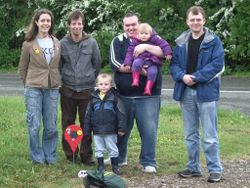
- DavidMiller and kids
Plans
It's a 4pm meetup! Bring food, juggling balls, games, the lot!
Bluecont may turn up, but this will require a little bit of advance notice regarding plans - it's a bit far to go and a bit too easy to find unless there is a Saturday meet-up happening.
- I will definitely be there at 4pm. Hope to see you! -- sermoa 11:05, 29 May 2010 (UTC)
Expedition
- Wow, two geohashes in two days! This is a really nice one, right near the Micheldever train station! Should be there for the 4pm meetup! :) -- sermoa 21:16, 28 May 2010 (GMT+01:00)
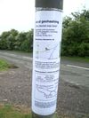
- I have printed and laminated a poster, yay! And there might be another person coming too! :) -- sermoa 14:17, 29 May 2010 (GMT+01:00)
- Good, all ready, just about to leave to get the train. -- sermoa 15:24, 29 May 2010 (GMT+01:00)
- Am at or close to hash point. Will await others. This phone sucks - bluecont
- On our way walking slowly due to little legs :) -- sermoa @51.1827,-1.2672 16:14, 29 May 2010 (GMT+01:00)
- Made it! Great event! Going back now :) -- sermoa @51.1849,-1.2698 17:13, 29 May 2010 (GMT+01:00)
Detailed Report
Actually, this isn't going to be very detailed. I took the train, with Mapaholic, DavidMiller and the kids, which was fun. We were disappointed to find that the fields had performed the same trick as the fields last night in appearing to be deceptively small on the satellite view. We had a long walk which was hard for little legs, but we got to the geohash in time to meet Bluecont. We played around, took photos, exchanged pleasant geeky conversation, put up our poster. Bluecont was extremely kind to give us all a lift back to the station where we had a quick search for a geocache, but it started to rain so we took the train back home again.
Photos
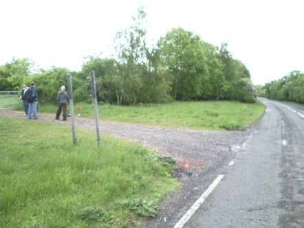
Nearly there! @51.1830,-1.2721
Useful links
Achievements
Bluecont earned the Meet-up achievement
|
Sermoa earned the xkcd Nullaturion achievement
|
Mapaholic and DavidMiller earned the xkcd Nullaturion achievement
|
Sermoa and Mapaholic earned the Consecutive geohash achievement
|
Sermoa, Mapaholic and DavidMiller earned the Public transport geohash achievement
|


