Difference between revisions of "2010-09-19 66 25"
From Geohashing
imported>Isopekka |
imported>FippeBot m (Location) |
||
| (3 intermediate revisions by one other user not shown) | |||
| Line 8: | Line 8: | ||
And DON'T FORGET to add your expedition and the best photo you took to the gallery on the Main Page! We'd love to read your report, but that means we first have to discover it! | And DON'T FORGET to add your expedition and the best photo you took to the gallery on the Main Page! We'd love to read your report, but that means we first have to discover it! | ||
--> | --> | ||
| − | [[Image: | + | [[Image:Geohash7 009.JPG|thumb|left]] |
{{meetup graticule | {{meetup graticule | ||
| Line 66: | Line 66: | ||
</Gallery> | </Gallery> | ||
| + | |||
== Achievements == | == Achievements == | ||
| + | |||
| + | {{land geohash | ||
| + | |||
| + | | latitude = 66 | ||
| + | | longitude = 25 | ||
| + | | date = 2010-09-19 | ||
| + | | name = isopekka | ||
| + | }} | ||
{{Bicycle geohash | {{Bicycle geohash | ||
| Line 79: | Line 88: | ||
}} | }} | ||
| − | |||
{{drag-along | {{drag-along | ||
| Line 91: | Line 99: | ||
}} | }} | ||
| − | |||
{{consecutive geohash | {{consecutive geohash | ||
| Line 104: | Line 111: | ||
| + | == Other Geohashing Expeditions and Plans on This Day == | ||
| + | |||
| + | {{expedition summaries|2010-09-19}} | ||
| Line 109: | Line 119: | ||
[[Category:Expeditions with photos]] | [[Category:Expeditions with photos]] | ||
[[Category:Coordinates reached]] | [[Category:Coordinates reached]] | ||
| + | {{location|FI|10}} | ||
Latest revision as of 03:48, 9 August 2019
| Sun 19 Sep 2010 in 66,25: 66.5101048, 25.8295401 geohashing.info google osm bing/os kml crox |
Contents
Location
About 6 km NW from my home, only 4 km from the center of the city Rovaniemi, Finland.
Participants
- isopekka & Tintti & Vilma &dog
Expedition
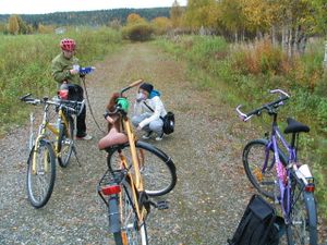
We started at 14:00 pm. After half an hour we were at the hashpoint. Luckily the hashpoint was not too close to a private house, so I could walk exactly to the hashpoint.On the way home we found a golf restaurant and something to drink. We were back at 15:45 pm.
- With bike total 13.4 km
- Walking total 0.05 km
- Expedition took 2 hours
- Physical efforts needed (1-5): 3
The path can be found at WikiLoc
Photos
Achievements
isopekka earned the Land geohash achievement
|
isopekka earned the Bicycle geohash achievement
|
isopekka earned the Drag-along achievement
|
isopekka earned the Consecutive geohash achievement
|
Other Geohashing Expeditions and Plans on This Day
Expeditions and Plans
| 2010-09-19 | ||
|---|---|---|
| Satna, India | Felix Dance | Well I must say this was one of the least inspiring of the geohashes I've d... |
| Lafayette, Indiana | Alex, Jessi | More later, when I don't have to go to class |
| Cleveland, Ohio | Jschleappi, teh lauren, Renee | Rocky River Park Beach Cliff Boulevard Rocky River, OH Facebook Event |
| Portland, Oregon | Jim, Elegant Forkbomb | Amid some trees near a huge field on the Nike Campus |
| Schweinfurt, Germany | Reinhard | Close to a track near Waldau in the Thuringian forest. |
| Northampton, United Kingdom | Joe | In the middle of the main road through Ashley village, between Market Harbo... |
| Cambridge, United Kingdom | Sourcerer | In a conifer plantation between the Peddar's Way long distance footpath and... |
| Växjö, Sweden | llavids | In the forest south of lake Frösjön, south of Urshult, Tingsryd, Småland, Sweden... |
| Rovaniemi, Finland | isopekka | About 6 km NW from my home, only 4 km from the center of the city Rovaniemi... |


