Difference between revisions of "2012-05-21 46 6"
imported>Crox (there is a plan) |
imported>FippeBot m (Location) |
||
| (4 intermediate revisions by one other user not shown) | |||
| Line 1: | Line 1: | ||
| − | |||
| − | |||
| − | |||
| − | |||
| − | |||
{{meetup graticule | {{meetup graticule | ||
| lat=46 | | lat=46 | ||
| Line 10: | Line 5: | ||
}} | }} | ||
| − | |||
__NOTOC__ | __NOTOC__ | ||
== Location == | == Location == | ||
| − | + | [http://map.geo.admin.ch/?Y=509797&X=155353&zoom=8&bgLayer=ch.swisstopo.pixelkarte-farbe&lang=fr 509797 155353], near [[wikipedia:Col du Marchairuz|Col du Marchairuz]] | |
== Participants == | == Participants == | ||
| − | + | [[user:Crox|Crox]] | |
| − | + | ||
| + | == Expedition == | ||
| + | The plan was to make it a [[Sunrise geohash]]. At the beginning, I considered combining it with the camping achievement, but then dismissed the idea because of timing constraints (I had to work afterwards) and also somehow because the weather forecast didn't make the idea very appealing. | ||
| + | |||
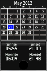
| + | Various online sources and my GPS told me sunrise would be around 05:55 (with dawn starting at 05:16), so I planned to leave home between 04:45 and 05:00 (I planned about 40 minutes driving + 10 minutes walking) which I more or less managed to do. | ||
| + | |||
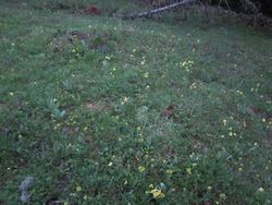
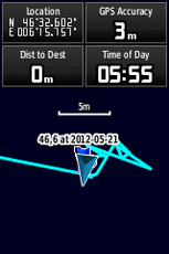
| + | The closest parking spot to the hash was reached around 05:40, and from there it was just a matter of minutes to walk to the spot. The GPS showed me "0 m left" which I guess is about as good as it gets. | ||
| − | + | In order to get a proper picnic achievement [[2009-09-21 46 5|this time]], I took my breakfast with me, including a picnic blanket, hot coffee, orange juice, fruits, bread and jam, and even colorful plastic cutlery. However the weather didn't motivate me to spend more time at the hash than was necessary, so I only drank my coffee and ate the rest of the breakfast later on the train. | |
| − | |||
| − | + | I left the hash area shortly thereafter and made it to the 06:50 train in order to start my regular day. | |
| − | |||
| − | |||
| − | |||
== Photos == | == Photos == | ||
| − | + | {{#vardefine:gaLines|3}} | |
| − | + | {{#vardefine:gaWidth|250}} | |
| − | -- | + | {{#vardefine:gaHeight|230}} |
| − | + | {{Gallery2| | |
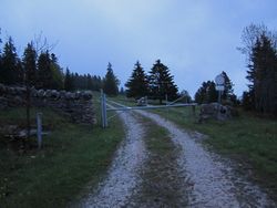
| − | + | {{GalleryItem | File:2012-05-21_46_6-01-IMG_1543.JPG | leaving the road }} | |
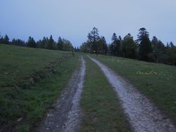
| + | {{GalleryItem | File:2012-05-21_46_6-02-IMG_1544.JPG | getting closer }} | ||
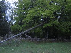
| + | {{GalleryItem | File:2012-05-21_46_6-03-IMG_1545.JPG | at the hash }} | ||
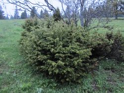
| + | {{GalleryItem | File:2012-05-21_46_6-04-IMG_1546.JPG | the hash is next to this bush }} | ||
| + | {{GalleryItem | File:2012-05-21_46_6-05-IMG_1547.JPG | ... here }} | ||
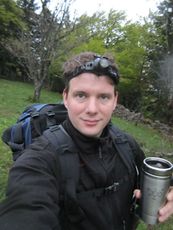
| + | {{GalleryItem | File:2012-05-21_46_6-06-IMG_1550.JPG | hasher at hash (unfortunately you can't really see it's raining) }} | ||
| + | {{GalleryItem | File:2012-05-21_46_6-07-GPS_2073.png | planned sunrise }} | ||
| + | {{GalleryItem | File:2012-05-21_46_6-08-GPS_2324.png | coordinates reached }} | ||
| + | {{GalleryItem | File:2012-05-21_46_6-09-IMG_1551.JPG | the sun is supposedly rising now }} | ||
| + | {{GalleryItem | File:2012-05-21_46_6-10-IMG_1552.JPG | still, the view is not that bad }} | ||
| + | {{GalleryItem | File:2012-05-21_46_6-11-IMG_1553.JPG | picnic on the train }} | ||
| + | }} | ||
== Achievements == | == Achievements == | ||
{{#vardefine:ribbonwidth|800px}} | {{#vardefine:ribbonwidth|800px}} | ||
| − | + | {{Sunrise geohash | |
| − | + | | latitude = 46 | |
| − | + | | longitude = 6 | |
| − | + | | date = 2012-05-21 | |
| − | + | | name = [[user:Crox|Crox]] | |
| − | + | }} | |
| − | + | {{Geohashing Day | |
| − | + | | latitude = 46 | |
| − | + | | longitude = 6 | |
| − | [[ | + | | date = 2012-05-21 |
| − | + | | name = [[user:Crox|Crox]] | |
| + | | coorddate = 2012-05-21 | ||
| + | | year = 2012 | ||
| + | }} | ||
| + | === Déjà vu === | ||
| + | I visited the area a number of times, including documented examples. I don't have a gps tracklog or a picture sowing me at the hash, although I'm pretty sure I walked to within 20m from it a few times. | ||
| + | {{#vardefine:gaLines|3}} | ||
| + | {{#vardefine:gaWidth|250}} | ||
| + | {{#vardefine:gaHeight|230}} | ||
| + | {{Gallery2| | ||
| + | {{GalleryItem | File:20070409-IMG 8099.jpg | April 2007: that's the path leading to the gate that you see in the first picture }} | ||
| + | {{GalleryItem | File:20081005-dsc 2819.jpg | October 2008: as far as I can tell, the hash is down there on the right }} | ||
| + | }} | ||
| + | {{Radio Yerevan | ||
| + | | achievement = Déjà vu geohash achievement | ||
| + | | detail = the available proofs do not suffice | ||
| + | | latitude = 46 | ||
| + | | longitude = 6 | ||
| + | | date = 2012-05-21 | ||
| + | | user = [[user:Crox|Crox]] | ||
| + | }} | ||
| − | <!-- | + | <!-- =============== USEFUL CATEGORIES FOLLOW ================ --> |
[[Category:Expeditions]] | [[Category:Expeditions]] | ||
| − | |||
[[Category:Expeditions with photos]] | [[Category:Expeditions with photos]] | ||
| − | |||
| − | |||
| − | |||
| − | |||
| − | |||
[[Category:Coordinates reached]] | [[Category:Coordinates reached]] | ||
| − | + | {{location|CH|VD}} | |
| − | |||
| − | |||
| − | |||
| − | |||
| − | |||
| − | |||
| − | |||
| − | |||
| − | |||
Latest revision as of 04:08, 13 August 2019
| Mon 21 May 2012 in 46,6: 46.5433661, 6.2626120 geohashing.info google osm bing/os kml crox |
Location
509797 155353, near Col du Marchairuz
Participants
Expedition
The plan was to make it a Sunrise geohash. At the beginning, I considered combining it with the camping achievement, but then dismissed the idea because of timing constraints (I had to work afterwards) and also somehow because the weather forecast didn't make the idea very appealing.
Various online sources and my GPS told me sunrise would be around 05:55 (with dawn starting at 05:16), so I planned to leave home between 04:45 and 05:00 (I planned about 40 minutes driving + 10 minutes walking) which I more or less managed to do.
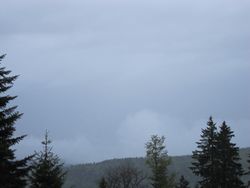
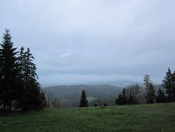
The closest parking spot to the hash was reached around 05:40, and from there it was just a matter of minutes to walk to the spot. The GPS showed me "0 m left" which I guess is about as good as it gets.
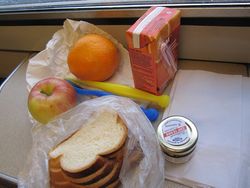
In order to get a proper picnic achievement this time, I took my breakfast with me, including a picnic blanket, hot coffee, orange juice, fruits, bread and jam, and even colorful plastic cutlery. However the weather didn't motivate me to spend more time at the hash than was necessary, so I only drank my coffee and ate the rest of the breakfast later on the train.
I left the hash area shortly thereafter and made it to the 06:50 train in order to start my regular day.
Photos
|
Achievements
Crox earned the Sunrise Geohash Achievement
|
Crox earned the 2012 Geohashing Day achievement
|
Déjà vu
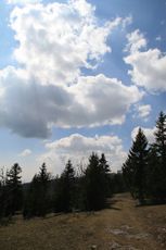
I visited the area a number of times, including documented examples. I don't have a gps tracklog or a picture sowing me at the hash, although I'm pretty sure I walked to within 20m from it a few times.
|
Is it true that Crox earned the Déjà vu geohash achievement?
|
