Difference between revisions of "2016-05-04 49 11"
From Geohashing
imported>Klaus (expedition) |
imported>Klaus m (achievements) |
||
| Line 33: | Line 33: | ||
== Achievements == | == Achievements == | ||
| + | {{land geohash | ||
| + | | latitude = 49 | ||
| + | | longitude = 11 | ||
| + | | date = 2016-05-04 | ||
| + | | name = [[User:Klaus|Klaus]] | ||
| + | }} | ||
| + | {{Template:Easy geohash | ||
| + | | latitude = 49 | ||
| + | | longitude = 11 | ||
| + | | date = 2016-01-04 | ||
| + | | name = [[User:Klaus|Klaus]] | ||
| + | }} | ||
Revision as of 13:44, 18 May 2016
| Wed 4 May 2016 in 49,11: 49.9147023, 11.0612251 geohashing.info google osm bing/os kml crox |
Location
between Lohndorf and Tiefenellern
Participants
Plans
This one is way too easy. It is like 200m off a street I'll be driving tomorrow anyway (by car). So I'll gonna stop at around 19:00 and cash this easy geohash!
Expedition
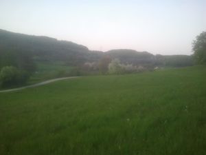
I was stuck in a horrible pre-long-weekend traffic jam, so I arrived at around 20:45. As I already was late (traffic jam!) for the evening plans, I drove until 50m to the hash, took the obligatory proof photo and continued. All in all, the whole expedition took only 6 minutes.
Photos
Achievements
Klaus earned the Land geohash achievement
|
Klaus has visited an Easy Geohash
|


