Difference between revisions of "2011-04-19 50 11"
imported>Paintedhell m |
m (Location correction) |
||
| (4 intermediate revisions by 2 users not shown) | |||
| Line 12: | Line 12: | ||
* [[User:Paintedhell|Juja]] will cycle there in the evening. | * [[User:Paintedhell|Juja]] will cycle there in the evening. | ||
| − | [[Category: | + | == Participants == |
| + | * [[User:Paintedhell|Juja]], Frankie and Benjy Mouse | ||
| + | |||
| + | == Expedition == | ||
| + | The weather in the evening was perfect for geohashing: warm and sunny, so I happily rode my bike through Ziegenhain and up to "Steinkreuz" - after cycling through the forest for about three kms and arriving 200 meters above Jena, I had hoped to find peace and quiet, but instead there were some hundreds of people starting barbies, children running around and the lots of cars that brought them there. | ||
| + | |||
| + | So I quickly went on to today's destination - on Google maps, the satellite picture and OSM it looked as if the nearest way to this geohash would be in about 300 meters distance, and from former (retro) Geohashes I knew that even 30 meters could be quite a problem in these forests. But Google and OSM obviously aren't perfect: the forest was full of ways (meaning ''ways'', not paths or trails!) and I just picked one that seemed to head in the right direction. This one brought me (through wonderful nature) about 50 meters near the hash - but since geohashes can never be that easy, from there on I had to walk... ''downhill''. | ||
| + | |||
| + | -30hm on 50m. Calculate yourself how fucking steep that was; after I had actually given a damn about the contour lines on the topo map, it was next to impossible that I should walk into something like that. Anyway, I slid down to the point, and guess what I found then? A path, leading back up to my starting point! (Near it.) I struggled back to my bike (now all the mountain running finally pays off) and after I found it, I took some relieved proof pictures of me and the mice and cycled back home, this time using beautiful ways I didn't even know yet... | ||
| + | |||
| + | == Photos == | ||
| + | {{gallery|width=200|height=200|lines=2 | ||
| + | |Image:110419_50_11_01.jpg|Back to nature... by car. | ||
| + | |Image:110419_50_11_02.jpg|Blooming periwinkle on my way. | ||
| + | |Image:110419_50_11_03.jpg|Yes, there ''was'' a way leading to the hash! | ||
| + | |Image:110419_50_11_04.jpg|Cowslip where I left my bike. | ||
| + | |Image:110419_50_11_05.jpg|Started walking at 55m distance. | ||
| + | |Image:110419_50_11_06.jpg|Somewhere all the way down there it is... | ||
| + | |Image:110419_50_11_07.jpg|Hashpoint reached within accuracy. | ||
| + | |Image:110419_50_11_08.jpg|Wait... ''a path?!'' | ||
| + | |Image:110419_50_11_09.jpg|Frankie and Benjy mouse enjoying the sun. | ||
| + | |Image:110419_50_11_11.jpg|Did not mark the point - but I marked the way there... | ||
| + | |Image:110419_50_11_12.jpg|The beautiful way back home. | ||
| + | }} | ||
| + | |||
| + | == Lessons learned == | ||
| + | * There are more ways around than I thought. Back to work, OSM guys! | ||
| + | * Ever been annoyed by some keys jangling about in your trouserpockets while you just wanted to go for a peaceful little run or bike trip? Just put them in the pocket together with some mice. That solves the whole problem. | ||
| + | |||
| + | [[Category:Expeditions]] | ||
| + | [[Category:Expeditions with photos]] | ||
| + | [[Category:Coordinates reached]] | ||
| + | {{location|DE|TH|J}} | ||
Latest revision as of 20:07, 16 May 2020
| Tue 19 Apr 2011 in 50,11: 50.9207829, 11.6613730 geohashing.info google osm bing/os kml crox |
Location
In the forest near Jenaprießnitz, on top of the Hirschberg. I'll probably need a machete for this one.
Plans
- Juja will cycle there in the evening.
Participants
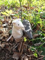
- Juja, Frankie and Benjy Mouse
Expedition
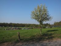
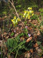
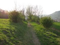
The weather in the evening was perfect for geohashing: warm and sunny, so I happily rode my bike through Ziegenhain and up to "Steinkreuz" - after cycling through the forest for about three kms and arriving 200 meters above Jena, I had hoped to find peace and quiet, but instead there were some hundreds of people starting barbies, children running around and the lots of cars that brought them there.
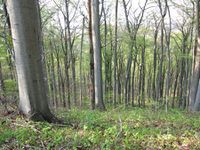
So I quickly went on to today's destination - on Google maps, the satellite picture and OSM it looked as if the nearest way to this geohash would be in about 300 meters distance, and from former (retro) Geohashes I knew that even 30 meters could be quite a problem in these forests. But Google and OSM obviously aren't perfect: the forest was full of ways (meaning ways, not paths or trails!) and I just picked one that seemed to head in the right direction. This one brought me (through wonderful nature) about 50 meters near the hash - but since geohashes can never be that easy, from there on I had to walk... downhill.
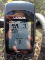
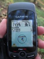
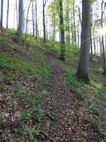
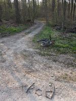
-30hm on 50m. Calculate yourself how fucking steep that was; after I had actually given a damn about the contour lines on the topo map, it was next to impossible that I should walk into something like that. Anyway, I slid down to the point, and guess what I found then? A path, leading back up to my starting point! (Near it.) I struggled back to my bike (now all the mountain running finally pays off) and after I found it, I took some relieved proof pictures of me and the mice and cycled back home, this time using beautiful ways I didn't even know yet...
Photos
|
Lessons learned
- There are more ways around than I thought. Back to work, OSM guys!
- Ever been annoyed by some keys jangling about in your trouserpockets while you just wanted to go for a peaceful little run or bike trip? Just put them in the pocket together with some mice. That solves the whole problem.
